Property Record
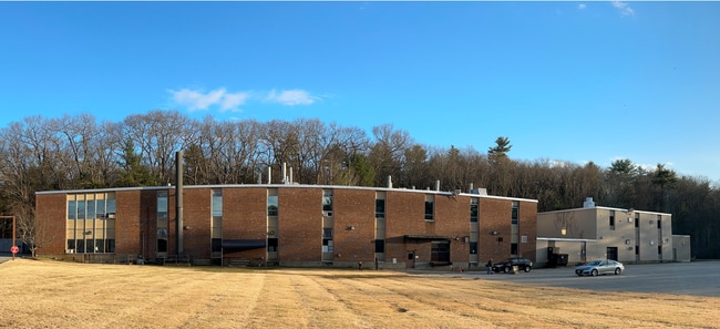
211 Boston St, Middleton, MA 01949

Current Lease Availabilities
Property Detail
211 Boston St
MIDD-000030-000000-000002
ESSEX
Industrialgeneral
Massachusetts
M1
2
AE The base floodplain where base flood elevations are provided. AE Zones are now used on new format FIRMs instead of A1-A30 Zones.
37.30 AC
2025
Reading/Melrose
2025
Boston
212102
Boston-Cambridge-Newton, MA-NH
351,796 SF
NEARBY LISTINGS FOR SALE OR LEASE
DEMOGRAPHICS near 211 Boston St
1 mile
3 mile
5 mile
2025 Total Population
4,435
34,668
120,924
2030 Population
4,566
35,693
124,755
Pop Growth 2025-2030
+ 2.95%
+ 2.96%
+ 3.17%
Average Age
45
44
44
2025 Total Households
1,514
12,219
46,339
HH Growth 2025-2030
+ 2.91%
+ 2.92%
+ 3.22%
Median Household Inc
$160,104
$156,283
$126,452
Avg Household Size
2.90
2.80
2.50
2025 Avg HH Vehicles
2.00
2.00
2.00
Median Home Value
$776,112
$778,600
$745,859
Median Year Built
1967
1969
1970
Nearby Places
Map Layers
Map Styles
 Street
 Aerial
Layers
 Traffic
 Biking
Places
Listings with unknown addresses are not visible on the map
- Restaurants
- Banks
- Shops
- Fitness
- Groceries
PUBLIC TRANSPORTATION
COMMUTER RAIL
Wakefield (Haverhill Line - Massachusetts Bay Transportation Authority Commuter Rail (Purple Line))
Drive
Walk
Distance
Wakefield (Haverhill Line - Massachusetts Bay Transportation Authority Commuter Rail (Purple Line))
15 min
6.2 mi
Reading (Haverhill Line - Massachusetts Bay Transportation Authority Commuter Rail (Purple Line))
Drive
Walk
Distance
Reading (Haverhill Line - Massachusetts Bay Transportation Authority Commuter Rail (Purple Line))
16 min
6.4 mi
AIRPORT
General Edward Lawrence Logan International
Drive
Walk
Distance
General Edward Lawrence Logan International
33 min
17.6 mi
Freight Ports
Port of Boston
Drive
Walk
Distance
Port of Boston
36 min
20.6 mi
Nearby Properties
Address
Land Use
TOTAL SIZE
Lot Size
Zoning
Address
Land Use
TOTAL SIZE
Lot Size
Zoning
198.74 AC
R3
Address
Land Use
TOTAL SIZE
Lot Size
Zoning
13.04 AC
HC
Address
Land Use
TOTAL SIZE
Lot Size
Zoning
40.20 AC
R1B
Address
Land Use
TOTAL SIZE
Lot Size
Zoning
113,502 SF
8.50 AC
LB
Address
Land Use
TOTAL SIZE
Lot Size
Zoning
24.54 AC
M1
Address
Land Use
TOTAL SIZE
Lot Size
Zoning
36,156 SF
754.25 AC
R1A
Address
Land Use
TOTAL SIZE
Lot Size
Zoning
110,812 SF
32.87 AC
RA
Address
Land Use
TOTAL SIZE
Lot Size
Zoning
81,746 SF
10.50 AC
R1A
Address
Land Use
TOTAL SIZE
Lot Size
Zoning
136,661 SF
27.50 AC
RB
Address
Land Use
TOTAL SIZE
Lot Size
Zoning
89,742 SF
10.78 AC
RC
Address
Land Use
TOTAL SIZE
Lot Size
Zoning
175,699 SF
22.91 AC
R3
Address
Land Use
TOTAL SIZE
Lot Size
Zoning
127,748 SF
13.64 AC
HC
Address
Land Use
TOTAL SIZE
Lot Size
Zoning
13.80 AC
BN2
Address
Land Use
TOTAL SIZE
Lot Size
Zoning
114,680 SF
13.73 AC
HC
Address
Land Use
TOTAL SIZE
Lot Size
Zoning
72,600 SF
4.01 AC
B
Address
Land Use
TOTAL SIZE
Lot Size
Zoning
59,514 SF
10.40 AC
B
Address
Land Use
TOTAL SIZE
Lot Size
Zoning
19,024 SF
13 AC
R1
Address
Land Use
TOTAL SIZE
Lot Size
Zoning
128,345 SF
9.54 AC
BR1
Address
Land Use
TOTAL SIZE
Lot Size
Zoning
112,499 SF
HC
Address
Land Use
TOTAL SIZE
Lot Size
Zoning
94,999 SF
B1A
Address
Land Use
TOTAL SIZE
Lot Size
Zoning
51,746 SF
5 AC
EH
Address
Land Use
TOTAL SIZE
Lot Size
Zoning
79,616 SF
M1
Address
Land Use
TOTAL SIZE
Lot Size
Zoning
66,660 SF
B1A
Address
Land Use
TOTAL SIZE
Lot Size
Zoning
70,316 SF
9.44 AC
RB
Address
Land Use
TOTAL SIZE
Lot Size
Zoning
58,893 SF
12.90 AC
R1
Address
Land Use
TOTAL SIZE
Lot Size
Zoning
4.68 AC
B
Address
Land Use
TOTAL SIZE
Lot Size
Zoning
54,342 SF
15 AC
R1
Address
Land Use
TOTAL SIZE
Lot Size
Zoning
57,632 SF
4.63 AC
R1
Address
Land Use
TOTAL SIZE
Lot Size
Zoning
4.11 AC
HC
The World's #1 Commercial Real Estate Marketplace
Connect with us
© 2026 CoStar Group
The information above has been obtained from sources believed reliable. While we do not doubt its accuracy we have not verified it and make no guarantee, warranty or representation about it. It is your responsibility to independently confirm its accuracy and completeness. Any projections, opinions, assumptions, or estimates used are for example only and do not represent the current or future performance of the property. The value of this transaction to you depends on tax and other factors which should be evaluated by your tax, financial, and legal advisors. You and your advisors should conduct a careful, independent investigation of the property to determine to your satisfaction the suitability of the property for your needs.