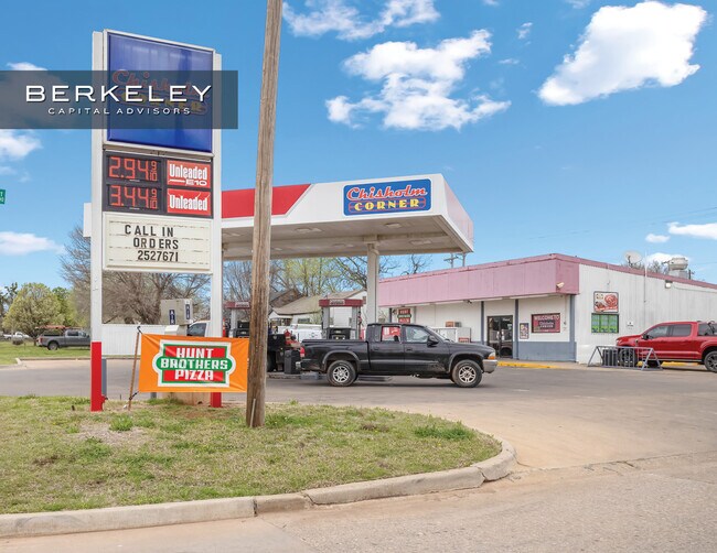
Property Record
211 E Chestnut Ave, Duncan, OK 73533

Property Detail
211 E Chestnut Ave
1285-00-003-023-0-000-00
BLK 3 LT 23 & LT 24 HOPKINS ADD (211 E CHESTNUT)
Conveniencestore
STEPHENS
R1
Oklahoma
B and X Area of moderate flood hazard, usually the area between the limits of the 100-year and 500-year floods.
23,24
2025
0.32 AC
2025
Oklahoma West Area
000400
Other Market Areas
2,344 SF
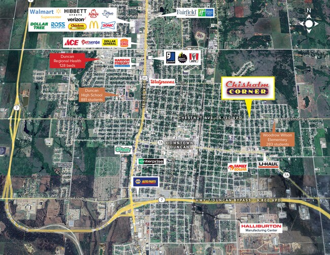
Duncan, OK
NEARBY LISTINGS FOR SALE OR LEASE
DEMOGRAPHICS near 211 E Chestnut Ave
1 mile
3 mile
5 mile
2025 Total Population
7,382
22,749
25,685
2030 Population
7,726
23,534
26,495
Pop Growth 2025-2030
+ 4.66%
+ 3.45%
+ 3.15%
Average Age
39
41
42
2025 Total Households
2,831
9,315
10,484
HH Growth 2025-2030
+ 4.70%
+ 3.42%
+ 3.13%
Median Household Inc
$47,605
$52,787
$55,207
Avg Household Size
2.40
2.30
2.40
2025 Avg HH Vehicles
2.00
2.00
2.00
Median Home Value
$70,192
$131,332
$142,110
Median Year Built
1957
1969
1971
Nearby Places
Map Layers
Map Styles
 Street
 Aerial
Transit
 Traffic
 Biking
Places
Listings with unknown addresses are not visible on the map
- Restaurants
- Banks
- Shops
- Fitness
- Groceries
PUBLIC TRANSPORTATION
AIRPORT
Lawton-Fort Sill Regional
Drive
Walk
Distance
Lawton-Fort Sill Regional
51 min
35.6 mi
SALE & LEASE HISTORY
LISTING DATE
SALE/LEASE

Mar 27, 2024
For Sale
Nearby Properties
Address
Land Use
TOTAL SIZE
Lot Size
Zoning
Address
Land Use
TOTAL SIZE
Lot Size
Zoning
91,737 SF
40 AC
C1
Address
Land Use
TOTAL SIZE
Lot Size
Zoning
82,956 SF
11.54 AC
C1
Address
Land Use
TOTAL SIZE
Lot Size
Zoning
59,480 SF
14.55 AC
Address
Land Use
TOTAL SIZE
Lot Size
Zoning
127,660 SF
20 AC
Address
Land Use
TOTAL SIZE
Lot Size
Zoning
34,192 SF
80.31 AC
Address
Land Use
TOTAL SIZE
Lot Size
Zoning
4,064 SF
43.23 AC
Address
Land Use
TOTAL SIZE
Lot Size
Zoning
61,514 SF
2.34 AC
C1
Address
Land Use
TOTAL SIZE
Lot Size
Zoning
9,694 SF
5.12 AC
C2
Address
Land Use
TOTAL SIZE
Lot Size
Zoning
170 SF
4.88 AC
Address
Land Use
TOTAL SIZE
Lot Size
Zoning
825 SF
97.38 AC
Address
Land Use
TOTAL SIZE
Lot Size
Zoning
61,546 SF
22.70 AC
Address
Land Use
TOTAL SIZE
Lot Size
Zoning
1,440 SF
33.58 AC
Address
Land Use
TOTAL SIZE
Lot Size
Zoning
816 SF
8 AC
C2
Address
Land Use
TOTAL SIZE
Lot Size
Zoning
28,987 SF
20 AC
R1
Address
Land Use
TOTAL SIZE
Lot Size
Zoning
260 SF
1.93 AC
R1
Address
Land Use
TOTAL SIZE
Lot Size
Zoning
2,460 SF
123.87 AC
Address
Land Use
TOTAL SIZE
Lot Size
Zoning
2,500 SF
77.75 AC
C1
Address
Land Use
TOTAL SIZE
Lot Size
Zoning
1,500 SF
5 AC
C2
Address
Land Use
TOTAL SIZE
Lot Size
Zoning
2,560 SF
43.66 AC
Address
Land Use
TOTAL SIZE
Lot Size
Zoning
16,360 SF
6.48 AC
R1
Address
Land Use
TOTAL SIZE
Lot Size
Zoning
38,723 SF
5.62 AC
R1
Address
Land Use
TOTAL SIZE
Lot Size
Zoning
86,400 SF
5 AC
C1
Address
Land Use
TOTAL SIZE
Lot Size
Zoning
32,998 SF
2.64 AC
C2
Address
Land Use
TOTAL SIZE
Lot Size
Zoning
17,205 SF
160 AC
C2
Address
Land Use
TOTAL SIZE
Lot Size
Zoning
33,921 SF
5.94 AC
R1
Address
Land Use
TOTAL SIZE
Lot Size
Zoning
13,433 SF
0.87 AC
R1
Address
Land Use
TOTAL SIZE
Lot Size
Zoning
7,582 SF
4.79 AC
R1
Address
Land Use
TOTAL SIZE
Lot Size
Zoning
9,014 SF
1.77 AC
C1
Address
Land Use
TOTAL SIZE
Lot Size
Zoning
20,966 SF
5 AC
R1
The World's #1 Commercial Real Estate Marketplace
Connect with us
© 2026 CoStar Group
The information above has been obtained from sources believed reliable. While we do not doubt its accuracy we have not verified it and make no guarantee, warranty or representation about it. It is your responsibility to independently confirm its accuracy and completeness. Any projections, opinions, assumptions, or estimates used are for example only and do not represent the current or future performance of the property. The value of this transaction to you depends on tax and other factors which should be evaluated by your tax, financial, and legal advisors. You and your advisors should conduct a careful, independent investigation of the property to determine to your satisfaction the suitability of the property for your needs.