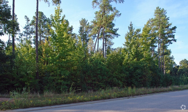
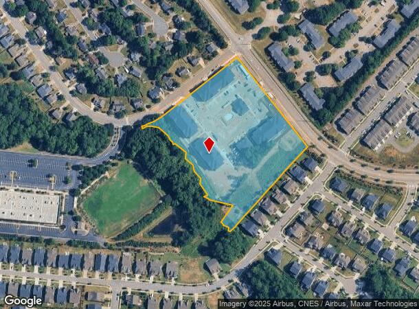
Property Record
211 Grove Park Dr, Wake Forest, NC 27587
NEARBY LISTINGS FOR SALE OR LEASE
Property Detail
211 Grove Park Dr
1851.03-04-4195-000
Pines At Wake Forest
Apartment
PINES AT WAKE FOREST ROW TR3 BM2024-0149
X
Wake
3720185100L
North Carolina
2025
6.29 AC
2025
Route 1
054223
Raleigh/Durham
103,310 SF
Raleigh, NC
DEMOGRAPHICS near 211 Grove Park Dr
1 Mile
3 Mile
5 Mile
2024 Total Population
7,979
44,533
91,266
2029 Population
8,836
49,742
102,319
Pop Growth 2024-2029
+ 10.74%
+ 11.70%
+ 12.11%
Average Age
39
39
39
2024 Total Households
2,941
16,116
33,141
HH Growth 2024-2029
+ 11.02%
+ 11.72%
+ 12.11%
Median Household Inc
$73,578
$102,575
$107,847
Avg Household Size
2.50
2.70
2.70
2024 Avg HH Vehicles
2.00
2.00
2.00
Median Home Value
$401,943
$364,648
$380,554
Median Year Built
2001
2005
2006
Nearby Places
Map Layers
Map Styles
 Street
 Aerial
- Restaurants
- Banks
- Shops
- Fitness
- Groceries
PUBLIC TRANSPORTATION
AIRPORT
Raleigh-Durham International
DRIVE
WALK
Distance
Raleigh-Durham International
37 min
24.2 mi
Freight Ports
Virginia Port Authority - Richmond
DRIVE
WALK
Distance
Virginia Port Authority - Richmond
161 min
133.4 mi
SALE & LEASE HISTORY
LISTING DATE
SALE/LEASE

Jan 05, 2017
For Lease
Nearby Properties
Address
Land Use
TOTAL SIZE
Lot Size
Zoning
Address
Land Use
TOTAL SIZE
Lot Size
Zoning
378,421 SF
19.06 AC
RMX
Address
Land Use
TOTAL SIZE
Lot Size
Zoning
283,870 SF
11.39 AC
RMX
Address
Land Use
TOTAL SIZE
Lot Size
Zoning
442,480 SF
52.02 AC
GR3
Address
Land Use
TOTAL SIZE
Lot Size
Zoning
306,712 SF
14.03 AC
PUD
Address
Land Use
TOTAL SIZE
Lot Size
Zoning
232,734 SF
57.28 AC
GR3
Address
Land Use
TOTAL SIZE
Lot Size
Zoning
243,797 SF
22.57 AC
GR10
Address
Land Use
TOTAL SIZE
Lot Size
Zoning
248,945 SF
16.41 AC
GR10
Address
Land Use
TOTAL SIZE
Lot Size
Zoning
225,390 SF
14.95 AC
GR10
Address
Land Use
TOTAL SIZE
Lot Size
Zoning
283,795 SF
31.33 AC
ICD
Address
Land Use
TOTAL SIZE
Lot Size
Zoning
159,584 SF
67.12 AC
FCO GB
Address
Land Use
TOTAL SIZE
Lot Size
Zoning
162,909 SF
9.84 AC
RMX
Address
Land Use
TOTAL SIZE
Lot Size
Zoning
136,644 SF
4.38 AC
RMX
Address
Land Use
TOTAL SIZE
Lot Size
Zoning
186,546 SF
6.84 AC
RMX
Address
Land Use
TOTAL SIZE
Lot Size
Zoning
166,192 SF
13.59 AC
GR10
Address
Land Use
TOTAL SIZE
Lot Size
Zoning
143,060 SF
7.19 AC
RMX
Address
Land Use
TOTAL SIZE
Lot Size
Zoning
154,602 SF
40 AC
ICD
Address
Land Use
TOTAL SIZE
Lot Size
Zoning
84,528 SF
14.44 AC
NB
Address
Land Use
TOTAL SIZE
Lot Size
Zoning
97,878 SF
26.85 AC
GR5
Address
Land Use
TOTAL SIZE
Lot Size
Zoning
111,616 SF
4.69 AC
NMX
Address
Land Use
TOTAL SIZE
Lot Size
Zoning
106,593 SF
15.32 AC
HB
Address
Land Use
TOTAL SIZE
Lot Size
Zoning
107,082 SF
4.17 AC
RMX
Address
Land Use
TOTAL SIZE
Lot Size
Zoning
91,233 SF
11.04 AC
GR10
Address
Land Use
TOTAL SIZE
Lot Size
Zoning
88,053 SF
12.16 AC
GR10
Address
Land Use
TOTAL SIZE
Lot Size
Zoning
101,307 SF
21 AC
HB
Address
Land Use
TOTAL SIZE
Lot Size
Zoning
117,680 SF
11.99 AC
GR10
Address
Land Use
TOTAL SIZE
Lot Size
Zoning
58,211 SF
6.96 AC
NMX
Address
Land Use
TOTAL SIZE
Lot Size
Zoning
102,578 SF
14 AC
PUD
Address
Land Use
TOTAL SIZE
Lot Size
Zoning
61,138 SF
36.70 AC
GR3
Address
Land Use
TOTAL SIZE
Lot Size
Zoning
364,500 SF
30.25 AC
IND
The World's #1 Commercial Real Estate Marketplace
Connect with us
© 2026 CoStar Group
The information above has been obtained from sources believed reliable. While we do not doubt its accuracy we have not verified it and make no guarantee, warranty or representation about it. It is your responsibility to independently confirm its accuracy and completeness. Any projections, opinions, assumptions, or estimates used are for example only and do not represent the current or future performance of the property. The value of this transaction to you depends on tax and other factors which should be evaluated by your tax, financial, and legal advisors. You and your advisors should conduct a careful, independent investigation of the property to determine to your satisfaction the suitability of the property for your needs.