Property Record
211 Ingles Pl, Seneca, SC 29678
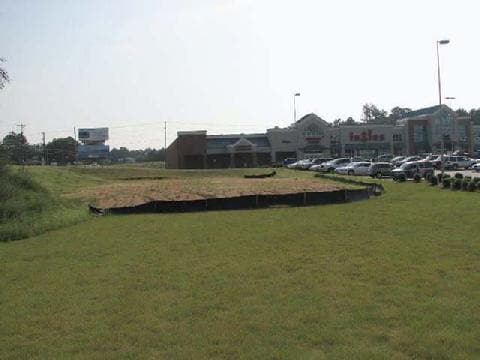

Property Detail
211 Ingles Pl
520-76-01-001
MAPPLATB P30 MAPPLATP 63
Supermarket
OCONEE
B and X Area of moderate flood hazard, usually the area between the limits of the 100-year and 500-year floods.
South Carolina
2025
7.79 AC
2025
South Carolina Rural Areas
030602
Other Market Areas
66,945 SF
Seneca, SC
NEARBY LISTINGS FOR SALE OR LEASE
DEMOGRAPHICS near 211 Ingles Pl
1 mile
3 mile
5 mile
2025 Total Population
2,494
16,416
29,255
2030 Population
2,589
17,043
30,420
Pop Growth 2025-2030
+ 3.81%
+ 3.82%
+ 3.98%
Average Age
45
43
44
2025 Total Households
1,109
7,116
12,686
HH Growth 2025-2030
+ 3.97%
+ 3.85%
+ 4.02%
Median Household Inc
$79,797
$62,296
$65,759
Avg Household Size
2.20
2.30
2.30
2025 Avg HH Vehicles
2.00
2.00
2.00
Median Home Value
$356,930
$257,158
$287,678
Median Year Built
1991
1984
1989
Nearby Places
Map Layers
Map Styles
 Street
 Aerial
Layers
 Traffic
 Biking
Places
Listings with unknown addresses are not visible on the map
- Restaurants
- Banks
- Shops
- Fitness
- Groceries
PUBLIC TRANSPORTATION
COMMUTER RAIL
Drive
Walk
Distance
11 min
6.6 mi
SALE & LEASE HISTORY
LISTING DATE
SALE/LEASE

Sep 24, 2016
For Sale
Nearby Properties
Address
Land Use
TOTAL SIZE
Lot Size
Zoning
Address
Land Use
TOTAL SIZE
Lot Size
Zoning
3,538 SF
7.12 AC
Address
Land Use
TOTAL SIZE
Lot Size
Zoning
142,238 SF
15.71 AC
Address
Land Use
TOTAL SIZE
Lot Size
Zoning
11,280 SF
9 AC
Address
Land Use
TOTAL SIZE
Lot Size
Zoning
1,200 SF
2.24 AC
Address
Land Use
TOTAL SIZE
Lot Size
Zoning
14,218 SF
46.68 AC
Address
Land Use
TOTAL SIZE
Lot Size
Zoning
13,012 SF
10.48 AC
Address
Land Use
TOTAL SIZE
Lot Size
Zoning
2.10 AC
Address
Land Use
TOTAL SIZE
Lot Size
Zoning
2.18 AC
Address
Land Use
TOTAL SIZE
Lot Size
Zoning
22,862 SF
6.66 AC
Address
Land Use
TOTAL SIZE
Lot Size
Zoning
65,865 SF
7.66 AC
Address
Land Use
TOTAL SIZE
Lot Size
Zoning
20,739 SF
7.59 AC
Address
Land Use
TOTAL SIZE
Lot Size
Zoning
31,224 SF
0.88 AC
Address
Land Use
TOTAL SIZE
Lot Size
Zoning
17,650 SF
2.63 AC
Address
Land Use
TOTAL SIZE
Lot Size
Zoning
267,424 SF
25.21 AC
Address
Land Use
TOTAL SIZE
Lot Size
Zoning
11,200 SF
1.34 AC
Address
Land Use
TOTAL SIZE
Lot Size
Zoning
47,164 SF
3.44 AC
Address
Land Use
TOTAL SIZE
Lot Size
Zoning
3,228 SF
42.60 AC
Address
Land Use
TOTAL SIZE
Lot Size
Zoning
3,306 SF
33.98 AC
Address
Land Use
TOTAL SIZE
Lot Size
Zoning
26,479 SF
8.86 AC
Address
Land Use
TOTAL SIZE
Lot Size
Zoning
80,100 SF
5.30 AC
Address
Land Use
TOTAL SIZE
Lot Size
Zoning
9,472 SF
4.92 AC
Address
Land Use
TOTAL SIZE
Lot Size
Zoning
6,152 SF
6.33 AC
Address
Land Use
TOTAL SIZE
Lot Size
Zoning
8,891 SF
3.15 AC
Address
Land Use
TOTAL SIZE
Lot Size
Zoning
23,624 SF
0.79 AC
Address
Land Use
TOTAL SIZE
Lot Size
Zoning
27,410 SF
7.22 AC
Address
Land Use
TOTAL SIZE
Lot Size
Zoning
10,600 SF
3.13 AC
Address
Land Use
TOTAL SIZE
Lot Size
Zoning
77,630 SF
10.61 AC
Address
Land Use
TOTAL SIZE
Lot Size
Zoning
3,725 SF
1.36 AC
The World's #1 Commercial Real Estate Marketplace
Connect with us
© 2026 CoStar Group
The information above has been obtained from sources believed reliable. While we do not doubt its accuracy we have not verified it and make no guarantee, warranty or representation about it. It is your responsibility to independently confirm its accuracy and completeness. Any projections, opinions, assumptions, or estimates used are for example only and do not represent the current or future performance of the property. The value of this transaction to you depends on tax and other factors which should be evaluated by your tax, financial, and legal advisors. You and your advisors should conduct a careful, independent investigation of the property to determine to your satisfaction the suitability of the property for your needs.