Property Record
211 N State St, Clairton, PA 15025


NEARBY LISTINGS FOR SALE OR LEASE
-
-
-
-
-
-
-
800 Fifth Street, West Elizabeth, PA 15088
Elizabeth, PA 15037
$8.00 - $12.00 SF/YR
775 - 3,500 SF
Retail
-
View all Clairton listings for sale on LoopNet.com
Property Detail
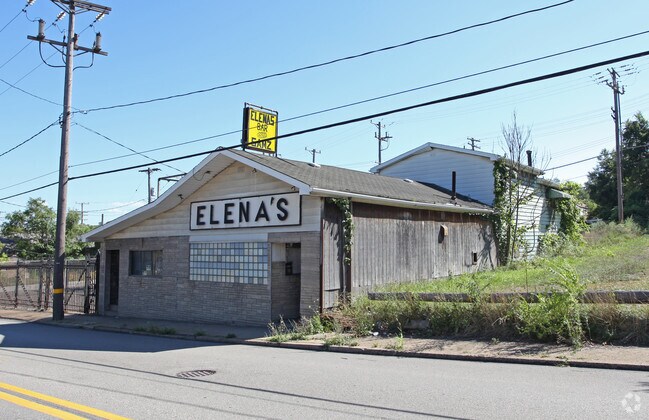
211 N State St
Pittsburgh, PA
C B Add
0764-D-00022-0000-00
CORWIN PLAN 26 LOT 40X128 STATE ST NORTH 1 & 2 STY ALUM SDG BLDG & STONE & C B ADD
Commercialacreage
Allegheny
X
Pennsylvania
42003C0492H
22
2024
0.12 AC
2025
South Pittsburgh/Rte 51
492700
Pittsburgh
DEMOGRAPHICS near 211 N State St
1 Mile
3 Mile
5 Mile
2024 Total Population
4,310
33,272
103,205
2029 Population
4,336
33,020
102,177
Pop Growth 2024-2029
+ 0.60%
(0.76%)
(1.00%)
Average Age
43
43
44
2024 Total Households
1,972
14,547
44,660
HH Growth 2024-2029
+ 0.56%
(0.81%)
(1.05%)
Median Household Inc
$35,123
$51,563
$56,566
Avg Household Size
2.10
2.20
2.20
2024 Avg HH Vehicles
1.00
2.00
2.00
Median Home Value
$73,728
$93,587
$130,879
Median Year Built
1948
1951
1954
Nearby Places
Map Layers
Map Styles
 Street
 Aerial
- Restaurants
- Banks
- Shops
- Fitness
- Groceries
PUBLIC TRANSPORTATION
AIRPORT
Pittsburgh International
DRIVE
WALK
Distance
Pittsburgh International
52 min
29.4 mi
Arnold Palmer Regional
DRIVE
WALK
Distance
Arnold Palmer Regional
61 min
33.1 mi
Nearby Properties
Address
Land Use
TOTAL SIZE
Lot Size
Zoning
Address
Land Use
TOTAL SIZE
Lot Size
Zoning
183.54 AC
Address
Land Use
TOTAL SIZE
Lot Size
Zoning
33.09 AC
Address
Land Use
TOTAL SIZE
Lot Size
Zoning
460.86 AC
Address
Land Use
TOTAL SIZE
Lot Size
Zoning
2.98 AC
Address
Land Use
TOTAL SIZE
Lot Size
Zoning
72.10 AC
Address
Land Use
TOTAL SIZE
Lot Size
Zoning
74.33 AC
Address
Land Use
TOTAL SIZE
Lot Size
Zoning
43.15 AC
Address
Land Use
TOTAL SIZE
Lot Size
Zoning
35.72 AC
Address
Land Use
TOTAL SIZE
Lot Size
Zoning
2.77 AC
Address
Land Use
TOTAL SIZE
Lot Size
Zoning
10.13 AC
Address
Land Use
TOTAL SIZE
Lot Size
Zoning
242.22 AC
Address
Land Use
TOTAL SIZE
Lot Size
Zoning
14.49 AC
Address
Land Use
TOTAL SIZE
Lot Size
Zoning
24.86 AC
Address
Land Use
TOTAL SIZE
Lot Size
Zoning
18.54 AC
Address
Land Use
TOTAL SIZE
Lot Size
Zoning
24.24 AC
Address
Land Use
TOTAL SIZE
Lot Size
Zoning
77.33 AC
Address
Land Use
TOTAL SIZE
Lot Size
Zoning
0.93 AC
Address
Land Use
TOTAL SIZE
Lot Size
Zoning
7.03 AC
Address
Land Use
TOTAL SIZE
Lot Size
Zoning
5.50 AC
Address
Land Use
TOTAL SIZE
Lot Size
Zoning
1.80 AC
Address
Land Use
TOTAL SIZE
Lot Size
Zoning
8.90 AC
Address
Land Use
TOTAL SIZE
Lot Size
Zoning
2.80 AC
Address
Land Use
TOTAL SIZE
Lot Size
Zoning
16.53 AC
Address
Land Use
TOTAL SIZE
Lot Size
Zoning
23.63 AC
Address
Land Use
TOTAL SIZE
Lot Size
Zoning
26.77 AC
Address
Land Use
TOTAL SIZE
Lot Size
Zoning
11.78 AC
Address
Land Use
TOTAL SIZE
Lot Size
Zoning
3.40 AC
Address
Land Use
TOTAL SIZE
Lot Size
Zoning
5.96 AC
Address
Land Use
TOTAL SIZE
Lot Size
Zoning
6.19 AC
Address
Land Use
TOTAL SIZE
Lot Size
Zoning
3.86 AC
The World's #1 Commercial Real Estate Marketplace
Connect with us
© 2026 CoStar Group
The information above has been obtained from sources believed reliable. While we do not doubt its accuracy we have not verified it and make no guarantee, warranty or representation about it. It is your responsibility to independently confirm its accuracy and completeness. Any projections, opinions, assumptions, or estimates used are for example only and do not represent the current or future performance of the property. The value of this transaction to you depends on tax and other factors which should be evaluated by your tax, financial, and legal advisors. You and your advisors should conduct a careful, independent investigation of the property to determine to your satisfaction the suitability of the property for your needs.