Property Record
211 Randy Way, Henderson, NV 89015
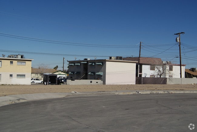

Property Detail
211 Randy Way
Las Vegas-Henderson-North Las Vegas, NV
BULLOCH SUB #1 PLAT BOOK 6 PAGE 83 LOT 9 BLOCK 2
179-17-511-016
CLARK
Vacantlandnec
Nevada
RH24
9
B and X Area of moderate flood hazard, usually the area between the limits of the 100-year and 500-year floods.
0.18 AC
0
Valley View
2026
Las Vegas
005423
NEARBY LISTINGS FOR SALE OR LEASE
-
-
View all Henderson listings for sale on LoopNet.com
DEMOGRAPHICS near 211 Randy Way
1 mile
3 mile
5 mile
2025 Total Population
19,291
89,144
174,896
2030 Population
20,336
95,172
185,400
Pop Growth 2025-2030
+ 5.42%
+ 6.76%
+ 6.01%
Average Age
40
42
41
2025 Total Households
7,174
33,708
66,841
HH Growth 2025-2030
+ 5.53%
+ 6.84%
+ 6.10%
Median Household Inc
$64,262
$88,158
$89,677
Avg Household Size
2.60
2.60
2.50
2025 Avg HH Vehicles
2.00
2.00
2.00
Median Home Value
$381,302
$446,078
$458,908
Median Year Built
1988
1997
2001
Nearby Places
Map Layers
Map Styles
 Street
 Aerial
Layers
 Traffic
 Biking
Places
Listings with unknown addresses are not visible on the map
- Restaurants
- Banks
- Shops
- Fitness
- Groceries
PUBLIC TRANSPORTATION
AIRPORT
Boulder City Municipal
Drive
Walk
Distance
Boulder City Municipal
19 min
10.9 mi
Harry Reid International
Drive
Walk
Distance
Harry Reid International
21 min
14.5 mi
Nearby Properties
Address
Land Use
TOTAL SIZE
Lot Size
Zoning
Address
Land Use
TOTAL SIZE
Lot Size
Zoning
100 SF
320 AC
DH
Address
Land Use
TOTAL SIZE
Lot Size
Zoning
62,258 SF
59.95 AC
Address
Land Use
TOTAL SIZE
Lot Size
Zoning
Address
Land Use
TOTAL SIZE
Lot Size
Zoning
31,463 SF
191.46 AC
PS
Address
Land Use
TOTAL SIZE
Lot Size
Zoning
502,625 SF
45.92 AC
Address
Land Use
TOTAL SIZE
Lot Size
Zoning
9,493 SF
15.37 AC
Address
Land Use
TOTAL SIZE
Lot Size
Zoning
350.47 AC
PS
Address
Land Use
TOTAL SIZE
Lot Size
Zoning
46.75 AC
PS
Address
Land Use
TOTAL SIZE
Lot Size
Zoning
10.50 AC
Address
Land Use
TOTAL SIZE
Lot Size
Zoning
81,485 SF
160.06 AC
PS
Address
Land Use
TOTAL SIZE
Lot Size
Zoning
387,990 SF
22.04 AC
Address
Land Use
TOTAL SIZE
Lot Size
Zoning
1,500 SF
25.08 AC
Address
Land Use
TOTAL SIZE
Lot Size
Zoning
9,000 SF
96.81 AC
RE
Address
Land Use
TOTAL SIZE
Lot Size
Zoning
40,031 SF
21.25 AC
Address
Land Use
TOTAL SIZE
Lot Size
Zoning
78,760 SF
1.23 AC
Address
Land Use
TOTAL SIZE
Lot Size
Zoning
23,087 SF
71.36 AC
PS
Address
Land Use
TOTAL SIZE
Lot Size
Zoning
239,288 SF
14.10 AC
Address
Land Use
TOTAL SIZE
Lot Size
Zoning
250,076 SF
24.61 AC
Address
Land Use
TOTAL SIZE
Lot Size
Zoning
295,238 SF
23.49 AC
IP
Address
Land Use
TOTAL SIZE
Lot Size
Zoning
71,133 SF
7.56 AC
DP
Address
Land Use
TOTAL SIZE
Lot Size
Zoning
19,753 SF
10.21 AC
DP
Address
Land Use
TOTAL SIZE
Lot Size
Zoning
213,472 SF
7.46 AC
Address
Land Use
TOTAL SIZE
Lot Size
Zoning
3,664 SF
16.09 AC
RH20
Address
Land Use
TOTAL SIZE
Lot Size
Zoning
14,463 SF
19.48 AC
Address
Land Use
TOTAL SIZE
Lot Size
Zoning
136,465 SF
34.67 AC
Address
Land Use
TOTAL SIZE
Lot Size
Zoning
168,361 SF
10.84 AC
Address
Land Use
TOTAL SIZE
Lot Size
Zoning
236,015 SF
17.43 AC
IG
Address
Land Use
TOTAL SIZE
Lot Size
Zoning
320 AC
PS
Address
Land Use
TOTAL SIZE
Lot Size
Zoning
292,375 SF
39.22 AC
M2
The World's #1 Commercial Real Estate Marketplace
Connect with us
© 2026 CoStar Group
The information above has been obtained from sources believed reliable. While we do not doubt its accuracy we have not verified it and make no guarantee, warranty or representation about it. It is your responsibility to independently confirm its accuracy and completeness. Any projections, opinions, assumptions, or estimates used are for example only and do not represent the current or future performance of the property. The value of this transaction to you depends on tax and other factors which should be evaluated by your tax, financial, and legal advisors. You and your advisors should conduct a careful, independent investigation of the property to determine to your satisfaction the suitability of the property for your needs.