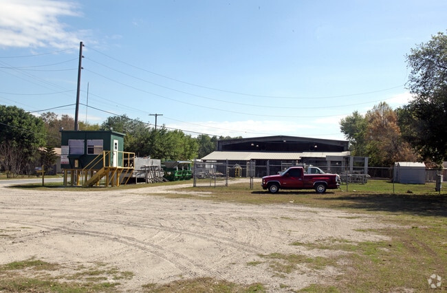
Property Record
211 Rayburn Rd, Plant City, FL 33566


NEARBY LISTINGS FOR SALE OR LEASE
Property Detail
211 Rayburn Rd
Tampa-St. Petersburg-Clearwater, FL
Unplatted
P-09-29-22-ZZZ-000004-88010.0
E 653.82 FT OF N 1/4 OF NW 1/4 OF NW 1/4 LESS N 193.8 FT... BEG NE COR OF NW 1/4 OF NW 1/4 AND RUN S 193.80 FT W 433.82 FT N 193.80 FT AND E 433.82 FT TO POB
Packing
Hillsborough
A
Florida
12057C0430H
88010
2024
3.89 AC
2024
E Hillsborough/Plant
013002
Tampa/St Petersburg
65,472 SF
DEMOGRAPHICS near 211 Rayburn Rd
1 Mile
3 Mile
5 Mile
2024 Total Population
4,859
35,023
67,580
2029 Population
5,315
38,142
73,921
Pop Growth 2024-2029
+ 9.38%
+ 8.91%
+ 9.38%
Average Age
35
38
38
2024 Total Households
1,592
11,862
23,126
HH Growth 2024-2029
+ 9.61%
+ 9.11%
+ 9.64%
Median Household Inc
$49,355
$59,804
$61,033
Avg Household Size
2.90
2.80
2.80
2024 Avg HH Vehicles
2.00
2.00
2.00
Median Home Value
$275,349
$257,443
$245,147
Median Year Built
2000
1989
1988
Nearby Places
Map Layers
Map Styles
 Street
 Aerial
- Restaurants
- Banks
- Shops
- Fitness
- Groceries
PUBLIC TRANSPORTATION
AIRPORT
Tampa International
DRIVE
WALK
Distance
Tampa International
45 min
32.7 mi
Freight Ports
Port of Tampa Bay
DRIVE
WALK
Distance
Port of Tampa Bay
38 min
26.1 mi
SALE & LEASE HISTORY
LISTING DATE
SALE/LEASE

Oct 04, 2023
For Sale
Nearby Properties
Address
Land Use
TOTAL SIZE
Lot Size
Zoning
Address
Land Use
TOTAL SIZE
Lot Size
Zoning
519,942 SF
130.03 AC
I
Address
Land Use
TOTAL SIZE
Lot Size
Zoning
286,824 SF
43.15 AC
PD
Address
Land Use
TOTAL SIZE
Lot Size
Zoning
605,109 SF
141.96 AC
PD
Address
Land Use
TOTAL SIZE
Lot Size
Zoning
505,506 SF
50.60 AC
MU-R/C/I
Address
Land Use
TOTAL SIZE
Lot Size
Zoning
235,102 SF
7.73 AC
P
Address
Land Use
TOTAL SIZE
Lot Size
Zoning
415,389 SF
62.31 AC
MU-R/C/I
Address
Land Use
TOTAL SIZE
Lot Size
Zoning
296,496 SF
77.52 AC
P
Address
Land Use
TOTAL SIZE
Lot Size
Zoning
496,217 SF
35.02 AC
I
Address
Land Use
TOTAL SIZE
Lot Size
Zoning
93,924 SF
3.96 AC
DC
Address
Land Use
TOTAL SIZE
Lot Size
Zoning
213,188 SF
16.10 AC
PD
Address
Land Use
TOTAL SIZE
Lot Size
Zoning
177,038 SF
16.95 AC
PD
Address
Land Use
TOTAL SIZE
Lot Size
Zoning
202,712 SF
28.41 AC
C
Address
Land Use
TOTAL SIZE
Lot Size
Zoning
247,608 SF
25.84 AC
PD
Address
Land Use
TOTAL SIZE
Lot Size
Zoning
122,814 SF
17.18 AC
I
Address
Land Use
TOTAL SIZE
Lot Size
Zoning
154,237 SF
17.92 AC
C
Address
Land Use
TOTAL SIZE
Lot Size
Zoning
169,563 SF
12.27 AC
I
Address
Land Use
TOTAL SIZE
Lot Size
Zoning
101,815 SF
15.76 AC
I
Address
Land Use
TOTAL SIZE
Lot Size
Zoning
144,010 SF
10.54 AC
I
Address
Land Use
TOTAL SIZE
Lot Size
Zoning
224,311 SF
36.86 AC
I
Address
Land Use
TOTAL SIZE
Lot Size
Zoning
157,584 SF
14.12 AC
I
Address
Land Use
TOTAL SIZE
Lot Size
Zoning
70,239 SF
53.33 AC
GWD
Address
Land Use
TOTAL SIZE
Lot Size
Zoning
127,470 SF
7.84 AC
R-20
Address
Land Use
TOTAL SIZE
Lot Size
Zoning
145,521 SF
19.83 AC
C
Address
Land Use
TOTAL SIZE
Lot Size
Zoning
125,744 SF
19.48 AC
I
Address
Land Use
TOTAL SIZE
Lot Size
Zoning
242,449 SF
19.97 AC
R-6
Address
Land Use
TOTAL SIZE
Lot Size
Zoning
109,293 SF
18.01 AC
R-12
Address
Land Use
TOTAL SIZE
Lot Size
Zoning
66,199 SF
4.32 AC
P
Address
Land Use
TOTAL SIZE
Lot Size
Zoning
90,436 SF
6.11 AC
C-1
Address
Land Use
TOTAL SIZE
Lot Size
Zoning
40,530 SF
2.36 AC
DC
Address
Land Use
TOTAL SIZE
Lot Size
Zoning
33,282 SF
16.94 AC
RO
The World's #1 Commercial Real Estate Marketplace
Connect with us
© 2026 CoStar Group
The information above has been obtained from sources believed reliable. While we do not doubt its accuracy we have not verified it and make no guarantee, warranty or representation about it. It is your responsibility to independently confirm its accuracy and completeness. Any projections, opinions, assumptions, or estimates used are for example only and do not represent the current or future performance of the property. The value of this transaction to you depends on tax and other factors which should be evaluated by your tax, financial, and legal advisors. You and your advisors should conduct a careful, independent investigation of the property to determine to your satisfaction the suitability of the property for your needs.