Property Record
211 Rosemary St, Clayton, NC 27520


Save to a Folder
{{folder.Name}}
{{folder.ListingIds.length}} Properties
{{folder.ListingIds.length}} Property
Create a New Folder
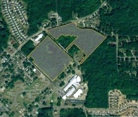
Property Detail
211 Rosemary St
05034068E
LOT 2 ACADEMY POINT 95/282
Gardenaptcourtapt5plusunits
JOHNSTON
PUD
North Carolina
B and X Area of moderate flood hazard, usually the area between the limits of the 100-year and 500-year floods.
2
2025
2 AC
2025
Johnston County
041104
Raleigh/Durham
6,960 SF
Raleigh-Cary, NC
NEARBY LISTINGS FOR SALE OR LEASE
DEMOGRAPHICS near 211 Rosemary St
1 mile
3 mile
5 mile
2025 Total Population
6,466
36,848
66,433
2030 Population
7,348
41,418
74,427
Pop Growth 2025-2030
+ 13.64%
+ 12.40%
+ 12.03%
Average Age
38
38
38
2025 Total Households
2,650
14,024
24,340
HH Growth 2025-2030
+ 13.66%
+ 12.49%
+ 12.14%
Median Household Inc
$79,576
$77,258
$91,363
Avg Household Size
2.40
2.60
2.70
2025 Avg HH Vehicles
2.00
2.00
2.00
Median Home Value
$345,298
$330,508
$360,466
Median Year Built
2001
2004
2005
Nearby Places
Map Layers
Map Styles
 Street
 Aerial
Layers
 Traffic
 Biking
Places
Listings with unknown addresses are not visible on the map
- Restaurants
- Banks
- Shops
- Fitness
- Groceries
PUBLIC TRANSPORTATION
AIRPORT
Raleigh-Durham International
Drive
Walk
Distance
Raleigh-Durham International
45 min
31.4 mi
Freight Ports
Port of Wilmington
Drive
Walk
Distance
Port of Wilmington
150 min
126.2 mi
SALE & LEASE HISTORY
LISTING DATE
SALE/LEASE

Sep 24, 2016
For Sale
Nearby Properties
Address
Land Use
TOTAL SIZE
Lot Size
Zoning
Address
Land Use
TOTAL SIZE
Lot Size
Zoning
5,616 SF
22.46 AC
PUD
Address
Land Use
TOTAL SIZE
Lot Size
Zoning
22,428 SF
19.98 AC
COM
Address
Land Use
TOTAL SIZE
Lot Size
Zoning
691,230 SF
106.53 AC
IND
Address
Land Use
TOTAL SIZE
Lot Size
Zoning
46,266 SF
19.36 AC
COM
Address
Land Use
TOTAL SIZE
Lot Size
Zoning
27,636 SF
17.81 AC
PUD
Address
Land Use
TOTAL SIZE
Lot Size
Zoning
65,586 SF
15.48 AC
OFF
Address
Land Use
TOTAL SIZE
Lot Size
Zoning
16,236 SF
45.70 AC
RES
Address
Land Use
TOTAL SIZE
Lot Size
Zoning
298,354 SF
36.16 AC
IND
Address
Land Use
TOTAL SIZE
Lot Size
Zoning
118,430 SF
24.82 AC
IND
Address
Land Use
TOTAL SIZE
Lot Size
Zoning
24,552 SF
17.40 AC
RES
Address
Land Use
TOTAL SIZE
Lot Size
Zoning
72,416 SF
6.61 AC
COM
Address
Land Use
TOTAL SIZE
Lot Size
Zoning
85,447 SF
36.25 AC
RES
Address
Land Use
TOTAL SIZE
Lot Size
Zoning
84,379 SF
6.87 AC
PUD
Address
Land Use
TOTAL SIZE
Lot Size
Zoning
10,052 SF
11.33 AC
OFF
Address
Land Use
TOTAL SIZE
Lot Size
Zoning
97,500 SF
3.96 AC
COM
Address
Land Use
TOTAL SIZE
Lot Size
Zoning
282,196 SF
139.44 AC
IND
Address
Land Use
TOTAL SIZE
Lot Size
Zoning
201,003 SF
21.64 AC
SUP
Address
Land Use
TOTAL SIZE
Lot Size
Zoning
59,600 SF
29 AC
PUD
Address
Land Use
TOTAL SIZE
Lot Size
Zoning
18,000 SF
249.20 AC
IND
Address
Land Use
TOTAL SIZE
Lot Size
Zoning
93,012 SF
3.11 AC
SUP
Address
Land Use
TOTAL SIZE
Lot Size
Zoning
67,730 SF
20.40 AC
RES
Address
Land Use
TOTAL SIZE
Lot Size
Zoning
74,219 SF
15.88 AC
COM
Address
Land Use
TOTAL SIZE
Lot Size
Zoning
99,500 SF
8.07 AC
IND
Address
Land Use
TOTAL SIZE
Lot Size
Zoning
24,552 SF
8.05 AC
RES
Address
Land Use
TOTAL SIZE
Lot Size
Zoning
57,701 SF
4.93 AC
COM
Address
Land Use
TOTAL SIZE
Lot Size
Zoning
20,991 SF
16.69 AC
RES
Address
Land Use
TOTAL SIZE
Lot Size
Zoning
41,446 SF
7.92 AC
COM
Address
Land Use
TOTAL SIZE
Lot Size
Zoning
42,348 SF
9.10 AC
SUP
Address
Land Use
TOTAL SIZE
Lot Size
Zoning
1,100 SF
9.63 AC
SUP
Address
Land Use
TOTAL SIZE
Lot Size
Zoning
63,660 SF
6.44 AC
SUP
The World's #1 Commercial Real Estate Marketplace
Connect with us
© 2026 CoStar Group
The information above has been obtained from sources believed reliable. While we do not doubt its accuracy we have not verified it and make no guarantee, warranty or representation about it. It is your responsibility to independently confirm its accuracy and completeness. Any projections, opinions, assumptions, or estimates used are for example only and do not represent the current or future performance of the property. The value of this transaction to you depends on tax and other factors which should be evaluated by your tax, financial, and legal advisors. You and your advisors should conduct a careful, independent investigation of the property to determine to your satisfaction the suitability of the property for your needs.