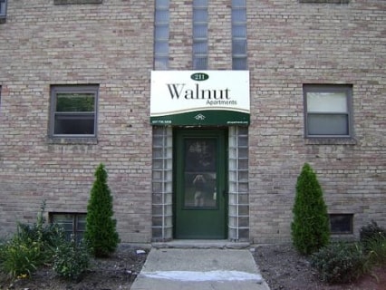
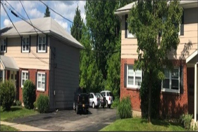
Property Record
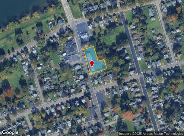
211 S Walnut St S, Elmira, NY 14904
NEARBY LISTINGS FOR SALE OR LEASE
-
-
View all Elmira listings for sale on LoopNet.com
Property Detail
211 S Walnut St S
Elmira, NY
Chemung
070400-099-006-0005-078-000-0000
New York
Apartment
78.000
2025
0.91 AC
2024
Ithaca/Elmira
001000
Other Market Areas
3,472 SF
DEMOGRAPHICS near 211 S Walnut St S
1 Mile
3 Mile
5 Mile
2024 Total Population
13,583
41,361
48,530
2029 Population
13,449
40,514
47,464
Pop Growth 2024-2029
(0.99%)
(2.05%)
(2.20%)
Average Age
39
41
41
2024 Total Households
6,004
17,676
20,810
HH Growth 2024-2029
(0.82%)
(2.20%)
(2.40%)
Median Household Inc
$46,315
$50,898
$52,651
Avg Household Size
2.10
2.20
2.20
2024 Avg HH Vehicles
1.00
1.00
2.00
Median Home Value
$88,645
$90,591
$97,314
Median Year Built
1947
1948
1948
Nearby Places
- Restaurants
- Banks
- Shops
- Fitness
- Groceries
PUBLIC TRANSPORTATION
AIRPORT
Elmira/Corning Regional
DRIVE
WALK
Distance
Elmira/Corning Regional
19 min
11.7 mi
Freight Ports
Albany, NY Port
DRIVE
WALK
Distance
Albany, NY Port
233 min
195.4 mi
SALE & LEASE HISTORY
LISTING DATE
SALE/LEASE

Aug 29, 2019
For Sale
Nearby Properties
Address
Land Use
TOTAL SIZE
Lot Size
Zoning
Address
Land Use
TOTAL SIZE
Lot Size
Zoning
323.72 AC
I
Address
Land Use
TOTAL SIZE
Lot Size
Zoning
59 AC
UNZONED
Address
Land Use
TOTAL SIZE
Lot Size
Zoning
118,475 SF
0.71 AC
LAC2
Address
Land Use
TOTAL SIZE
Lot Size
Zoning
308,479 SF
28.20 AC
HA
Address
Land Use
TOTAL SIZE
Lot Size
Zoning
221,341 SF
10.49 AC
R-2
Address
Land Use
TOTAL SIZE
Lot Size
Zoning
290,934 SF
13.50 AC
HED
Address
Land Use
TOTAL SIZE
Lot Size
Zoning
271,462 SF
7.50 AC
HS
Address
Land Use
TOTAL SIZE
Lot Size
Zoning
160.74 AC
AR
Address
Land Use
TOTAL SIZE
Lot Size
Zoning
31,140 SF
13.50 AC
HA
Address
Land Use
TOTAL SIZE
Lot Size
Zoning
Address
Land Use
TOTAL SIZE
Lot Size
Zoning
Address
Land Use
TOTAL SIZE
Lot Size
Zoning
25,388 SF
58.90 AC
RAA
Address
Land Use
TOTAL SIZE
Lot Size
Zoning
18.61 AC
IB
Address
Land Use
TOTAL SIZE
Lot Size
Zoning
69,403 SF
30.10 AC
R-2
Address
Land Use
TOTAL SIZE
Lot Size
Zoning
52,628 SF
2.40 AC
HED
Address
Land Use
TOTAL SIZE
Lot Size
Zoning
103,764 SF
31.98 AC
R2
Address
Land Use
TOTAL SIZE
Lot Size
Zoning
208,197 SF
39.40 AC
R-2
Address
Land Use
TOTAL SIZE
Lot Size
Zoning
Address
Land Use
TOTAL SIZE
Lot Size
Zoning
57,736 SF
20.62 AC
PMR
Address
Land Use
TOTAL SIZE
Lot Size
Zoning
61,157 SF
1 AC
CBD
Address
Land Use
TOTAL SIZE
Lot Size
Zoning
136,977 SF
2.55 AC
HED
Address
Land Use
TOTAL SIZE
Lot Size
Zoning
194,626 SF
10.20 AC
RAA
Address
Land Use
TOTAL SIZE
Lot Size
Zoning
5,562 SF
22.64 AC
RD
Address
Land Use
TOTAL SIZE
Lot Size
Zoning
14.10 AC
M
Address
Land Use
TOTAL SIZE
Lot Size
Zoning
157,418 SF
0.72 AC
CBD
Address
Land Use
TOTAL SIZE
Lot Size
Zoning
130,248 SF
7.10 AC
HA
Address
Land Use
TOTAL SIZE
Lot Size
Zoning
82,385 SF
18.38 AC
BE
Address
Land Use
TOTAL SIZE
Lot Size
Zoning
159,458 SF
3.15 AC
UMU
Address
Land Use
TOTAL SIZE
Lot Size
Zoning
77,451 SF
4.70 AC
AA
Address
Land Use
TOTAL SIZE
Lot Size
Zoning
52,122 SF
1.45 AC
HA
The World's #1 Commercial Real Estate Marketplace
Connect with us
© 2025 CoStar Group
The information above has been obtained from sources believed reliable. While we do not doubt its accuracy we have not verified it and make no guarantee, warranty or representation about it. It is your responsibility to independently confirm its accuracy and completeness. Any projections, opinions, assumptions, or estimates used are for example only and do not represent the current or future performance of the property. The value of this transaction to you depends on tax and other factors which should be evaluated by your tax, financial, and legal advisors. You and your advisors should conduct a careful, independent investigation of the property to determine to your satisfaction the suitability of the property for your needs.