Property Record
2110 Buchanan Loop, Ferndale, WA 98248
NEARBY LISTINGS FOR SALE OR LEASE
Property Detail
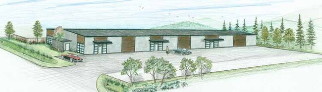
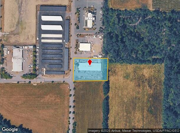
2110 Buchanan Loop
Bellingham, WA
I-5 Industrial Park Sbsp No 6
390206-510118-0000
TRACT 20 I-5 INDUSTRIAL PARK SPECIFIC BINDING SITE PLAN NO 6 AS REC AF 2061202701
Wholesaleoutletdiscountstore
Whatcom
X
Washington
53073C0690D
20
2024
1.35 AC
2024
Bellingham/Northwest
010407
Other Market Areas
11,970 SF
DEMOGRAPHICS near 2110 Buchanan Loop
1 Mile
3 Mile
5 Mile
2024 Total Population
902
13,725
29,002
2029 Population
934
14,318
30,110
Pop Growth 2024-2029
+ 3.55%
+ 4.32%
+ 3.82%
Average Age
41
39
40
2024 Total Households
323
4,706
10,210
HH Growth 2024-2029
+ 3.41%
+ 4.25%
+ 3.71%
Median Household Inc
$106,534
$89,088
$93,737
Avg Household Size
2.80
2.90
2.80
2024 Avg HH Vehicles
3.00
3.00
3.00
Median Home Value
$602,201
$503,929
$552,940
Median Year Built
1977
1988
1987
Nearby Places
Map Layers
Map Styles
 Street
 Aerial
- Restaurants
- Banks
- Shops
- Fitness
- Groceries
PUBLIC TRANSPORTATION
AIRPORT
Bellingham International
DRIVE
WALK
Distance
Bellingham International
14 min
9.8 mi
Abbotsford International
DRIVE
WALK
Distance
Abbotsford International
42 min
22.1 mi
Freight Ports
Port of Bellingham, WA
DRIVE
WALK
Distance
Port of Bellingham, WA
19 min
12.8 mi
Nearby Properties
Address
Land Use
TOTAL SIZE
Lot Size
Zoning
Address
Land Use
TOTAL SIZE
Lot Size
Zoning
116,159 SF
24.54 AC
P
Address
Land Use
TOTAL SIZE
Lot Size
Zoning
235,594 SF
56.20 AC
PBI
Address
Land Use
TOTAL SIZE
Lot Size
Zoning
203,305 SF
13.80 AC
LII
Address
Land Use
TOTAL SIZE
Lot Size
Zoning
153,557 SF
39.70 AC
PBI
Address
Land Use
TOTAL SIZE
Lot Size
Zoning
60,446 SF
4.03 AC
PBI
Address
Land Use
TOTAL SIZE
Lot Size
Zoning
72,720 SF
3.94 AC
LII
Address
Land Use
TOTAL SIZE
Lot Size
Zoning
103,600 SF
7 AC
LII
Address
Land Use
TOTAL SIZE
Lot Size
Zoning
140,381 SF
9.76 AC
M
Address
Land Use
TOTAL SIZE
Lot Size
Zoning
109,540 SF
5.30 AC
LII
Address
Land Use
TOTAL SIZE
Lot Size
Zoning
23,499 SF
4.46 AC
MCD
Address
Land Use
TOTAL SIZE
Lot Size
Zoning
115,975 SF
9.21 AC
LII
Address
Land Use
TOTAL SIZE
Lot Size
Zoning
25,854 SF
4.94 AC
RS8.5
Address
Land Use
TOTAL SIZE
Lot Size
Zoning
43,890 SF
6.90 AC
LII
Address
Land Use
TOTAL SIZE
Lot Size
Zoning
17,237 SF
10.43 AC
AG
Address
Land Use
TOTAL SIZE
Lot Size
Zoning
1,788 SF
19.60 AC
R5A
Address
Land Use
TOTAL SIZE
Lot Size
Zoning
59,038 SF
5.57 AC
LII
Address
Land Use
TOTAL SIZE
Lot Size
Zoning
87,004 SF
7 AC
LII
Address
Land Use
TOTAL SIZE
Lot Size
Zoning
25,380 SF
2.89 AC
LII
Address
Land Use
TOTAL SIZE
Lot Size
Zoning
2,448 SF
62.11 AC
R5A
Address
Land Use
TOTAL SIZE
Lot Size
Zoning
1,051 SF
21.84 AC
GB
Address
Land Use
TOTAL SIZE
Lot Size
Zoning
3,644 SF
77.90 AC
AG
Address
Land Use
TOTAL SIZE
Lot Size
Zoning
45,883 SF
3.10 AC
LII
Address
Land Use
TOTAL SIZE
Lot Size
Zoning
18,432 SF
2.28 AC
LII
Address
Land Use
TOTAL SIZE
Lot Size
Zoning
26,681 SF
73 AC
AG
Address
Land Use
TOTAL SIZE
Lot Size
Zoning
30,600 SF
2.06 AC
LII
Address
Land Use
TOTAL SIZE
Lot Size
Zoning
27,796 SF
5.38 AC
LII
Address
Land Use
TOTAL SIZE
Lot Size
Zoning
7.48 AC
GB
Address
Land Use
TOTAL SIZE
Lot Size
Zoning
26.60 AC
GB
Address
Land Use
TOTAL SIZE
Lot Size
Zoning
48,460 SF
2.57 AC
LII
Address
Land Use
TOTAL SIZE
Lot Size
Zoning
22,400 SF
1.19 AC
LII
The World's #1 Commercial Real Estate Marketplace
Connect with us
© 2025 CoStar Group
The information above has been obtained from sources believed reliable. While we do not doubt its accuracy we have not verified it and make no guarantee, warranty or representation about it. It is your responsibility to independently confirm its accuracy and completeness. Any projections, opinions, assumptions, or estimates used are for example only and do not represent the current or future performance of the property. The value of this transaction to you depends on tax and other factors which should be evaluated by your tax, financial, and legal advisors. You and your advisors should conduct a careful, independent investigation of the property to determine to your satisfaction the suitability of the property for your needs.