Property Record
2110 Daniels St, Manteca, CA 95337
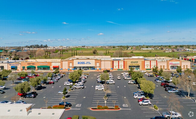


Property Detail
2110 Daniels St
241-530-06
06-FM PT 241-310-47/PT 530-01-05/07-11/RD/PM23-117
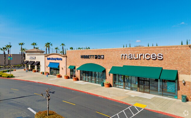
Regionalshoppingcenterormallwithanchorstore
SAN JOAQUIN
C and X Area of minimal flood hazard, usually depicted on FIRMs as above the 500-year flood level.
California
2025
15.18 AC
2025
Tracy/Manteca
005137
Stockton/Modesto
10,000 SF
Stockton-Lodi, CA
NEARBY LISTINGS FOR SALE OR LEASE
DEMOGRAPHICS near 2110 Daniels St
1 mile
3 mile
5 mile
2025 Total Population
10,313
79,255
135,237
2030 Population
11,054
83,755
143,456
Pop Growth 2025-2030
+ 7.19%
+ 5.68%
+ 6.08%
Average Age
38
38
38
2025 Total Households
2,867
24,152
41,630
HH Growth 2025-2030
+ 7.25%
+ 5.69%
+ 6.04%
Median Household Inc
$124,457
$96,483
$99,869
Avg Household Size
3.50
3.20
3.20
2025 Avg HH Vehicles
3.00
2.00
2.00
Median Home Value
$726,512
$635,108
$664,804
Median Year Built
2004
1992
1999
Nearby Places
Map Layers
Map Styles
 Street
 Aerial
Layers
 Traffic
 Biking
Places
Listings with unknown addresses are not visible on the map
- Restaurants
- Banks
- Shops
- Fitness
- Groceries
PUBLIC TRANSPORTATION
COMMUTER RAIL
Drive
Walk
Distance
5 min
2.0 mi
AIRPORT
Stockton Metro
Drive
Walk
Distance
Stockton Metro
15 min
8.0 mi
SALE & LEASE HISTORY
LISTING DATE
SALE/LEASE

Jan 30, 2025
For Lease
Feb 27, 2019
For Lease
Aug 04, 2017
For Lease
Nearby Properties
Address
Land Use
TOTAL SIZE
Lot Size
Zoning
Address
Land Use
TOTAL SIZE
Lot Size
Zoning
496,888 SF
29.11 AC
Address
Land Use
TOTAL SIZE
Lot Size
Zoning
510,086 SF
28.72 AC
Address
Land Use
TOTAL SIZE
Lot Size
Zoning
1,135,653 SF
49.62 AC
IL
Address
Land Use
TOTAL SIZE
Lot Size
Zoning
921,733 SF
44.72 AC
Address
Land Use
TOTAL SIZE
Lot Size
Zoning
832,994 SF
106.05 AC
Address
Land Use
TOTAL SIZE
Lot Size
Zoning
870,294 SF
48.64 AC
Address
Land Use
TOTAL SIZE
Lot Size
Zoning
622,959 SF
31.75 AC
IW
Address
Land Use
TOTAL SIZE
Lot Size
Zoning
649,693 SF
35.59 AC
Address
Land Use
TOTAL SIZE
Lot Size
Zoning
26,118 SF
10.80 AC
Address
Land Use
TOTAL SIZE
Lot Size
Zoning
932,400 SF
47.16 AC
Address
Land Use
TOTAL SIZE
Lot Size
Zoning
81.08 AC
Address
Land Use
TOTAL SIZE
Lot Size
Zoning
610,025 SF
26.34 AC
C2
Address
Land Use
TOTAL SIZE
Lot Size
Zoning
747,035 SF
38.06 AC
Address
Land Use
TOTAL SIZE
Lot Size
Zoning
565,580 SF
56.99 AC
Address
Land Use
TOTAL SIZE
Lot Size
Zoning
21,924 SF
9.27 AC
Address
Land Use
TOTAL SIZE
Lot Size
Zoning
381,555 SF
19.04 AC
CC
Address
Land Use
TOTAL SIZE
Lot Size
Zoning
417,600 SF
34.46 AC
Address
Land Use
TOTAL SIZE
Lot Size
Zoning
456,465 SF
20.62 AC
Address
Land Use
TOTAL SIZE
Lot Size
Zoning
27,162 SF
8.31 AC
R3
Address
Land Use
TOTAL SIZE
Lot Size
Zoning
517,600 SF
27.93 AC
Address
Land Use
TOTAL SIZE
Lot Size
Zoning
346,860 SF
18.70 AC
Address
Land Use
TOTAL SIZE
Lot Size
Zoning
390,443 SF
17.40 AC
Address
Land Use
TOTAL SIZE
Lot Size
Zoning
374,976 SF
15.18 AC
Address
Land Use
TOTAL SIZE
Lot Size
Zoning
440,490 SF
19.39 AC
Address
Land Use
TOTAL SIZE
Lot Size
Zoning
266,309 SF
12.50 AC
Address
Land Use
TOTAL SIZE
Lot Size
Zoning
198,183 SF
11 AC
Address
Land Use
TOTAL SIZE
Lot Size
Zoning
276,228 SF
12.50 AC
IG
Address
Land Use
TOTAL SIZE
Lot Size
Zoning
82,329 SF
5.96 AC
Address
Land Use
TOTAL SIZE
Lot Size
Zoning
175,025 SF
9.06 AC
The World's #1 Commercial Real Estate Marketplace
Connect with us
© 2026 CoStar Group
The information above has been obtained from sources believed reliable. While we do not doubt its accuracy we have not verified it and make no guarantee, warranty or representation about it. It is your responsibility to independently confirm its accuracy and completeness. Any projections, opinions, assumptions, or estimates used are for example only and do not represent the current or future performance of the property. The value of this transaction to you depends on tax and other factors which should be evaluated by your tax, financial, and legal advisors. You and your advisors should conduct a careful, independent investigation of the property to determine to your satisfaction the suitability of the property for your needs.