Property Record
2110 Fiserv Dr Sw, Cedar Rapids, IA 52404
NEARBY LISTINGS FOR SALE OR LEASE
-
-
View all Cedar Rapids listings for lease on LoopNet.com
Property Detail
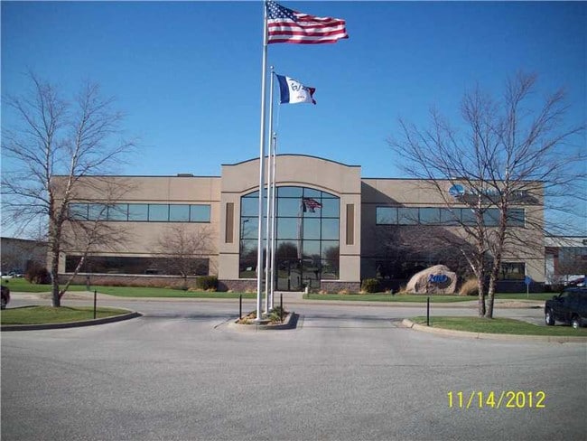
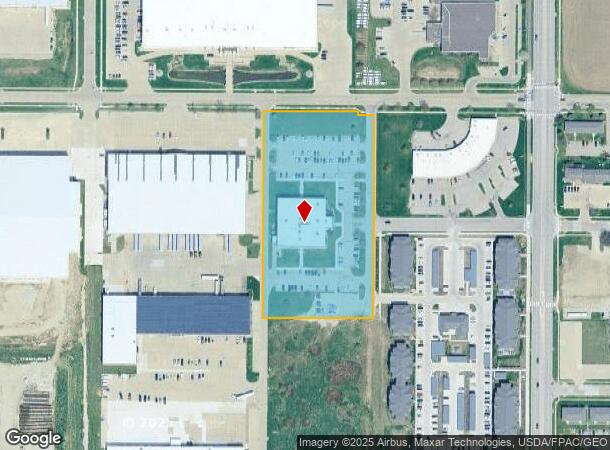
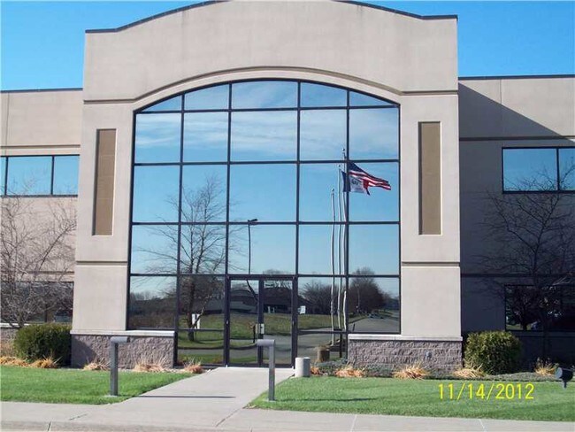
2110 Fiserv Dr Sw
Cedar Rapids, IA
Landmark 3Rd
13362-76009-00000
LANDMARK 3RD STR/LB 1
Officebuilding
Linn
X
Iowa
19113C0405F
1
2024
4.44 AC
2025
Iowa City/Waterloo
002900
Other Market Areas
20,889 SF
DEMOGRAPHICS near 2110 Fiserv Dr Sw
1 Mile
3 Mile
5 Mile
2024 Total Population
10,304
52,684
95,380
2029 Population
10,444
52,602
95,393
Pop Growth 2024-2029
+ 1.36%
(0.16%)
+ 0.01%
Average Age
38
40
39
2024 Total Households
4,535
21,957
39,842
HH Growth 2024-2029
+ 1.48%
(0.16%)
+ 0.04%
Median Household Inc
$37,822
$60,406
$60,994
Avg Household Size
2.20
2.30
2.20
2024 Avg HH Vehicles
2.00
2.00
2.00
Median Home Value
$142,857
$166,320
$169,353
Median Year Built
1989
1976
1973
Nearby Places
- Restaurants
- Banks
- Shops
- Fitness
- Groceries
PUBLIC TRANSPORTATION
AIRPORT
The Eastern Iowa
DRIVE
WALK
Distance
The Eastern Iowa
11 min
5.9 mi
Freight Ports
Port of Shreveport
DRIVE
WALK
Distance
Port of Shreveport
1 min
671.7 mi
SALE & LEASE HISTORY
LISTING DATE
SALE/LEASE

Nov 21, 2017
For Lease
Nearby Properties
Address
Land Use
TOTAL SIZE
Lot Size
Zoning
Address
Land Use
TOTAL SIZE
Lot Size
Zoning
308,309 SF
17.97 AC
Address
Land Use
TOTAL SIZE
Lot Size
Zoning
550,428 SF
78.91 AC
Address
Land Use
TOTAL SIZE
Lot Size
Zoning
427,700 SF
12.67 AC
Address
Land Use
TOTAL SIZE
Lot Size
Zoning
68,553 SF
7.70 AC
Address
Land Use
TOTAL SIZE
Lot Size
Zoning
42,449 SF
4.70 AC
Address
Land Use
TOTAL SIZE
Lot Size
Zoning
1,049,268 SF
79.35 AC
Address
Land Use
TOTAL SIZE
Lot Size
Zoning
59,467 SF
8.39 AC
Address
Land Use
TOTAL SIZE
Lot Size
Zoning
110,583 SF
15.56 AC
Address
Land Use
TOTAL SIZE
Lot Size
Zoning
66,922 SF
4.90 AC
Address
Land Use
TOTAL SIZE
Lot Size
Zoning
156,678 SF
21.85 AC
Address
Land Use
TOTAL SIZE
Lot Size
Zoning
907,717 SF
152.19 AC
Address
Land Use
TOTAL SIZE
Lot Size
Zoning
315,459 SF
13.85 AC
Address
Land Use
TOTAL SIZE
Lot Size
Zoning
416,830 SF
18.06 AC
Address
Land Use
TOTAL SIZE
Lot Size
Zoning
88,849 SF
18.63 AC
Address
Land Use
TOTAL SIZE
Lot Size
Zoning
212,316 SF
23.89 AC
Address
Land Use
TOTAL SIZE
Lot Size
Zoning
205,013 SF
16.44 AC
Address
Land Use
TOTAL SIZE
Lot Size
Zoning
189,188 SF
19.44 AC
Address
Land Use
TOTAL SIZE
Lot Size
Zoning
175,600 SF
15.91 AC
Address
Land Use
TOTAL SIZE
Lot Size
Zoning
44,754 SF
6 AC
Address
Land Use
TOTAL SIZE
Lot Size
Zoning
68,384 SF
17.90 AC
Address
Land Use
TOTAL SIZE
Lot Size
Zoning
70,918 SF
6.70 AC
Address
Land Use
TOTAL SIZE
Lot Size
Zoning
58,289 SF
4 AC
Address
Land Use
TOTAL SIZE
Lot Size
Zoning
24,178 SF
0.52 AC
Address
Land Use
TOTAL SIZE
Lot Size
Zoning
49,896 SF
3.80 AC
Address
Land Use
TOTAL SIZE
Lot Size
Zoning
39,060 SF
10.69 AC
Address
Land Use
TOTAL SIZE
Lot Size
Zoning
274,433 SF
17.68 AC
Address
Land Use
TOTAL SIZE
Lot Size
Zoning
14,839 SF
1.82 AC
Address
Land Use
TOTAL SIZE
Lot Size
Zoning
232,750 SF
9.65 AC
Address
Land Use
TOTAL SIZE
Lot Size
Zoning
39,679 SF
28.85 AC
Address
Land Use
TOTAL SIZE
Lot Size
Zoning
15,196 SF
1.79 AC
The World's #1 Commercial Real Estate Marketplace
Connect with us
© 2025 CoStar Group
The information above has been obtained from sources believed reliable. While we do not doubt its accuracy we have not verified it and make no guarantee, warranty or representation about it. It is your responsibility to independently confirm its accuracy and completeness. Any projections, opinions, assumptions, or estimates used are for example only and do not represent the current or future performance of the property. The value of this transaction to you depends on tax and other factors which should be evaluated by your tax, financial, and legal advisors. You and your advisors should conduct a careful, independent investigation of the property to determine to your satisfaction the suitability of the property for your needs.