Property Record
2110 Fm Rd 286, Corpus Christi, TX 78415

Save to a Folder
{{folder.Name}}
{{folder.ListingIds.length}} Properties
{{folder.ListingIds.length}} Property
Create a New Folder
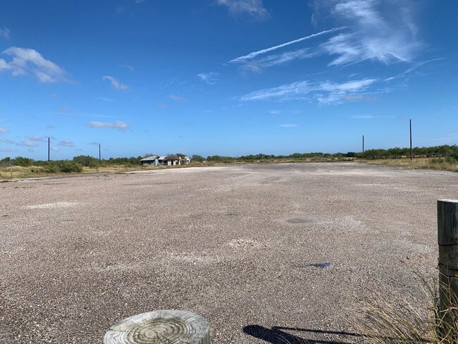
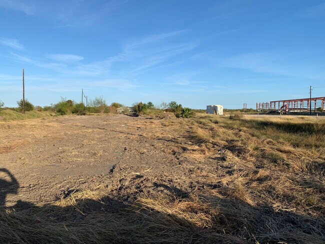
Property Detail
2110 Fm Rd 286
256864
LAURELES FARM TRACTS 5.25 ACS OUT SW/4 SEC 8 & 9.977 ACS OUT NW/4 SEC 29, 15.227 ACS
Commercialnec
NUECES
AE The base floodplain where base flood elevations are provided. AE Zones are now used on new format FIRMs instead of A1-A30 Zones.
Texas
2024
15.23 AC
2025
Southwest
001905
Corpus Christi
150 SF
Corpus Christi, TX
NEARBY LISTINGS FOR SALE OR LEASE
DEMOGRAPHICS near 2110 Fm Rd 286
1 mile
3 mile
5 mile
2025 Total Population
80
6,518
69,757
2030 Population
83
6,530
69,285
Pop Growth 2025-2030
+ 3.75%
+ 0.18%
(0.68%)
Average Age
36
40
38
2025 Total Households
26
2,152
25,233
HH Growth 2025-2030
+ 3.85%
(0.19%)
(0.84%)
Median Household Inc
$114,999
$118,535
$78,994
Avg Household Size
3.20
2.90
2.70
2025 Avg HH Vehicles
2.00
2.00
2.00
Median Home Value
$711,538
$384,753
$251,652
Median Year Built
2003
1995
1989
Nearby Places
Map Layers
Map Styles
 Street
 Aerial
Layers
 Traffic
 Biking
Places
Listings with unknown addresses are not visible on the map
- Restaurants
- Banks
- Shops
- Fitness
- Groceries
PUBLIC TRANSPORTATION
AIRPORT
Corpus Christi International
Drive
Walk
Distance
Corpus Christi International
19 min
12.9 mi
Freight Ports
Port of Corpus Christi
Drive
Walk
Distance
Port of Corpus Christi
14 min
11.5 mi
SALE & LEASE HISTORY
LISTING DATE
SALE/LEASE

Nov 20, 2019
For Lease
Jun 27, 2023
For Lease
Jul 07, 2022
For Lease
Dec 08, 2021
For Sale
Nearby Properties
Address
Land Use
TOTAL SIZE
Lot Size
Zoning
Address
Land Use
TOTAL SIZE
Lot Size
Zoning
296,470 SF
81.22 AC
Address
Land Use
TOTAL SIZE
Lot Size
Zoning
86,224 SF
33.89 AC
Address
Land Use
TOTAL SIZE
Lot Size
Zoning
81,798 SF
23.13 AC
A2
Address
Land Use
TOTAL SIZE
Lot Size
Zoning
221.94 AC
FR
Address
Land Use
TOTAL SIZE
Lot Size
Zoning
16,008 SF
13.59 AC
B4
Address
Land Use
TOTAL SIZE
Lot Size
Zoning
308.99 AC
OCL
Address
Land Use
TOTAL SIZE
Lot Size
Zoning
24,560 SF
2 AC
OCL
Address
Land Use
TOTAL SIZE
Lot Size
Zoning
3,705 SF
29.03 AC
Address
Land Use
TOTAL SIZE
Lot Size
Zoning
3,200 SF
35.04 AC
Address
Land Use
TOTAL SIZE
Lot Size
Zoning
46,735 SF
5.63 AC
B4
Address
Land Use
TOTAL SIZE
Lot Size
Zoning
Address
Land Use
TOTAL SIZE
Lot Size
Zoning
17.43 AC
Address
Land Use
TOTAL SIZE
Lot Size
Zoning
22,678 SF
1.49 AC
R-2
Address
Land Use
TOTAL SIZE
Lot Size
Zoning
41,969 SF
5.38 AC
Address
Land Use
TOTAL SIZE
Lot Size
Zoning
74.47 AC
Address
Land Use
TOTAL SIZE
Lot Size
Zoning
9,648 SF
1.06 AC
OCL
Address
Land Use
TOTAL SIZE
Lot Size
Zoning
9,632 SF
1.06 AC
OCL
Address
Land Use
TOTAL SIZE
Lot Size
Zoning
3.36 AC
R1B
Address
Land Use
TOTAL SIZE
Lot Size
Zoning
8,800 SF
2 AC
FR
Address
Land Use
TOTAL SIZE
Lot Size
Zoning
61.62 AC
Address
Land Use
TOTAL SIZE
Lot Size
Zoning
9,237 SF
3.07 AC
OCL
Address
Land Use
TOTAL SIZE
Lot Size
Zoning
Address
Land Use
TOTAL SIZE
Lot Size
Zoning
25.80 AC
Address
Land Use
TOTAL SIZE
Lot Size
Zoning
8,907 SF
2.31 AC
Address
Land Use
TOTAL SIZE
Lot Size
Zoning
4,943 SF
0.92 AC
B-4
Address
Land Use
TOTAL SIZE
Lot Size
Zoning
4,416 SF
1.67 AC
Address
Land Use
TOTAL SIZE
Lot Size
Zoning
10,960 SF
4 AC
Address
Land Use
TOTAL SIZE
Lot Size
Zoning
3,793 SF
0.66 AC
Address
Land Use
TOTAL SIZE
Lot Size
Zoning
5,623 SF
2.01 AC
Address
Land Use
TOTAL SIZE
Lot Size
Zoning
8,737 SF
10 AC
The World's #1 Commercial Real Estate Marketplace
Connect with us
© 2026 CoStar Group
The information above has been obtained from sources believed reliable. While we do not doubt its accuracy we have not verified it and make no guarantee, warranty or representation about it. It is your responsibility to independently confirm its accuracy and completeness. Any projections, opinions, assumptions, or estimates used are for example only and do not represent the current or future performance of the property. The value of this transaction to you depends on tax and other factors which should be evaluated by your tax, financial, and legal advisors. You and your advisors should conduct a careful, independent investigation of the property to determine to your satisfaction the suitability of the property for your needs.