Property Record
2110 Harding St, Wichita Falls, TX 76305
NEARBY LISTINGS FOR SALE OR LEASE
Property Detail
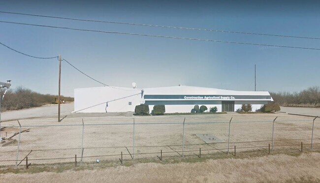
2110 Harding St
156143
Cherokee Csl
Transportnec
AB 959 SURVEY #58 H & T B RR J G EUSTIS 4400 US HWY 287 N ACCESS
AE
Wichita
48485C0350G
Texas
2025
137.40 AC
2025
East Wichita Falls
030301
Other Market Areas
19,083 SF
Wichita Falls, TX
DEMOGRAPHICS near 2110 Harding St
1 Mile
3 Mile
5 Mile
2024 Total Population
404
8,754
30,713
2029 Population
426
9,196
31,815
Pop Growth 2024-2029
+ 5.45%
+ 5.05%
+ 3.59%
Average Age
41
38
38
2024 Total Households
172
3,527
12,327
HH Growth 2024-2029
+ 5.23%
+ 5.19%
+ 3.71%
Median Household Inc
$43,499
$29,715
$38,033
Avg Household Size
2.40
2.40
2.30
2024 Avg HH Vehicles
2.00
2.00
2.00
Median Home Value
$119,231
$72,117
$81,918
Median Year Built
1973
1963
1958
Nearby Places
Map Layers
Map Styles
 Street
 Aerial
- Restaurants
- Banks
- Shops
- Fitness
- Groceries
Nearby Properties
Address
Land Use
TOTAL SIZE
Lot Size
Zoning
Address
Land Use
TOTAL SIZE
Lot Size
Zoning
356,863 SF
26.90 AC
HI
Address
Land Use
TOTAL SIZE
Lot Size
Zoning
140,976 SF
18.49 AC
Address
Land Use
TOTAL SIZE
Lot Size
Zoning
109,536 SF
27.02 AC
Address
Land Use
TOTAL SIZE
Lot Size
Zoning
98,700 SF
14.70 AC
Address
Land Use
TOTAL SIZE
Lot Size
Zoning
138,450 SF
2.61 AC
CBD
Address
Land Use
TOTAL SIZE
Lot Size
Zoning
188,940 SF
35 AC
Address
Land Use
TOTAL SIZE
Lot Size
Zoning
5,600 SF
15 AC
Address
Land Use
TOTAL SIZE
Lot Size
Zoning
75,096 SF
16.86 AC
Address
Land Use
TOTAL SIZE
Lot Size
Zoning
39,971 SF
163.30 AC
Address
Land Use
TOTAL SIZE
Lot Size
Zoning
47,365 SF
7.46 AC
SF2
Address
Land Use
TOTAL SIZE
Lot Size
Zoning
135,220 SF
20 AC
Address
Land Use
TOTAL SIZE
Lot Size
Zoning
129,229 SF
9.08 AC
Address
Land Use
TOTAL SIZE
Lot Size
Zoning
8,334 SF
21.37 AC
Address
Land Use
TOTAL SIZE
Lot Size
Zoning
58,933 SF
5.63 AC
RMU
Address
Land Use
TOTAL SIZE
Lot Size
Zoning
62,425 SF
6.81 AC
HI
Address
Land Use
TOTAL SIZE
Lot Size
Zoning
12,145 SF
5.29 AC
Address
Land Use
TOTAL SIZE
Lot Size
Zoning
20,322 SF
9.68 AC
GC
Address
Land Use
TOTAL SIZE
Lot Size
Zoning
52,650 SF
4.19 AC
MFR
Address
Land Use
TOTAL SIZE
Lot Size
Zoning
27,567 SF
3.75 AC
SF2
Address
Land Use
TOTAL SIZE
Lot Size
Zoning
115,861 SF
7.83 AC
Address
Land Use
TOTAL SIZE
Lot Size
Zoning
100,639 SF
6.20 AC
Address
Land Use
TOTAL SIZE
Lot Size
Zoning
42,376 SF
3.48 AC
Address
Land Use
TOTAL SIZE
Lot Size
Zoning
25,064 SF
1.76 AC
GC
Address
Land Use
TOTAL SIZE
Lot Size
Zoning
20,063 SF
1.29 AC
MFR
Address
Land Use
TOTAL SIZE
Lot Size
Zoning
21,665 SF
10.84 AC
HI
Address
Land Use
TOTAL SIZE
Lot Size
Zoning
22,785 SF
16.01 AC
Address
Land Use
TOTAL SIZE
Lot Size
Zoning
34,020 SF
1.21 AC
LI
Address
Land Use
TOTAL SIZE
Lot Size
Zoning
0.91 AC
HI
Address
Land Use
TOTAL SIZE
Lot Size
Zoning
12,060 SF
6.89 AC
Address
Land Use
TOTAL SIZE
Lot Size
Zoning
25,790 SF
18.85 AC
HI
The World's #1 Commercial Real Estate Marketplace
Connect with us
© 2025 CoStar Group
The information above has been obtained from sources believed reliable. While we do not doubt its accuracy we have not verified it and make no guarantee, warranty or representation about it. It is your responsibility to independently confirm its accuracy and completeness. Any projections, opinions, assumptions, or estimates used are for example only and do not represent the current or future performance of the property. The value of this transaction to you depends on tax and other factors which should be evaluated by your tax, financial, and legal advisors. You and your advisors should conduct a careful, independent investigation of the property to determine to your satisfaction the suitability of the property for your needs.