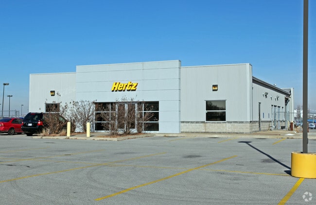
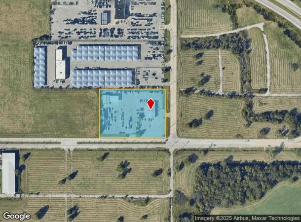
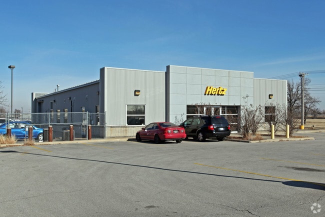
Property Record
2110 N 73Rd Ave E, Tulsa, OK 74115
NEARBY LISTINGS FOR SALE OR LEASE
Property Detail
2110 N 73Rd Ave E
Tulsa, OK
Mohawk Ridge
28250-03-26-05770
PRT BLK 16 & PRT VAC VIRGIN PL BEG 10W SECR LT 24 TH W424.97 N307.50 E424.97 S307.50 POB
Taxexempt
Tulsa
X
Oklahoma
40143C0242L
24
0
3 AC
2025
Northeast Tulsa
011300
Tulsa
5,824 SF
DEMOGRAPHICS near 2110 N 73Rd Ave E
1 Mile
3 Mile
5 Mile
2024 Total Population
4,344
45,125
135,059
2029 Population
4,530
46,905
140,573
Pop Growth 2024-2029
+ 4.28%
+ 3.94%
+ 4.08%
Average Age
35
35
36
2024 Total Households
1,485
16,662
52,729
HH Growth 2024-2029
+ 4.38%
+ 3.97%
+ 4.19%
Median Household Inc
$33,715
$41,061
$43,882
Avg Household Size
2.80
2.60
2.40
2024 Avg HH Vehicles
2.00
2.00
2.00
Median Home Value
$61,145
$73,522
$114,673
Median Year Built
1955
1956
1958
Nearby Places
Map Layers
Map Styles
 Street
 Aerial
- Restaurants
- Banks
- Shops
- Fitness
- Groceries
PUBLIC TRANSPORTATION
AIRPORT
Tulsa International
DRIVE
WALK
Distance
Tulsa International
8 min
3.6 mi
Freight Ports
DRIVE
WALK
Distance
18 min
11.8 mi
Nearby Properties
Address
Land Use
TOTAL SIZE
Lot Size
Zoning
Address
Land Use
TOTAL SIZE
Lot Size
Zoning
609,418 SF
177.77 AC
IM
Address
Land Use
TOTAL SIZE
Lot Size
Zoning
353.75 AC
IL
Address
Land Use
TOTAL SIZE
Lot Size
Zoning
94,115 SF
15.18 AC
IM
Address
Land Use
TOTAL SIZE
Lot Size
Zoning
1 SF
207.77 AC
IM
Address
Land Use
TOTAL SIZE
Lot Size
Zoning
228.59 AC
IL
Address
Land Use
TOTAL SIZE
Lot Size
Zoning
195,492 SF
17.11 AC
RM1
Address
Land Use
TOTAL SIZE
Lot Size
Zoning
42,665 SF
493.63 AC
RS3
Address
Land Use
TOTAL SIZE
Lot Size
Zoning
110.77 AC
IL
Address
Land Use
TOTAL SIZE
Lot Size
Zoning
103,248 SF
8.87 AC
IL
Address
Land Use
TOTAL SIZE
Lot Size
Zoning
36,962 SF
1.23 AC
CH
Address
Land Use
TOTAL SIZE
Lot Size
Zoning
97.68 AC
CH
Address
Land Use
TOTAL SIZE
Lot Size
Zoning
29,584 SF
2.99 AC
IM
Address
Land Use
TOTAL SIZE
Lot Size
Zoning
41,874 SF
35.70 AC
RS3
Address
Land Use
TOTAL SIZE
Lot Size
Zoning
124,648 SF
21.23 AC
IL
Address
Land Use
TOTAL SIZE
Lot Size
Zoning
139.39 AC
IM
Address
Land Use
TOTAL SIZE
Lot Size
Zoning
34,356 SF
35.67 AC
RS3
Address
Land Use
TOTAL SIZE
Lot Size
Zoning
19,708 SF
21.04 AC
IL
Address
Land Use
TOTAL SIZE
Lot Size
Zoning
35,474 SF
6.11 AC
CM
Address
Land Use
TOTAL SIZE
Lot Size
Zoning
35,406 SF
1.51 AC
CH
Address
Land Use
TOTAL SIZE
Lot Size
Zoning
187,351 SF
218.26 AC
IL
Address
Land Use
TOTAL SIZE
Lot Size
Zoning
185,649 SF
56.23 AC
IL
Address
Land Use
TOTAL SIZE
Lot Size
Zoning
101,090 SF
1.70 AC
RS2
Address
Land Use
TOTAL SIZE
Lot Size
Zoning
55,425 SF
2.96 AC
IL
Address
Land Use
TOTAL SIZE
Lot Size
Zoning
36,450 SF
30.52 AC
RS3
Address
Land Use
TOTAL SIZE
Lot Size
Zoning
513.99 AC
RS3
Address
Land Use
TOTAL SIZE
Lot Size
Zoning
44,195 SF
5.07 AC
RS3
Address
Land Use
TOTAL SIZE
Lot Size
Zoning
49,953 SF
2.36 AC
OL
Address
Land Use
TOTAL SIZE
Lot Size
Zoning
147,683 SF
9.19 AC
IL
Address
Land Use
TOTAL SIZE
Lot Size
Zoning
63,675 SF
3.26 AC
CH
The World's #1 Commercial Real Estate Marketplace
Connect with us
© 2026 CoStar Group
The information above has been obtained from sources believed reliable. While we do not doubt its accuracy we have not verified it and make no guarantee, warranty or representation about it. It is your responsibility to independently confirm its accuracy and completeness. Any projections, opinions, assumptions, or estimates used are for example only and do not represent the current or future performance of the property. The value of this transaction to you depends on tax and other factors which should be evaluated by your tax, financial, and legal advisors. You and your advisors should conduct a careful, independent investigation of the property to determine to your satisfaction the suitability of the property for your needs.