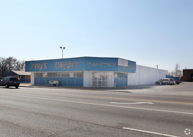
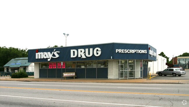
Property Record
2110 S Harvard Ave, Tulsa, OK 74114

NEARBY LISTINGS FOR SALE OR LEASE
Property Detail
2110 S Harvard Ave
Tulsa, OK
Bonnie Brae
04250-93-17-00430
LTS 4 THRU 6 & PRT VAC STREETS BEG 89.93S & 50W NEC SEC 17 19 13 TH S245.07 W131.80 NW103.20 NE31.13 N105.22 E9.16 N94.76 E151.01CRV RT 62.76 POB LESS BEG SECR LT 6 TH W85.04 NE32.53 E62 S23 POB BLK 3
Storebuilding
Tulsa
X
Oklahoma
40143C0240L
4
2025
1.20 AC
2025
North Central Tulsa
004200
Tulsa
13,146 SF
DEMOGRAPHICS near 2110 S Harvard Ave
1 Mile
3 Mile
5 Mile
2024 Total Population
10,670
96,035
233,358
2029 Population
11,002
99,941
242,887
Pop Growth 2024-2029
+ 3.11%
+ 4.07%
+ 4.08%
Average Age
41
39
38
2024 Total Households
5,432
43,681
100,408
HH Growth 2024-2029
+ 3.17%
+ 4.23%
+ 4.22%
Median Household Inc
$70,566
$56,817
$48,489
Avg Household Size
1.90
2.10
2.20
2024 Avg HH Vehicles
2.00
2.00
2.00
Median Home Value
$224,757
$189,177
$160,487
Median Year Built
1948
1955
1962
Nearby Places
Map Layers
Map Styles
 Street
 Aerial
- Restaurants
- Banks
- Shops
- Fitness
- Groceries
PUBLIC TRANSPORTATION
AIRPORT
Tulsa International
DRIVE
WALK
Distance
Tulsa International
16 min
8.5 mi
Freight Ports
Tulsa Port Of Catoosa
DRIVE
WALK
Distance
Tulsa Port Of Catoosa
24 min
16.8 mi
Nearby Properties
Address
Land Use
TOTAL SIZE
Lot Size
Zoning
Address
Land Use
TOTAL SIZE
Lot Size
Zoning
1,303,210 SF
7.94 AC
OH
Address
Land Use
TOTAL SIZE
Lot Size
Zoning
1,604,892 SF
208.96 AC
AG
Address
Land Use
TOTAL SIZE
Lot Size
Zoning
1,673,798 SF
90.26 AC
NCU
Address
Land Use
TOTAL SIZE
Lot Size
Zoning
431,569 SF
39.02 AC
RM2
Address
Land Use
TOTAL SIZE
Lot Size
Zoning
247,806 SF
8.40 AC
RS3
Address
Land Use
TOTAL SIZE
Lot Size
Zoning
49,992 SF
33.23 AC
AG
Address
Land Use
TOTAL SIZE
Lot Size
Zoning
528,432 SF
0.01 AC
CBD
Address
Land Use
TOTAL SIZE
Lot Size
Zoning
110,922 SF
1.59 AC
RM2
Address
Land Use
TOTAL SIZE
Lot Size
Zoning
254,800 SF
2.07 AC
CBD
Address
Land Use
TOTAL SIZE
Lot Size
Zoning
114,791 SF
23.40 AC
RE
Address
Land Use
TOTAL SIZE
Lot Size
Zoning
238,884 SF
38.79 AC
RS2
Address
Land Use
TOTAL SIZE
Lot Size
Zoning
175,176 SF
1.57 AC
RM2
Address
Land Use
TOTAL SIZE
Lot Size
Zoning
230,620 SF
16.72 AC
RM2
Address
Land Use
TOTAL SIZE
Lot Size
Zoning
216,280 SF
41.17 AC
RS2
Address
Land Use
TOTAL SIZE
Lot Size
Zoning
303 SF
33.64 AC
RS2
Address
Land Use
TOTAL SIZE
Lot Size
Zoning
266,944 SF
2.07 AC
CBD
Address
Land Use
TOTAL SIZE
Lot Size
Zoning
46,859 SF
5.80 AC
CH
Address
Land Use
TOTAL SIZE
Lot Size
Zoning
66,541 SF
6.05 AC
CN
Address
Land Use
TOTAL SIZE
Lot Size
Zoning
146,538 SF
2.56 AC
CS
Address
Land Use
TOTAL SIZE
Lot Size
Zoning
1,264,325 SF
10.72 AC
CH
Address
Land Use
TOTAL SIZE
Lot Size
Zoning
53,337 SF
3.34 AC
FBC
Address
Land Use
TOTAL SIZE
Lot Size
Zoning
108,416 SF
4.26 AC
OM
Address
Land Use
TOTAL SIZE
Lot Size
Zoning
60,320 SF
5.23 AC
NCU
Address
Land Use
TOTAL SIZE
Lot Size
Zoning
180,642 SF
5.14 AC
CS
Address
Land Use
TOTAL SIZE
Lot Size
Zoning
163,321 SF
10.74 AC
RS3
Address
Land Use
TOTAL SIZE
Lot Size
Zoning
63,384 SF
0.56 AC
OH
Address
Land Use
TOTAL SIZE
Lot Size
Zoning
149,830 SF
0.83 AC
CBD
Address
Land Use
TOTAL SIZE
Lot Size
Zoning
77,346 SF
8.59 AC
RS3
Address
Land Use
TOTAL SIZE
Lot Size
Zoning
51,539 SF
0.96 AC
RM2
Address
Land Use
TOTAL SIZE
Lot Size
Zoning
96,983 SF
5.42 AC
RM2
The World's #1 Commercial Real Estate Marketplace
Connect with us
© 2025 CoStar Group
The information above has been obtained from sources believed reliable. While we do not doubt its accuracy we have not verified it and make no guarantee, warranty or representation about it. It is your responsibility to independently confirm its accuracy and completeness. Any projections, opinions, assumptions, or estimates used are for example only and do not represent the current or future performance of the property. The value of this transaction to you depends on tax and other factors which should be evaluated by your tax, financial, and legal advisors. You and your advisors should conduct a careful, independent investigation of the property to determine to your satisfaction the suitability of the property for your needs.