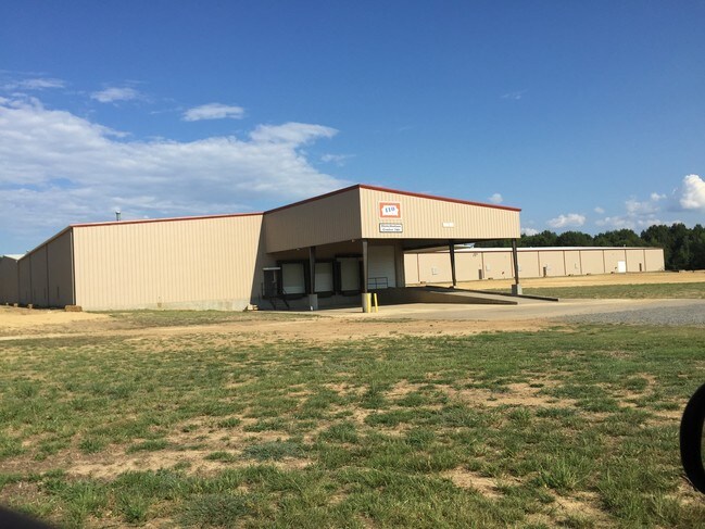
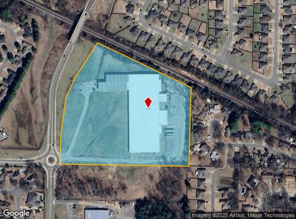
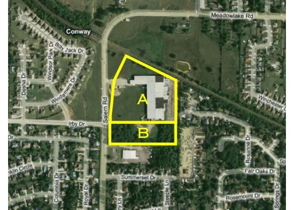
Property Record
2110 Salem Rd, Conway, AR 72034
NEARBY LISTINGS FOR SALE OR LEASE
Property Detail
2110 Salem Rd
710-08754-000C
PT S 1/2 SW
Warehouse
Faulkner
X
Arkansas
05045C0276J
13.11 AC
2025
Faulkner County
2025
Little Rock/N Little Rock
030600
Little Rock-North Little Rock-Conway, AR
129,938 SF
DEMOGRAPHICS near 2110 Salem Rd
1 Mile
3 Mile
5 Mile
2024 Total Population
8,701
46,471
69,925
2029 Population
9,276
49,726
75,255
Pop Growth 2024-2029
+ 6.61%
+ 7.00%
+ 7.62%
Average Age
37
35
36
2024 Total Households
3,636
18,352
27,611
HH Growth 2024-2029
+ 6.77%
+ 7.46%
+ 8.00%
Median Household Inc
$53,379
$47,459
$52,407
Avg Household Size
2.30
2.30
2.30
2024 Avg HH Vehicles
2.00
2.00
2.00
Median Home Value
$197,515
$222,258
$222,561
Median Year Built
1994
1994
1996
Nearby Places
Map Layers
Map Styles
 Street
 Aerial
- Restaurants
- Banks
- Shops
- Fitness
- Groceries
PUBLIC TRANSPORTATION
AIRPORT
Bill and Hillary Clinton Ntl/Adams Field
DRIVE
WALK
Distance
Bill and Hillary Clinton Ntl/Adams Field
44 min
37.6 mi
SALE & LEASE HISTORY
LISTING DATE
SALE/LEASE

Sep 25, 2016
For Lease
Nearby Properties
Address
Land Use
TOTAL SIZE
Lot Size
Zoning
Address
Land Use
TOTAL SIZE
Lot Size
Zoning
123,032 SF
9.59 AC
Address
Land Use
TOTAL SIZE
Lot Size
Zoning
94,854 SF
10.40 AC
Address
Land Use
TOTAL SIZE
Lot Size
Zoning
89,037 SF
11.30 AC
Address
Land Use
TOTAL SIZE
Lot Size
Zoning
164,655 SF
10.36 AC
Address
Land Use
TOTAL SIZE
Lot Size
Zoning
26,928 SF
2.37 AC
Address
Land Use
TOTAL SIZE
Lot Size
Zoning
24,757 SF
27.65 AC
Address
Land Use
TOTAL SIZE
Lot Size
Zoning
38,442 SF
30.57 AC
Address
Land Use
TOTAL SIZE
Lot Size
Zoning
21,664 SF
13.85 AC
Address
Land Use
TOTAL SIZE
Lot Size
Zoning
77,129 SF
12.84 AC
Address
Land Use
TOTAL SIZE
Lot Size
Zoning
21,532 SF
13.21 AC
Address
Land Use
TOTAL SIZE
Lot Size
Zoning
30,312 SF
7.24 AC
Address
Land Use
TOTAL SIZE
Lot Size
Zoning
42,457 SF
16.89 AC
Address
Land Use
TOTAL SIZE
Lot Size
Zoning
31,520 SF
12.22 AC
Address
Land Use
TOTAL SIZE
Lot Size
Zoning
98,915 SF
2.77 AC
Address
Land Use
TOTAL SIZE
Lot Size
Zoning
73,124 SF
11.60 AC
Address
Land Use
TOTAL SIZE
Lot Size
Zoning
1,811 SF
23.47 AC
Address
Land Use
TOTAL SIZE
Lot Size
Zoning
31,584 SF
8.60 AC
Address
Land Use
TOTAL SIZE
Lot Size
Zoning
12,419 SF
1.56 AC
Address
Land Use
TOTAL SIZE
Lot Size
Zoning
28,167 SF
6.85 AC
Address
Land Use
TOTAL SIZE
Lot Size
Zoning
154,053 SF
15.07 AC
Address
Land Use
TOTAL SIZE
Lot Size
Zoning
12,948 SF
7.18 AC
Address
Land Use
TOTAL SIZE
Lot Size
Zoning
126,911 SF
10.19 AC
Address
Land Use
TOTAL SIZE
Lot Size
Zoning
15,000 SF
7.50 AC
Address
Land Use
TOTAL SIZE
Lot Size
Zoning
17,444 SF
8.01 AC
Address
Land Use
TOTAL SIZE
Lot Size
Zoning
22,100 SF
1.42 AC
Address
Land Use
TOTAL SIZE
Lot Size
Zoning
8,956 SF
7.63 AC
Address
Land Use
TOTAL SIZE
Lot Size
Zoning
31,520 SF
12.66 AC
Address
Land Use
TOTAL SIZE
Lot Size
Zoning
40,806 SF
5.13 AC
Address
Land Use
TOTAL SIZE
Lot Size
Zoning
43,180 SF
4.33 AC
Address
Land Use
TOTAL SIZE
Lot Size
Zoning
42,637 SF
21.45 AC
The World's #1 Commercial Real Estate Marketplace
Connect with us
© 2026 CoStar Group
The information above has been obtained from sources believed reliable. While we do not doubt its accuracy we have not verified it and make no guarantee, warranty or representation about it. It is your responsibility to independently confirm its accuracy and completeness. Any projections, opinions, assumptions, or estimates used are for example only and do not represent the current or future performance of the property. The value of this transaction to you depends on tax and other factors which should be evaluated by your tax, financial, and legal advisors. You and your advisors should conduct a careful, independent investigation of the property to determine to your satisfaction the suitability of the property for your needs.