Property Record
2110 Sparkman Dr Nw, Huntsville, AL 35810


NEARBY LISTINGS FOR SALE OR LEASE
Property Detail
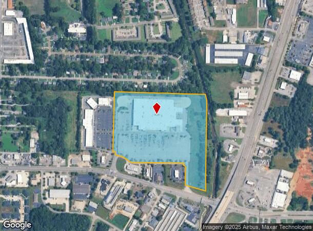
2110 Sparkman Dr Nw
Huntsville, AL
10 A R/S Of Lt 1 10 A Wal Mart Developme
14-06-23-1-002-077.000
LOT 1A BLK A R/S OF LT 1 BLK A WAL MART DEVELOPMENT OF A R/S OF LT 1 & 2 OF WAL MART DEVELOPMENT OF A R/S OF BENT CREEK & OTH
Wholesaleoutletdiscountstore
Madison
AE
Alabama
01089C0189F
1a
2025
24.81 AC
2025
North Huntsville
000302
Huntsville
204,388 SF
DEMOGRAPHICS near 2110 Sparkman Dr Nw
1 Mile
3 Mile
5 Mile
2024 Total Population
8,726
60,963
112,628
2029 Population
9,722
67,411
124,867
Pop Growth 2024-2029
+ 11.41%
+ 10.58%
+ 10.87%
Average Age
39
39
39
2024 Total Households
3,616
24,917
46,769
HH Growth 2024-2029
+ 11.86%
+ 11.61%
+ 11.70%
Median Household Inc
$33,604
$48,792
$51,449
Avg Household Size
2.30
2.20
2.20
2024 Avg HH Vehicles
2.00
2.00
2.00
Median Home Value
$74,611
$128,159
$174,258
Median Year Built
1966
1968
1971
Nearby Places
Map Layers
Map Styles
 Street
 Aerial
- Restaurants
- Banks
- Shops
- Fitness
- Groceries
PUBLIC TRANSPORTATION
AIRPORT
Huntsville International-Carl T Jones Field
DRIVE
WALK
Distance
Huntsville International-Carl T Jones Field
24 min
16.2 mi
Freight Ports
Port of Mobile
DRIVE
WALK
Distance
Port of Mobile
392 min
357.4 mi
Nearby Properties
Address
Land Use
TOTAL SIZE
Lot Size
Zoning
Address
Land Use
TOTAL SIZE
Lot Size
Zoning
92,055 SF
4.83 AC
Address
Land Use
TOTAL SIZE
Lot Size
Zoning
76,442 SF
Address
Land Use
TOTAL SIZE
Lot Size
Zoning
0.77 AC
Address
Land Use
TOTAL SIZE
Lot Size
Zoning
18,182 SF
Address
Land Use
TOTAL SIZE
Lot Size
Zoning
61,559 SF
5.15 AC
Address
Land Use
TOTAL SIZE
Lot Size
Zoning
47,696 SF
1.63 AC
Address
Land Use
TOTAL SIZE
Lot Size
Zoning
61,712 SF
0.01 AC
Address
Land Use
TOTAL SIZE
Lot Size
Zoning
2,532 SF
22.76 AC
Address
Land Use
TOTAL SIZE
Lot Size
Zoning
15,121 SF
1.73 AC
Address
Land Use
TOTAL SIZE
Lot Size
Zoning
17,333 SF
1.65 AC
Address
Land Use
TOTAL SIZE
Lot Size
Zoning
33,558 SF
4.30 AC
Address
Land Use
TOTAL SIZE
Lot Size
Zoning
2,471 SF
14.44 AC
Address
Land Use
TOTAL SIZE
Lot Size
Zoning
12,568 SF
0.41 AC
Address
Land Use
TOTAL SIZE
Lot Size
Zoning
19,999 SF
14.93 AC
Address
Land Use
TOTAL SIZE
Lot Size
Zoning
12,989 SF
2.07 AC
Address
Land Use
TOTAL SIZE
Lot Size
Zoning
73,640 SF
0.71 AC
Address
Land Use
TOTAL SIZE
Lot Size
Zoning
25.18 AC
Address
Land Use
TOTAL SIZE
Lot Size
Zoning
10,322 SF
0.57 AC
Address
Land Use
TOTAL SIZE
Lot Size
Zoning
71,695 SF
7.80 AC
Address
Land Use
TOTAL SIZE
Lot Size
Zoning
2,604 SF
1.92 AC
Address
Land Use
TOTAL SIZE
Lot Size
Zoning
14,244 SF
Address
Land Use
TOTAL SIZE
Lot Size
Zoning
5,772 SF
0.60 AC
Address
Land Use
TOTAL SIZE
Lot Size
Zoning
90,690 SF
9.29 AC
Address
Land Use
TOTAL SIZE
Lot Size
Zoning
6,120 SF
10 AC
Address
Land Use
TOTAL SIZE
Lot Size
Zoning
9,458 SF
0.58 AC
Address
Land Use
TOTAL SIZE
Lot Size
Zoning
13,670 SF
0.45 AC
Address
Land Use
TOTAL SIZE
Lot Size
Zoning
57,106 SF
47 AC
Address
Land Use
TOTAL SIZE
Lot Size
Zoning
5,965 SF
0.96 AC
Address
Land Use
TOTAL SIZE
Lot Size
Zoning
21,651 SF
2.04 AC
The World's #1 Commercial Real Estate Marketplace
Connect with us
© 2025 CoStar Group
The information above has been obtained from sources believed reliable. While we do not doubt its accuracy we have not verified it and make no guarantee, warranty or representation about it. It is your responsibility to independently confirm its accuracy and completeness. Any projections, opinions, assumptions, or estimates used are for example only and do not represent the current or future performance of the property. The value of this transaction to you depends on tax and other factors which should be evaluated by your tax, financial, and legal advisors. You and your advisors should conduct a careful, independent investigation of the property to determine to your satisfaction the suitability of the property for your needs.