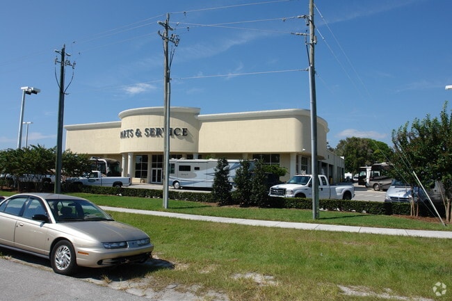
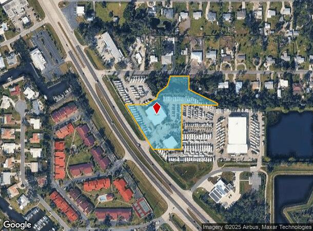
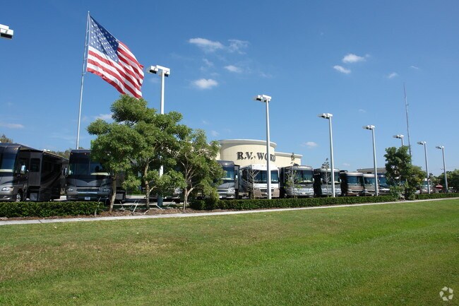
Property Record
2110 Tamiami Trl N, Nokomis, FL 34275
NEARBY LISTINGS FOR SALE OR LEASE
Property Detail
2110 Tamiami Trl N
North Port-Sarasota-Bradenton, FL
Venetian Gardens Replat
0161-16-0009
LOTS 3, 4 & 5, LESS ST RD R/W FOR US 41 & LESS R/W FOR SR 681 IN OR 1297/1777 & ALSO LOTS 9, 10, 11, 12 & 13 LESS COM AT NW COR OF LOT 6 TH E 120 FT FOR POB, TH SELY 73.08 FT, TH E 13 FT TO LAKE
Vehiclerentalsvehiclesales
Sarasota
X
Florida
12115C0239G
3,4,5
2024
2.84 AC
2025
Sarasota
002201
Tampa/St Petersburg
18,712 SF
DEMOGRAPHICS near 2110 Tamiami Trl N
1 Mile
3 Mile
5 Mile
2024 Total Population
5,747
23,484
61,307
2029 Population
6,700
27,386
71,883
Pop Growth 2024-2029
+ 16.58%
+ 16.62%
+ 17.25%
Average Age
56
56
59
2024 Total Households
2,864
11,506
31,718
HH Growth 2024-2029
+ 16.55%
+ 16.63%
+ 17.30%
Median Household Inc
$73,660
$74,230
$73,950
Avg Household Size
2.00
2.00
1.90
2024 Avg HH Vehicles
2.00
2.00
2.00
Median Home Value
$325,482
$376,123
$382,096
Median Year Built
1981
1986
1988
Nearby Places
Map Layers
Map Styles
 Street
 Aerial
- Restaurants
- Banks
- Shops
- Fitness
- Groceries
PUBLIC TRANSPORTATION
AIRPORT
Sarasota/Bradenton International
DRIVE
WALK
Distance
Sarasota/Bradenton International
36 min
19.0 mi
Punta Gorda
DRIVE
WALK
Distance
Punta Gorda
50 min
39.6 mi
Freight Ports
Port Manatee
DRIVE
WALK
Distance
Port Manatee
49 min
38.5 mi
Nearby Properties
Address
Land Use
TOTAL SIZE
Lot Size
Zoning
Address
Land Use
TOTAL SIZE
Lot Size
Zoning
308,834 SF
16 AC
PUD
Address
Land Use
TOTAL SIZE
Lot Size
Zoning
8,017 SF
56 AC
RMH
Address
Land Use
TOTAL SIZE
Lot Size
Zoning
181,657 SF
56.90 AC
GU
Address
Land Use
TOTAL SIZE
Lot Size
Zoning
8,562 SF
58.92 AC
RMH
Address
Land Use
TOTAL SIZE
Lot Size
Zoning
244,492 SF
73.19 AC
GU
Address
Land Use
TOTAL SIZE
Lot Size
Zoning
23,348 SF
77.03 AC
RMH
Address
Land Use
TOTAL SIZE
Lot Size
Zoning
175,813 SF
10.09 AC
CG
Address
Land Use
TOTAL SIZE
Lot Size
Zoning
1,184 SF
90 AC
PUD
Address
Land Use
TOTAL SIZE
Lot Size
Zoning
425,768 SF
18.41 AC
RMF2
Address
Land Use
TOTAL SIZE
Lot Size
Zoning
124,423 SF
76 AC
GU
Address
Land Use
TOTAL SIZE
Lot Size
Zoning
209,566 SF
18.63 AC
CG
Address
Land Use
TOTAL SIZE
Lot Size
Zoning
12,552 SF
6.73 AC
RE2
Address
Land Use
TOTAL SIZE
Lot Size
Zoning
17,028 SF
3.57 AC
RE2
Address
Land Use
TOTAL SIZE
Lot Size
Zoning
12,263 SF
3.38 AC
RE2
Address
Land Use
TOTAL SIZE
Lot Size
Zoning
127,135 SF
12.37 AC
CG
Address
Land Use
TOTAL SIZE
Lot Size
Zoning
88,509 SF
12.03 AC
CG
Address
Land Use
TOTAL SIZE
Lot Size
Zoning
68,641 SF
6.40 AC
RTR
Address
Land Use
TOTAL SIZE
Lot Size
Zoning
112,788 SF
3.06 AC
CG
Address
Land Use
TOTAL SIZE
Lot Size
Zoning
40.20 AC
RMH
Address
Land Use
TOTAL SIZE
Lot Size
Zoning
59,645 SF
2.68 AC
CG
Address
Land Use
TOTAL SIZE
Lot Size
Zoning
18.76 AC
CG
Address
Land Use
TOTAL SIZE
Lot Size
Zoning
100,001 SF
5.14 AC
CG
Address
Land Use
TOTAL SIZE
Lot Size
Zoning
897 SF
11.41 AC
GU
Address
Land Use
TOTAL SIZE
Lot Size
Zoning
2,259 SF
19.28 AC
GU
Address
Land Use
TOTAL SIZE
Lot Size
Zoning
8,188 SF
3.38 AC
CM
Address
Land Use
TOTAL SIZE
Lot Size
Zoning
27,472 SF
8.36 AC
GU
Address
Land Use
TOTAL SIZE
Lot Size
Zoning
21,385 SF
9.23 AC
CI
Address
Land Use
TOTAL SIZE
Lot Size
Zoning
74,091 SF
1.67 AC
CI
Address
Land Use
TOTAL SIZE
Lot Size
Zoning
95,124 SF
1.79 AC
CG
Address
Land Use
TOTAL SIZE
Lot Size
Zoning
50,844 SF
3.67 AC
RMF2
The World's #1 Commercial Real Estate Marketplace
Connect with us
© 2025 CoStar Group
The information above has been obtained from sources believed reliable. While we do not doubt its accuracy we have not verified it and make no guarantee, warranty or representation about it. It is your responsibility to independently confirm its accuracy and completeness. Any projections, opinions, assumptions, or estimates used are for example only and do not represent the current or future performance of the property. The value of this transaction to you depends on tax and other factors which should be evaluated by your tax, financial, and legal advisors. You and your advisors should conduct a careful, independent investigation of the property to determine to your satisfaction the suitability of the property for your needs.