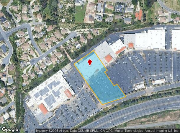
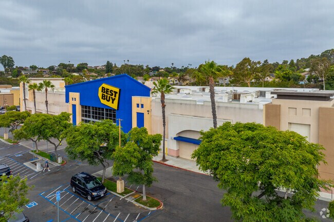
Property Record
2110 Vista Way, Oceanside, CA 92054

NEARBY LISTINGS FOR SALE OR LEASE
Property Detail
2110 Vista Way
154-130-24
Parcel Map No 17735
Storesoffices
PAR 2 TR PM17735
X
San Diego
06073C0761H
California
2024
3.42 AC
2025
Oceanside
018504
San Diego
45,528 SF
San Diego-Carlsbad, CA
DEMOGRAPHICS near 2110 Vista Way
1 Mile
3 Mile
5 Mile
2024 Total Population
9,536
98,039
208,671
2029 Population
9,402
97,902
207,741
Pop Growth 2024-2029
(1.41%)
(0.14%)
(0.45%)
Average Age
43
41
40
2024 Total Households
3,664
40,241
76,108
HH Growth 2024-2029
(1.58%)
(0.05%)
(0.43%)
Median Household Inc
$95,083
$80,606
$83,747
Avg Household Size
2.50
2.40
2.60
2024 Avg HH Vehicles
2.00
2.00
2.00
Median Home Value
$894,365
$784,299
$725,670
Median Year Built
1971
1978
1982
Nearby Places
Map Layers
Map Styles
 Street
 Aerial
- Restaurants
- Banks
- Shops
- Fitness
- Groceries
PUBLIC TRANSPORTATION
COMMUTER RAIL
Carlsbad Village (Coaster - San Diego North County Transit District (Coaster/Sprinter/Breeze))
DRIVE
WALK
Distance
Carlsbad Village (Coaster - San Diego North County Transit District (Coaster/Sprinter/Breeze))
9 min
3.0 mi
Oceanside Transit Center (Orange County Line - Southern California Regional Rail Authority (Metrolink))
DRIVE
WALK
Distance
Oceanside Transit Center (Orange County Line - Southern California Regional Rail Authority (Metrolink))
10 min
4.7 mi
AIRPORT
San Diego International
DRIVE
WALK
Distance
San Diego International
47 min
35.2 mi
Freight Ports
Port of San Diego
DRIVE
WALK
Distance
Port of San Diego
52 min
39.5 mi
Nearby Properties
Address
Land Use
TOTAL SIZE
Lot Size
Zoning
Address
Land Use
TOTAL SIZE
Lot Size
Zoning
1.38 AC
C
Address
Land Use
TOTAL SIZE
Lot Size
Zoning
15.25 AC
P-C
Address
Land Use
TOTAL SIZE
Lot Size
Zoning
5.28 AC
C2
Address
Land Use
TOTAL SIZE
Lot Size
Zoning
16 AC
P-C
Address
Land Use
TOTAL SIZE
Lot Size
Zoning
1.38 AC
C
Address
Land Use
TOTAL SIZE
Lot Size
Zoning
12 AC
SP-1-09
Address
Land Use
TOTAL SIZE
Lot Size
Zoning
4.26 AC
C-2
Address
Land Use
TOTAL SIZE
Lot Size
Zoning
1.77 AC
C-2
Address
Land Use
TOTAL SIZE
Lot Size
Zoning
1.14 AC
C
Address
Land Use
TOTAL SIZE
Lot Size
Zoning
96,240 SF
22.25 AC
PD-2
Address
Land Use
TOTAL SIZE
Lot Size
Zoning
85,000 SF
4.40 AC
CC
Address
Land Use
TOTAL SIZE
Lot Size
Zoning
5.24 AC
SP-1-09
Address
Land Use
TOTAL SIZE
Lot Size
Zoning
19.51 AC
C-2-Q
Address
Land Use
TOTAL SIZE
Lot Size
Zoning
10.63 AC
RD-M
Address
Land Use
TOTAL SIZE
Lot Size
Zoning
1.02 AC
D-1
Address
Land Use
TOTAL SIZE
Lot Size
Zoning
2.30 AC
V-R
Address
Land Use
TOTAL SIZE
Lot Size
Zoning
4.68 AC
D-6B
Address
Land Use
TOTAL SIZE
Lot Size
Zoning
15.02 AC
SP-1-84 (I
Address
Land Use
TOTAL SIZE
Lot Size
Zoning
6.63 AC
RD-M
Address
Land Use
TOTAL SIZE
Lot Size
Zoning
78,489 SF
2.67 AC
PD-1 (IL)
Address
Land Use
TOTAL SIZE
Lot Size
Zoning
57,905 SF
2.16 AC
R-3
Address
Land Use
TOTAL SIZE
Lot Size
Zoning
83,995 SF
5.88 AC
PD-1 (IL)
Address
Land Use
TOTAL SIZE
Lot Size
Zoning
15.81 AC
SP-1-84 (I
Address
Land Use
TOTAL SIZE
Lot Size
Zoning
1.34 AC
V-B
Address
Land Use
TOTAL SIZE
Lot Size
Zoning
64,722 SF
2.17 AC
D-1
Address
Land Use
TOTAL SIZE
Lot Size
Zoning
2.98 AC
SP-1-84 (I
Address
Land Use
TOTAL SIZE
Lot Size
Zoning
6,024 SF
6.92 AC
VC
Address
Land Use
TOTAL SIZE
Lot Size
Zoning
99,771 SF
4.22 AC
SP-1-84
Address
Land Use
TOTAL SIZE
Lot Size
Zoning
92,481 SF
9.53 AC
CG-PBD
Address
Land Use
TOTAL SIZE
Lot Size
Zoning
9.59 AC
RD-M-Q
The World's #1 Commercial Real Estate Marketplace
Connect with us
© 2025 CoStar Group
The information above has been obtained from sources believed reliable. While we do not doubt its accuracy we have not verified it and make no guarantee, warranty or representation about it. It is your responsibility to independently confirm its accuracy and completeness. Any projections, opinions, assumptions, or estimates used are for example only and do not represent the current or future performance of the property. The value of this transaction to you depends on tax and other factors which should be evaluated by your tax, financial, and legal advisors. You and your advisors should conduct a careful, independent investigation of the property to determine to your satisfaction the suitability of the property for your needs.