Property Record
2111 E Virginia Ave, Des Moines, IA 50320
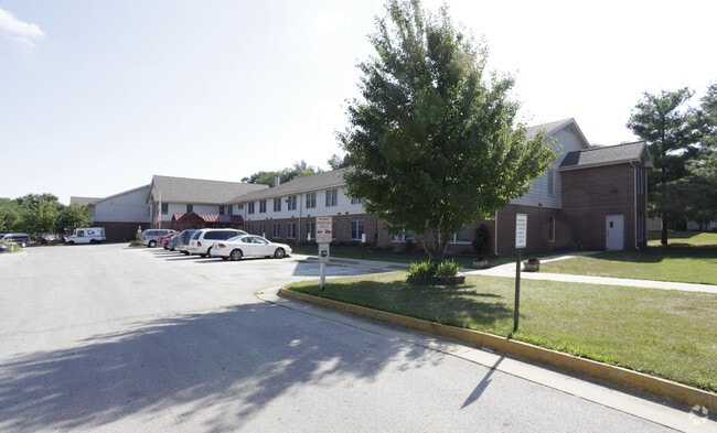

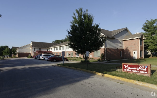
Property Detail
2111 E Virginia Ave
010-03972593006
E 175F W 473.25F LOT 3 PARK FOREST PLAT 2
Apartment
Polk
R-3
Iowa
B and X Area of moderate flood hazard, usually the area between the limits of the 100-year and 500-year floods.
3
0
2.01 AC
2025
Pioneer Park
003901
Des Moines
34,562 SF
Des Moines-West Des Moines, IA
NEARBY LISTINGS FOR SALE OR LEASE
DEMOGRAPHICS near 2111 E Virginia Ave
1 mile
3 mile
5 mile
2025 Total Population
10,779
63,369
156,207
2030 Population
11,159
65,901
163,396
Pop Growth 2025-2030
+ 3.53%
+ 4.00%
+ 4.60%
Average Age
36
37
38
2025 Total Households
3,889
25,340
64,447
HH Growth 2025-2030
+ 3.75%
+ 4.27%
+ 4.97%
Median Household Inc
$70,865
$62,763
$59,536
Avg Household Size
2.70
2.40
2.30
2025 Avg HH Vehicles
2.00
2.00
2.00
Median Home Value
$240,042
$174,488
$185,168
Median Year Built
1984
1973
1970
Nearby Places
Map Layers
Map Styles
 Street
 Aerial
Layers
 Traffic
 Biking
Places
Listings with unknown addresses are not visible on the map
- Restaurants
- Banks
- Shops
- Fitness
- Groceries
PUBLIC TRANSPORTATION
AIRPORT
Des Moines International
Drive
Walk
Distance
Des Moines International
13 min
5.8 mi
Nearby Properties
Address
Land Use
TOTAL SIZE
Lot Size
Zoning
Address
Land Use
TOTAL SIZE
Lot Size
Zoning
177,094 SF
24.60 AC
Address
Land Use
TOTAL SIZE
Lot Size
Zoning
300,115 SF
2.48 AC
Address
Land Use
TOTAL SIZE
Lot Size
Zoning
208,955 SF
1.84 AC
Address
Land Use
TOTAL SIZE
Lot Size
Zoning
402,849 SF
0.83 AC
C-3
Address
Land Use
TOTAL SIZE
Lot Size
Zoning
475,929 SF
49.86 AC
M2
Address
Land Use
TOTAL SIZE
Lot Size
Zoning
342,000 SF
22.18 AC
Address
Land Use
TOTAL SIZE
Lot Size
Zoning
178,611 SF
3.02 AC
Address
Land Use
TOTAL SIZE
Lot Size
Zoning
257,407 SF
1.43 AC
Address
Land Use
TOTAL SIZE
Lot Size
Zoning
127,000 SF
1.92 AC
Address
Land Use
TOTAL SIZE
Lot Size
Zoning
117,000 SF
4.02 AC
PUD
Address
Land Use
TOTAL SIZE
Lot Size
Zoning
123,535 SF
0.63 AC
Address
Land Use
TOTAL SIZE
Lot Size
Zoning
162,217 SF
6.32 AC
Address
Land Use
TOTAL SIZE
Lot Size
Zoning
218,593 SF
19.31 AC
M-2
Address
Land Use
TOTAL SIZE
Lot Size
Zoning
274,385 SF
3.83 AC
D-R
Address
Land Use
TOTAL SIZE
Lot Size
Zoning
95,384 SF
3.23 AC
Address
Land Use
TOTAL SIZE
Lot Size
Zoning
118,080 SF
15.76 AC
Address
Land Use
TOTAL SIZE
Lot Size
Zoning
175,854 SF
22.81 AC
Address
Land Use
TOTAL SIZE
Lot Size
Zoning
96,032 SF
1.74 AC
Address
Land Use
TOTAL SIZE
Lot Size
Zoning
208,456 SF
14.42 AC
PUD
Address
Land Use
TOTAL SIZE
Lot Size
Zoning
231,168 SF
22.29 AC
PUD
Address
Land Use
TOTAL SIZE
Lot Size
Zoning
1,890,511 SF
39.03 AC
M-2
Address
Land Use
TOTAL SIZE
Lot Size
Zoning
119,899 SF
1.13 AC
Address
Land Use
TOTAL SIZE
Lot Size
Zoning
260,467 SF
1.98 AC
D-R
Address
Land Use
TOTAL SIZE
Lot Size
Zoning
178,415 SF
13.35 AC
R-6
Address
Land Use
TOTAL SIZE
Lot Size
Zoning
74,760 SF
3.17 AC
Address
Land Use
TOTAL SIZE
Lot Size
Zoning
74,880 SF
0.45 AC
Address
Land Use
TOTAL SIZE
Lot Size
Zoning
201,072 SF
26.81 AC
Address
Land Use
TOTAL SIZE
Lot Size
Zoning
70,030 SF
0.36 AC
Address
Land Use
TOTAL SIZE
Lot Size
Zoning
67,080 SF
1.29 AC
The World's #1 Commercial Real Estate Marketplace
Connect with us
© 2026 CoStar Group
The information above has been obtained from sources believed reliable. While we do not doubt its accuracy we have not verified it and make no guarantee, warranty or representation about it. It is your responsibility to independently confirm its accuracy and completeness. Any projections, opinions, assumptions, or estimates used are for example only and do not represent the current or future performance of the property. The value of this transaction to you depends on tax and other factors which should be evaluated by your tax, financial, and legal advisors. You and your advisors should conduct a careful, independent investigation of the property to determine to your satisfaction the suitability of the property for your needs.