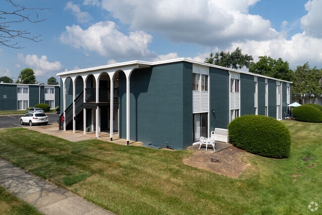
Property Record
2111 Lansill Rd, Lexington, KY 40504

NEARBY LISTINGS FOR SALE OR LEASE
Property Detail
2111 Lansill Rd
Lexington-Fayette, KY
Beaumont Park
15641400
D-355 BEAUMONT PARK LOT; BOOK: 1802 PAGE: 499
Apartment
Fayette
X
Kentucky
2100670118E
1-2
2025
13.88 AC
2025
Garden Springs
003000
Lexington/Fayette
4,929 SF
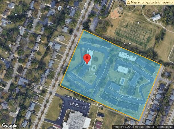
DEMOGRAPHICS near 2111 Lansill Rd
1 Mile
3 Mile
5 Mile
2024 Total Population
12,021
70,895
187,940
2029 Population
12,101
70,907
188,078
Pop Growth 2024-2029
+ 0.67%
+ 0.02%
+ 0.07%
Average Age
41
38
38
2024 Total Households
5,355
29,933
79,888
HH Growth 2024-2029
+ 0.65%
(0.01%)
+ 0.07%
Median Household Inc
$57,356
$56,200
$58,299
Avg Household Size
2.20
2.20
2.20
2024 Avg HH Vehicles
1.00
2.00
2.00
Median Home Value
$250,535
$257,094
$262,304
Median Year Built
1968
1974
1977
Nearby Places
Map Layers
Map Styles
 Street
 Aerial
- Restaurants
- Banks
- Shops
- Fitness
- Groceries
PUBLIC TRANSPORTATION
AIRPORT
Blue Grass
DRIVE
WALK
Distance
Blue Grass
13 min
6.3 mi
Freight Ports
Port of Toledo
DRIVE
WALK
Distance
Port of Toledo
340 min
290.7 mi
SALE & LEASE HISTORY
LISTING DATE
SALE/LEASE

Feb 21, 2023
For Sale
Nearby Properties
Address
Land Use
TOTAL SIZE
Lot Size
Zoning
Address
Land Use
TOTAL SIZE
Lot Size
Zoning
3,896 SF
0.49 AC
B-4
Address
Land Use
TOTAL SIZE
Lot Size
Zoning
635,961 SF
23.52 AC
P-1
Address
Land Use
TOTAL SIZE
Lot Size
Zoning
510,633 SF
15.10 AC
P-1
Address
Land Use
TOTAL SIZE
Lot Size
Zoning
372,139 SF
4.82 AC
R-4
Address
Land Use
TOTAL SIZE
Lot Size
Zoning
82.77 AC
R-4
Address
Land Use
TOTAL SIZE
Lot Size
Zoning
Address
Land Use
TOTAL SIZE
Lot Size
Zoning
87 SF
R-4
Address
Land Use
TOTAL SIZE
Lot Size
Zoning
Address
Land Use
TOTAL SIZE
Lot Size
Zoning
582.34 AC
A-U
Address
Land Use
TOTAL SIZE
Lot Size
Zoning
319,500 SF
0.25 AC
P-1
Address
Land Use
TOTAL SIZE
Lot Size
Zoning
292,730 SF
3.18 AC
R-1C
Address
Land Use
TOTAL SIZE
Lot Size
Zoning
648.54 AC
A-R
Address
Land Use
TOTAL SIZE
Lot Size
Zoning
394,590 SF
14.76 AC
R-4
Address
Land Use
TOTAL SIZE
Lot Size
Zoning
263,090 SF
37.66 AC
A-U
Address
Land Use
TOTAL SIZE
Lot Size
Zoning
599,650 SF
262.66 AC
A-R
Address
Land Use
TOTAL SIZE
Lot Size
Zoning
29,480 SF
4.60 AC
MU-3
Address
Land Use
TOTAL SIZE
Lot Size
Zoning
134,783 SF
1.36 AC
B-1
Address
Land Use
TOTAL SIZE
Lot Size
Zoning
8,078 SF
10.61 AC
R-5
Address
Land Use
TOTAL SIZE
Lot Size
Zoning
384,037 SF
9.52 AC
P-1
Address
Land Use
TOTAL SIZE
Lot Size
Zoning
2,545 SF
14 AC
R-4
Address
Land Use
TOTAL SIZE
Lot Size
Zoning
9,774 SF
798.32 AC
A-R
Address
Land Use
TOTAL SIZE
Lot Size
Zoning
8,880 SF
7.39 AC
R-4
Address
Land Use
TOTAL SIZE
Lot Size
Zoning
63,509 SF
2.24 AC
B-1
Address
Land Use
TOTAL SIZE
Lot Size
Zoning
46,470 SF
4.91 AC
R-3
Address
Land Use
TOTAL SIZE
Lot Size
Zoning
2,968 SF
14.26 AC
R-3
Address
Land Use
TOTAL SIZE
Lot Size
Zoning
97,729 SF
4.22 AC
P-1
Address
Land Use
TOTAL SIZE
Lot Size
Zoning
10.41 AC
R-3
Address
Land Use
TOTAL SIZE
Lot Size
Zoning
14,292 SF
11.32 AC
R-4
Address
Land Use
TOTAL SIZE
Lot Size
Zoning
2,480 SF
9.12 AC
R-3
Address
Land Use
TOTAL SIZE
Lot Size
Zoning
23,042 SF
8.90 AC
R-4
The World's #1 Commercial Real Estate Marketplace
Connect with us
© 2025 CoStar Group
The information above has been obtained from sources believed reliable. While we do not doubt its accuracy we have not verified it and make no guarantee, warranty or representation about it. It is your responsibility to independently confirm its accuracy and completeness. Any projections, opinions, assumptions, or estimates used are for example only and do not represent the current or future performance of the property. The value of this transaction to you depends on tax and other factors which should be evaluated by your tax, financial, and legal advisors. You and your advisors should conduct a careful, independent investigation of the property to determine to your satisfaction the suitability of the property for your needs.