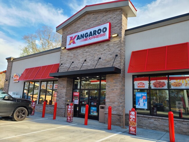
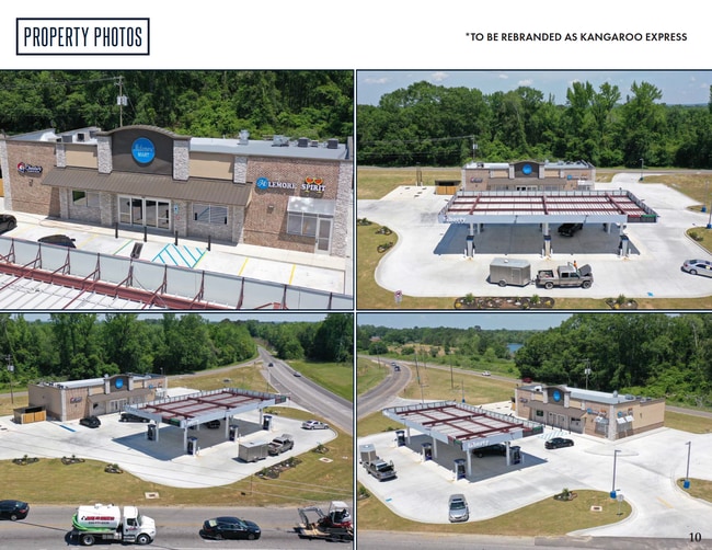
Property Record
2111 Mclemore Dr, Montgomery, AL 36117

Property Detail
2111 Mclemore Dr
05-08-33-0-000-005.002
0508330000005002
Conveniencestore
Montgomery
B-3
Alabama
B and X Area of moderate flood hazard, usually the area between the limits of the 100-year and 500-year floods.
1
2025
1.30 AC
2025
North Montgomery
005414
Montgomery
4,562 SF
Montgomery, AL
NEARBY LISTINGS FOR SALE OR LEASE
DEMOGRAPHICS near 2111 Mclemore Dr
1 mile
3 mile
5 mile
2025 Total Population
1,503
20,270
57,072
2030 Population
1,449
19,639
55,486
Pop Growth 2025-2030
(3.59%)
(3.11%)
(2.78%)
Average Age
41
39
40
2025 Total Households
610
8,675
23,981
HH Growth 2025-2030
(3.61%)
(3.02%)
(2.94%)
Median Household Inc
$97,804
$72,710
$75,397
Avg Household Size
2.40
2.30
2.30
2025 Avg HH Vehicles
2.00
2.00
2.00
Median Home Value
$223,162
$190,144
$220,009
Median Year Built
1997
1991
1990
Nearby Places
Map Layers
Map Styles
 Street
 Aerial
Layers
 Traffic
 Biking
Places
Listings with unknown addresses are not visible on the map
- Restaurants
- Banks
- Shops
- Fitness
- Groceries
PUBLIC TRANSPORTATION
AIRPORT
Montgomery Regional (Dannelly Field)
Drive
Walk
Distance
Montgomery Regional (Dannelly Field)
28 min
18.6 mi
Freight Ports
Port of Panama City
Drive
Walk
Distance
Port of Panama City
239 min
187.4 mi
SALE & LEASE HISTORY
LISTING DATE
SALE/LEASE

May 11, 2022
For Sale
Nearby Properties
Address
Land Use
TOTAL SIZE
Lot Size
Zoning
Address
Land Use
TOTAL SIZE
Lot Size
Zoning
117,161 SF
12.07 AC
INST
Address
Land Use
TOTAL SIZE
Lot Size
Zoning
5,118 SF
22.75 AC
R-65-M
Address
Land Use
TOTAL SIZE
Lot Size
Zoning
1,996 SF
15.81 AC
PUD
Address
Land Use
TOTAL SIZE
Lot Size
Zoning
76,996 SF
15.51 AC
B-3
Address
Land Use
TOTAL SIZE
Lot Size
Zoning
385,644 SF
26.60 AC
B-2
Address
Land Use
TOTAL SIZE
Lot Size
Zoning
6,605 SF
6 AC
PUD
Address
Land Use
TOTAL SIZE
Lot Size
Zoning
92,200 SF
9.74 AC
O-1
Address
Land Use
TOTAL SIZE
Lot Size
Zoning
7,040 SF
11.70 AC
R-65-M
Address
Land Use
TOTAL SIZE
Lot Size
Zoning
224,132 SF
26.57 AC
AGR-2
Address
Land Use
TOTAL SIZE
Lot Size
Zoning
223,000 SF
26 AC
O-1
Address
Land Use
TOTAL SIZE
Lot Size
Zoning
82,638 SF
O-1
Address
Land Use
TOTAL SIZE
Lot Size
Zoning
2,200 SF
11.06 AC
R-75-M
Address
Land Use
TOTAL SIZE
Lot Size
Zoning
30,077 SF
8.53 AC
PUD
Address
Land Use
TOTAL SIZE
Lot Size
Zoning
6,024 SF
17.30 AC
R-75-M
Address
Land Use
TOTAL SIZE
Lot Size
Zoning
8,014 SF
7.10 AC
R-75-M
Address
Land Use
TOTAL SIZE
Lot Size
Zoning
64,237 SF
11.30 AC
INST
Address
Land Use
TOTAL SIZE
Lot Size
Zoning
36,514 SF
4.57 AC
R-65-M
Address
Land Use
TOTAL SIZE
Lot Size
Zoning
27,398 SF
10.61 AC
B-3
Address
Land Use
TOTAL SIZE
Lot Size
Zoning
34.70 AC
B-2
Address
Land Use
TOTAL SIZE
Lot Size
Zoning
18,439 SF
15 AC
B-3
Address
Land Use
TOTAL SIZE
Lot Size
Zoning
55,345 SF
6.78 AC
Address
Land Use
TOTAL SIZE
Lot Size
Zoning
1,959 SF
6.43 AC
B-2
Address
Land Use
TOTAL SIZE
Lot Size
Zoning
1,782 SF
7.06 AC
R-65-M
Address
Land Use
TOTAL SIZE
Lot Size
Zoning
72,139 SF
2.96 AC
B-2
Address
Land Use
TOTAL SIZE
Lot Size
Zoning
40,166 SF
7.38 AC
B-2
Address
Land Use
TOTAL SIZE
Lot Size
Zoning
16,240 SF
4 AC
R-60-S
Address
Land Use
TOTAL SIZE
Lot Size
Zoning
107,444 SF
7.20 AC
B-3
Address
Land Use
TOTAL SIZE
Lot Size
Zoning
9,538 SF
11 AC
B-3
Address
Land Use
TOTAL SIZE
Lot Size
Zoning
53,037 SF
9.40 AC
B-3
Address
Land Use
TOTAL SIZE
Lot Size
Zoning
82,600 SF
2.71 AC
R-65-M
The World's #1 Commercial Real Estate Marketplace
Connect with us
© 2026 CoStar Group
The information above has been obtained from sources believed reliable. While we do not doubt its accuracy we have not verified it and make no guarantee, warranty or representation about it. It is your responsibility to independently confirm its accuracy and completeness. Any projections, opinions, assumptions, or estimates used are for example only and do not represent the current or future performance of the property. The value of this transaction to you depends on tax and other factors which should be evaluated by your tax, financial, and legal advisors. You and your advisors should conduct a careful, independent investigation of the property to determine to your satisfaction the suitability of the property for your needs.