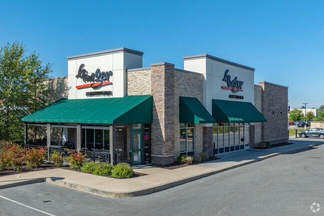
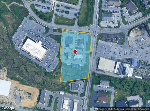
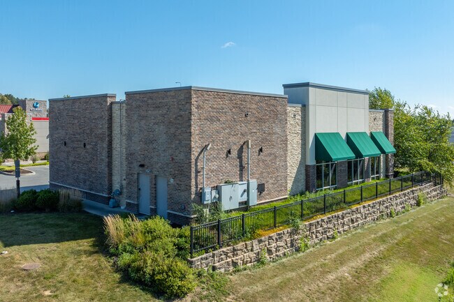
Property Record
2111 Noll Dr, Lancaster, PA 17603
NEARBY LISTINGS FOR SALE OR LEASE
Property Detail
2111 Noll Dr
290-65891-0-0000
Lime Spring Square Phase 3
Storebuilding
Lancaster
AE
Pennsylvania
42071C0361F
4.72 AC
2024
Lancaster County
2025
Philadelphia
011701
Lancaster, PA
10,175 SF
DEMOGRAPHICS near 2111 Noll Dr
1 Mile
3 Mile
5 Mile
2024 Total Population
6,063
78,534
178,450
2029 Population
6,115
79,069
179,814
Pop Growth 2024-2029
+ 0.86%
+ 0.68%
+ 0.76%
Average Age
44
40
40
2024 Total Households
2,434
30,727
67,822
HH Growth 2024-2029
+ 0.86%
+ 0.56%
+ 0.70%
Median Household Inc
$85,304
$75,962
$73,850
Avg Household Size
2.40
2.40
2.40
2024 Avg HH Vehicles
2.00
2.00
2.00
Median Home Value
$248,104
$236,527
$237,686
Median Year Built
1969
1966
1968
Nearby Places
Map Layers
Map Styles
 Street
 Aerial
- Restaurants
- Banks
- Shops
- Fitness
- Groceries
PUBLIC TRANSPORTATION
COMMUTER RAIL
Lancaster (Keystone Service - Amtrak, Pennsylvanian - Amtrak)
DRIVE
WALK
Distance
Lancaster (Keystone Service - Amtrak, Pennsylvanian - Amtrak)
9 min
5.4 mi
AIRPORT
Harrisburg International
DRIVE
WALK
Distance
Harrisburg International
40 min
30.4 mi
Freight Ports
Port of Wilmington, RI
DRIVE
WALK
Distance
Port of Wilmington, RI
99 min
57.9 mi
Nearby Properties
Address
Land Use
TOTAL SIZE
Lot Size
Zoning
Address
Land Use
TOTAL SIZE
Lot Size
Zoning
822,920 SF
97.54 AC
HCD
Address
Land Use
TOTAL SIZE
Lot Size
Zoning
1,603,151 SF
104.89 AC
C3
Address
Land Use
TOTAL SIZE
Lot Size
Zoning
526,898 SF
26.10 AC
AH
Address
Land Use
TOTAL SIZE
Lot Size
Zoning
1,003,686 SF
127.66 AC
HR
Address
Land Use
TOTAL SIZE
Lot Size
Zoning
712,737 SF
52.50 AC
R2
Address
Land Use
TOTAL SIZE
Lot Size
Zoning
243,960 SF
39.27 AC
Address
Land Use
TOTAL SIZE
Lot Size
Zoning
941,905 SF
141.50 AC
I
Address
Land Use
TOTAL SIZE
Lot Size
Zoning
905,200 SF
68.60 AC
Address
Land Use
TOTAL SIZE
Lot Size
Zoning
224,054 SF
71 AC
Address
Land Use
TOTAL SIZE
Lot Size
Zoning
308,727 SF
11.37 AC
Address
Land Use
TOTAL SIZE
Lot Size
Zoning
193,864 SF
9 AC
Address
Land Use
TOTAL SIZE
Lot Size
Zoning
99,894 SF
21.88 AC
Address
Land Use
TOTAL SIZE
Lot Size
Zoning
269,890 SF
57.10 AC
SR
Address
Land Use
TOTAL SIZE
Lot Size
Zoning
135,998 SF
28.64 AC
HR
Address
Land Use
TOTAL SIZE
Lot Size
Zoning
223,327 SF
21.80 AC
B-4
Address
Land Use
TOTAL SIZE
Lot Size
Zoning
691,290 SF
3 AC
Address
Land Use
TOTAL SIZE
Lot Size
Zoning
372,708 SF
50.40 AC
HR
Address
Land Use
TOTAL SIZE
Lot Size
Zoning
128,939 SF
27.39 AC
Address
Land Use
TOTAL SIZE
Lot Size
Zoning
101,558 SF
28.14 AC
AH
Address
Land Use
TOTAL SIZE
Lot Size
Zoning
199,107 SF
26.20 AC
CC
Address
Land Use
TOTAL SIZE
Lot Size
Zoning
138,618 SF
9.53 AC
Address
Land Use
TOTAL SIZE
Lot Size
Zoning
385,561 SF
27.20 AC
Address
Land Use
TOTAL SIZE
Lot Size
Zoning
299,600 SF
63 AC
HR
Address
Land Use
TOTAL SIZE
Lot Size
Zoning
10 SF
14.11 AC
CM
Address
Land Use
TOTAL SIZE
Lot Size
Zoning
244,568 SF
8.30 AC
IN
Address
Land Use
TOTAL SIZE
Lot Size
Zoning
1,382,541 SF
106.20 AC
Address
Land Use
TOTAL SIZE
Lot Size
Zoning
18,843 SF
4.62 AC
I-2
Address
Land Use
TOTAL SIZE
Lot Size
Zoning
198,577 SF
2.88 AC
Address
Land Use
TOTAL SIZE
Lot Size
Zoning
113,967 SF
13.32 AC
Address
Land Use
TOTAL SIZE
Lot Size
Zoning
75,766 SF
9.07 AC
The World's #1 Commercial Real Estate Marketplace
Connect with us
© 2025 CoStar Group
The information above has been obtained from sources believed reliable. While we do not doubt its accuracy we have not verified it and make no guarantee, warranty or representation about it. It is your responsibility to independently confirm its accuracy and completeness. Any projections, opinions, assumptions, or estimates used are for example only and do not represent the current or future performance of the property. The value of this transaction to you depends on tax and other factors which should be evaluated by your tax, financial, and legal advisors. You and your advisors should conduct a careful, independent investigation of the property to determine to your satisfaction the suitability of the property for your needs.