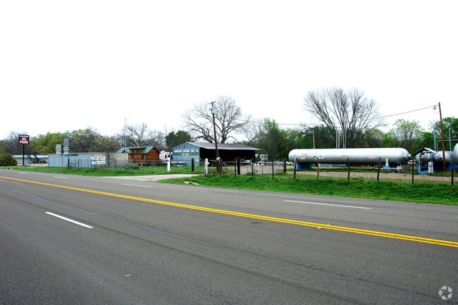
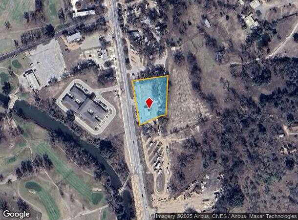
Property Record
2111 Us Highway 281 S, Lampasas, TX 76550
NEARBY LISTINGS FOR SALE OR LEASE
Property Detail
2111 Us Highway 281 S
Killeen-Temple, TX
ACR: 1.38 ABST: 0419 SURV: L H W JOHNSON LOCCD:129
10892
Lampasas
Commercialnec
Texas
2025
1.38 AC
2025
Lampasas County
950400
Killeen/Temple/Fort Hood
5,122 SF
DEMOGRAPHICS near 2111 Us Highway 281 S
1 mile
3 mile
5 mile
2024 Total Population
2,407
9,785
10,476
2029 Population
2,724
11,113
11,905
Pop Growth 2024-2029
+ 13.17%
+ 13.57%
+ 13.64%
Average Age
42
42
42
2024 Total Households
1,027
3,972
4,239
HH Growth 2024-2029
+ 12.76%
+ 13.19%
+ 13.23%
Median Household Inc
$57,865
$58,637
$60,093
Avg Household Size
2.30
2.40
2.40
2024 Avg HH Vehicles
2.00
2.00
2.00
Median Home Value
$140,104
$158,435
$164,224
Median Year Built
1972
1976
1977
Nearby Places
Map Layers
Map Styles
 Street
 Aerial
Transit
 Traffic
 Biking
Places
Listings with unknown addresses are not visible on the map
- Restaurants
- Banks
- Shops
- Fitness
- Groceries
PUBLIC TRANSPORTATION
AIRPORT
Robert Gray AAF
Drive
Walk
Distance
Robert Gray AAF
37 min
25.6 mi
Killeen Municipal
Drive
Walk
Distance
Killeen Municipal
41 min
33.5 mi
Freight Ports
Calhoun Port
Drive
Walk
Distance
Calhoun Port
259 min
222.2 mi
Nearby Properties
Address
Land Use
TOTAL SIZE
Lot Size
Zoning
Address
Land Use
TOTAL SIZE
Lot Size
Zoning
85,131 SF
10.25 AC
Address
Land Use
TOTAL SIZE
Lot Size
Zoning
3,739 SF
1,028.44 AC
Address
Land Use
TOTAL SIZE
Lot Size
Zoning
114,129 SF
20.59 AC
Address
Land Use
TOTAL SIZE
Lot Size
Zoning
600 AC
Address
Land Use
TOTAL SIZE
Lot Size
Zoning
34,868 SF
5.22 AC
Address
Land Use
TOTAL SIZE
Lot Size
Zoning
102,661 SF
2.81 AC
Address
Land Use
TOTAL SIZE
Lot Size
Zoning
34,034 SF
3.25 AC
Address
Land Use
TOTAL SIZE
Lot Size
Zoning
10,637 SF
412 AC
Address
Land Use
TOTAL SIZE
Lot Size
Zoning
16,966 SF
172 AC
Address
Land Use
TOTAL SIZE
Lot Size
Zoning
72,670 SF
2.98 AC
Address
Land Use
TOTAL SIZE
Lot Size
Zoning
146,911 SF
3.87 AC
Address
Land Use
TOTAL SIZE
Lot Size
Zoning
34,635 SF
1.70 AC
Address
Land Use
TOTAL SIZE
Lot Size
Zoning
23,135 SF
1.72 AC
Address
Land Use
TOTAL SIZE
Lot Size
Zoning
18,723 SF
1.85 AC
Address
Land Use
TOTAL SIZE
Lot Size
Zoning
3,440 SF
342.15 AC
Address
Land Use
TOTAL SIZE
Lot Size
Zoning
34,264 SF
2 AC
Address
Land Use
TOTAL SIZE
Lot Size
Zoning
19,800 SF
0.60 AC
Address
Land Use
TOTAL SIZE
Lot Size
Zoning
38,872 SF
0.90 AC
Address
Land Use
TOTAL SIZE
Lot Size
Zoning
19,244 SF
1.01 AC
Address
Land Use
TOTAL SIZE
Lot Size
Zoning
91,014 SF
2.60 AC
Address
Land Use
TOTAL SIZE
Lot Size
Zoning
10,432 SF
225.79 AC
Address
Land Use
TOTAL SIZE
Lot Size
Zoning
86,584 SF
15.07 AC
Address
Land Use
TOTAL SIZE
Lot Size
Zoning
12,240 SF
2.79 AC
Address
Land Use
TOTAL SIZE
Lot Size
Zoning
150,207 SF
6.97 AC
Address
Land Use
TOTAL SIZE
Lot Size
Zoning
22,544 SF
25 AC
Address
Land Use
TOTAL SIZE
Lot Size
Zoning
32,049 SF
2.13 AC
Address
Land Use
TOTAL SIZE
Lot Size
Zoning
47,882 SF
4.50 AC
Address
Land Use
TOTAL SIZE
Lot Size
Zoning
9,152 SF
1 AC
Address
Land Use
TOTAL SIZE
Lot Size
Zoning
11,011 SF
94.86 AC
Address
Land Use
TOTAL SIZE
Lot Size
Zoning
5,160 SF
255.85 AC
The World's #1 Commercial Real Estate Marketplace
Connect with us
© 2026 CoStar Group
The information above has been obtained from sources believed reliable. While we do not doubt its accuracy we have not verified it and make no guarantee, warranty or representation about it. It is your responsibility to independently confirm its accuracy and completeness. Any projections, opinions, assumptions, or estimates used are for example only and do not represent the current or future performance of the property. The value of this transaction to you depends on tax and other factors which should be evaluated by your tax, financial, and legal advisors. You and your advisors should conduct a careful, independent investigation of the property to determine to your satisfaction the suitability of the property for your needs.