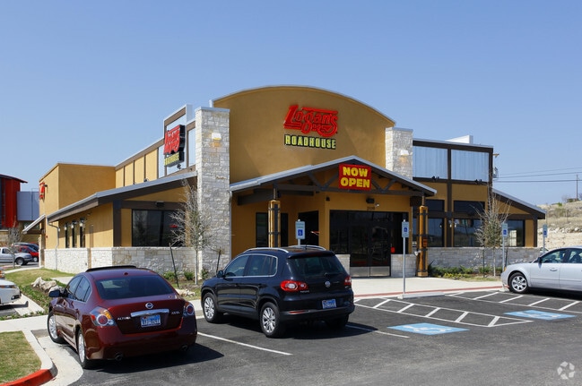
Property Record
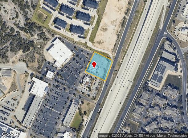
21119 Us Highway 281 N, San Antonio, TX 78258
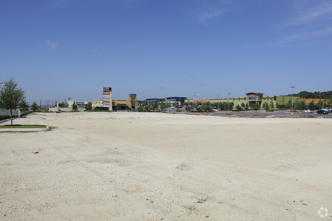
NEARBY LISTINGS FOR SALE OR LEASE
Property Detail
21119 Us Highway 281 N
San Antonio-New Braunfels, TX
Ncb 19219 Stone Ridge Market Retail Ce
19219-064-0140
NCB 19219 BLK 64 LOT 14 1.325AC (STONE RIDGE MARKET RETAIL CENTER SUBD) 2011 NEW ACCT PER PLAT 9618/211-215
Restaurantbuilding
Bexar
X
Texas
48029C0140G
14
2024
1.33 AC
2025
Far North Central
191819
San Antonio
6,443 SF
DEMOGRAPHICS near 21119 Us Highway 281 N
1 Mile
3 Mile
5 Mile
2024 Total Population
11,523
85,704
185,939
2029 Population
12,630
91,720
198,642
Pop Growth 2024-2029
+ 9.61%
+ 7.02%
+ 6.83%
Average Age
36
37
38
2024 Total Households
4,341
30,981
68,199
HH Growth 2024-2029
+ 10.00%
+ 7.34%
+ 7.04%
Median Household Inc
$91,498
$101,398
$99,324
Avg Household Size
2.60
2.70
2.70
2024 Avg HH Vehicles
2.00
2.00
2.00
Median Home Value
$325,518
$354,533
$332,684
Median Year Built
2008
2006
2002
Nearby Places
Map Layers
Map Styles
 Street
 Aerial
- Restaurants
- Banks
- Shops
- Fitness
- Groceries
PUBLIC TRANSPORTATION
AIRPORT
San Antonio International
DRIVE
WALK
Distance
San Antonio International
13 min
9.3 mi
SALE & LEASE HISTORY
LISTING DATE
SALE/LEASE

Sep 25, 2016
For Lease
Jun 23, 2017
For Lease
Nearby Properties
Address
Land Use
TOTAL SIZE
Lot Size
Zoning
Address
Land Use
TOTAL SIZE
Lot Size
Zoning
621,591 SF
15.25 AC
Address
Land Use
TOTAL SIZE
Lot Size
Zoning
427,456 SF
37.12 AC
Address
Land Use
TOTAL SIZE
Lot Size
Zoning
631,284 SF
14.61 AC
Address
Land Use
TOTAL SIZE
Lot Size
Zoning
390,736 SF
31.72 AC
Address
Land Use
TOTAL SIZE
Lot Size
Zoning
387,893 SF
11.97 AC
Address
Land Use
TOTAL SIZE
Lot Size
Zoning
116,135 SF
17.35 AC
Address
Land Use
TOTAL SIZE
Lot Size
Zoning
5,687 SF
19.39 AC
Address
Land Use
TOTAL SIZE
Lot Size
Zoning
391,871 SF
17.94 AC
Address
Land Use
TOTAL SIZE
Lot Size
Zoning
352,144 SF
29.83 AC
Address
Land Use
TOTAL SIZE
Lot Size
Zoning
311,728 SF
7.47 AC
Address
Land Use
TOTAL SIZE
Lot Size
Zoning
325,041 SF
25.31 AC
Address
Land Use
TOTAL SIZE
Lot Size
Zoning
115.46 AC
Address
Land Use
TOTAL SIZE
Lot Size
Zoning
225,204 SF
32.21 AC
Address
Land Use
TOTAL SIZE
Lot Size
Zoning
283,877 SF
22.15 AC
Address
Land Use
TOTAL SIZE
Lot Size
Zoning
225,819 SF
23.29 AC
Address
Land Use
TOTAL SIZE
Lot Size
Zoning
315,719 SF
13.91 AC
Address
Land Use
TOTAL SIZE
Lot Size
Zoning
364,026 SF
27.34 AC
Address
Land Use
TOTAL SIZE
Lot Size
Zoning
280,330 SF
20.99 AC
Address
Land Use
TOTAL SIZE
Lot Size
Zoning
159,671 SF
15.69 AC
Address
Land Use
TOTAL SIZE
Lot Size
Zoning
123,938 SF
27.21 AC
Address
Land Use
TOTAL SIZE
Lot Size
Zoning
309,507 SF
14.95 AC
Address
Land Use
TOTAL SIZE
Lot Size
Zoning
306,523 SF
16.29 AC
Address
Land Use
TOTAL SIZE
Lot Size
Zoning
209,715 SF
22.91 AC
Address
Land Use
TOTAL SIZE
Lot Size
Zoning
323,716 SF
19.74 AC
Address
Land Use
TOTAL SIZE
Lot Size
Zoning
317,041 SF
26.69 AC
Address
Land Use
TOTAL SIZE
Lot Size
Zoning
289,271 SF
16.87 AC
Address
Land Use
TOTAL SIZE
Lot Size
Zoning
364,922 SF
23.73 AC
Address
Land Use
TOTAL SIZE
Lot Size
Zoning
154,937 SF
22 AC
Address
Land Use
TOTAL SIZE
Lot Size
Zoning
269,525 SF
17.75 AC
Address
Land Use
TOTAL SIZE
Lot Size
Zoning
341,841 SF
22 AC
The World's #1 Commercial Real Estate Marketplace
Connect with us
© 2025 CoStar Group
The information above has been obtained from sources believed reliable. While we do not doubt its accuracy we have not verified it and make no guarantee, warranty or representation about it. It is your responsibility to independently confirm its accuracy and completeness. Any projections, opinions, assumptions, or estimates used are for example only and do not represent the current or future performance of the property. The value of this transaction to you depends on tax and other factors which should be evaluated by your tax, financial, and legal advisors. You and your advisors should conduct a careful, independent investigation of the property to determine to your satisfaction the suitability of the property for your needs.