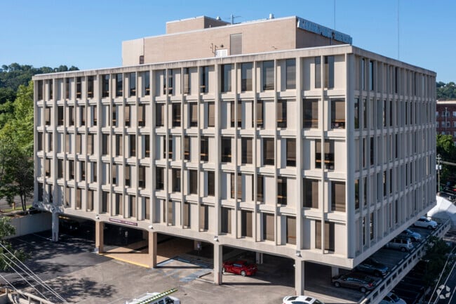
Property Record
2112 Richard Arrington Jr Blvd, Birmingham, AL 35205


Current Lease Availabilities
Property Detail
2112 Richard Arrington Jr Blvd
28-00-06-2-020-002.000
POB W INTER OF 11TH AVENUE S AND 21ST PLACE SOUTH TH NW 170.1 FT ALG 21ST PLACE SOUTH TO ALLEY TH SW 301.3 FT TO 21ST ST S TH SE 86 FT S ALG SD ST TH NE 130 FT S TH SE 112 FT S TO 11TH AVE S TH NE 262 FT S ALG SAID AVE TO POB LYING IN W2 OF NE4 SECT
Officebuilding
JEFFERSON
B2
Alabama
B and X Area of moderate flood hazard, usually the area between the limits of the 100-year and 500-year floods.
1 AC
2024
Southside
2025
Birmingham
004902
Birmingham, AL
36,536 SF
NEARBY LISTINGS FOR SALE OR LEASE
DEMOGRAPHICS near 2112 Richard Arrington Jr Blvd
1 mile
3 mile
5 mile
2025 Total Population
17,245
85,684
177,543
2030 Population
17,303
86,042
177,877
Pop Growth 2025-2030
+ 0.34%
+ 0.42%
+ 0.19%
Average Age
34
37
39
2025 Total Households
8,284
38,491
76,317
HH Growth 2025-2030
+ 0.36%
+ 0.39%
+ 0.18%
Median Household Inc
$53,386
$56,161
$57,276
Avg Household Size
1.60
1.90
2.10
2025 Avg HH Vehicles
1.00
1.00
2.00
Median Home Value
$482,950
$463,244
$373,566
Median Year Built
1970
1965
1966
Nearby Places
Map Layers
Map Styles
 Street
 Aerial
Layers
 Traffic
 Biking
Places
Listings with unknown addresses are not visible on the map
- Restaurants
- Banks
- Shops
- Fitness
- Groceries
PUBLIC TRANSPORTATION
COMMUTER RAIL
Drive
Walk
Distance
4 min
1.4 mi
AIRPORT
Birmingham-Shuttlesworth International
Drive
Walk
Distance
Birmingham-Shuttlesworth International
11 min
6.1 mi
Nearby Properties
Address
Land Use
TOTAL SIZE
Lot Size
Zoning
Address
Land Use
TOTAL SIZE
Lot Size
Zoning
296,284 SF
12 AC
OI
Address
Land Use
TOTAL SIZE
Lot Size
Zoning
305,826 SF
4 AC
B4
Address
Land Use
TOTAL SIZE
Lot Size
Zoning
189,447 SF
4 AC
B4
Address
Land Use
TOTAL SIZE
Lot Size
Zoning
224,049 SF
4 AC
M1
Address
Land Use
TOTAL SIZE
Lot Size
Zoning
978,879 SF
44 AC
I3
Address
Land Use
TOTAL SIZE
Lot Size
Zoning
239,334 SF
4 AC
B6
Address
Land Use
TOTAL SIZE
Lot Size
Zoning
31,980 SF
100 AC
I3/P
Address
Land Use
TOTAL SIZE
Lot Size
Zoning
203,878 SF
13 AC
B6
Address
Land Use
TOTAL SIZE
Lot Size
Zoning
261,311 SF
21 AC
C1
Address
Land Use
TOTAL SIZE
Lot Size
Zoning
183,862 SF
10 AC
B4
Address
Land Use
TOTAL SIZE
Lot Size
Zoning
230,441 SF
10 AC
M1
Address
Land Use
TOTAL SIZE
Lot Size
Zoning
106,144 SF
1 AC
B4
Address
Land Use
TOTAL SIZE
Lot Size
Zoning
94,958 SF
4 AC
M1
Address
Land Use
TOTAL SIZE
Lot Size
Zoning
334,463 SF
2 AC
B4
Address
Land Use
TOTAL SIZE
Lot Size
Zoning
154,474 SF
12.50 AC
R-D
Address
Land Use
TOTAL SIZE
Lot Size
Zoning
57,066 SF
1 AC
B4
Address
Land Use
TOTAL SIZE
Lot Size
Zoning
46,161 SF
1 AC
M1-B
Address
Land Use
TOTAL SIZE
Lot Size
Zoning
95,993 SF
3.67 AC
M1
Address
Land Use
TOTAL SIZE
Lot Size
Zoning
229,669 SF
2.75 AC
B4
Address
Land Use
TOTAL SIZE
Lot Size
Zoning
109,411 SF
3 AC
B4
Address
Land Use
TOTAL SIZE
Lot Size
Zoning
2 AC
M1-B
Address
Land Use
TOTAL SIZE
Lot Size
Zoning
1,666 SF
2 AC
M1
Address
Land Use
TOTAL SIZE
Lot Size
Zoning
30,453 SF
0.87 AC
B2
Address
Land Use
TOTAL SIZE
Lot Size
Zoning
2 AC
B4
Address
Land Use
TOTAL SIZE
Lot Size
Zoning
51,699 SF
1 AC
PCD-
Address
Land Use
TOTAL SIZE
Lot Size
Zoning
29,136 SF
2 AC
B4
Address
Land Use
TOTAL SIZE
Lot Size
Zoning
79,458 SF
1 AC
B4
Address
Land Use
TOTAL SIZE
Lot Size
Zoning
81,807 SF
6 AC
C1
Address
Land Use
TOTAL SIZE
Lot Size
Zoning
143,200 SF
23.49 AC
R3/O
Address
Land Use
TOTAL SIZE
Lot Size
Zoning
109,819 SF
2.91 AC
M2
The World's #1 Commercial Real Estate Marketplace
Connect with us
© 2026 CoStar Group
The information above has been obtained from sources believed reliable. While we do not doubt its accuracy we have not verified it and make no guarantee, warranty or representation about it. It is your responsibility to independently confirm its accuracy and completeness. Any projections, opinions, assumptions, or estimates used are for example only and do not represent the current or future performance of the property. The value of this transaction to you depends on tax and other factors which should be evaluated by your tax, financial, and legal advisors. You and your advisors should conduct a careful, independent investigation of the property to determine to your satisfaction the suitability of the property for your needs.