Property Record
817 Finley Ave W, Birmingham, AL 35204

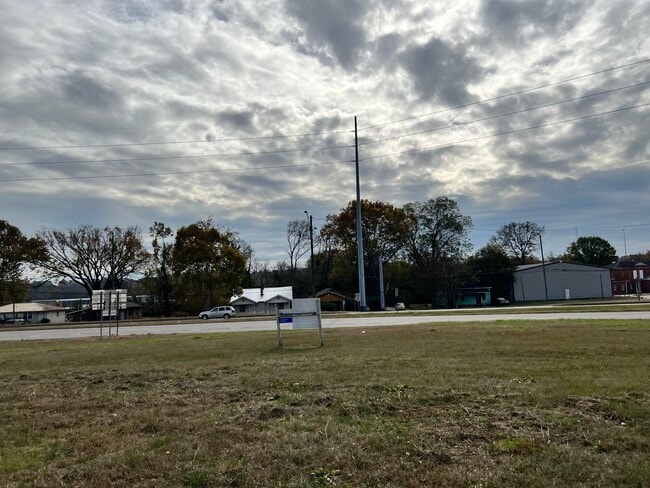

This Property Is For Sale
NEARBY LISTINGS FOR SALE OR LEASE
Property Detail
817 Finley Ave W
Birmingham-Hoover, AL
Walker J R &Josephine Sur
22-00-28-1-007-005.000
BEG 62.4 FT NE OF SE INTER OF ARKEDELPHIA RD & FINLEY AVE NE 1/4 SEC 28 TP 17 S R 3W TH NE ALG FINLEY AVE 127 FT TH SE 150 FT TH SW 70 FT TH SELY 20 FT TH WLY 182 FT TH NLY 50 FT TH ELY 100.4 FT TH NWLY 91.9 FT TO POB
Vacantlandnec
Jefferson
X
Alabama
01073C0388H
27
0
0.58 AC
2024
Fultondale
001200
Birmingham
DEMOGRAPHICS near 817 Finley Ave W
1 Mile
3 Mile
5 Mile
2024 Total Population
3,876
55,720
152,986
2029 Population
3,893
56,782
153,672
Pop Growth 2024-2029
+ 0.44%
+ 1.91%
+ 0.45%
Average Age
39
41
39
2024 Total Households
1,283
24,425
68,078
HH Growth 2024-2029
+ 1.01%
+ 2.10%
+ 0.53%
Median Household Inc
$39,098
$31,679
$38,330
Avg Household Size
2.20
2.00
2.10
2024 Avg HH Vehicles
2.00
1.00
1.00
Median Home Value
$72,821
$84,286
$107,645
Median Year Built
1954
1964
1964
Nearby Places
Map Layers
Map Styles
 Street
 Aerial
- Restaurants
- Banks
- Shops
- Fitness
- Groceries
PUBLIC TRANSPORTATION
COMMUTER RAIL
Birmingham (Crescent - Amtrak)
DRIVE
WALK
Distance
Birmingham (Crescent - Amtrak)
7 min
4.2 mi
AIRPORT
Birmingham-Shuttlesworth International
DRIVE
WALK
Distance
Birmingham-Shuttlesworth International
14 min
9.0 mi
Freight Ports
Port of Mobile
DRIVE
WALK
Distance
Port of Mobile
283 min
258.6 mi
Nearby Properties
Address
Land Use
TOTAL SIZE
Lot Size
Zoning
Address
Land Use
TOTAL SIZE
Lot Size
Zoning
305,826 SF
3.68 AC
B4
Address
Land Use
TOTAL SIZE
Lot Size
Zoning
224,049 SF
4.33 AC
M1
Address
Land Use
TOTAL SIZE
Lot Size
Zoning
203,878 SF
12.58 AC
B6
Address
Land Use
TOTAL SIZE
Lot Size
Zoning
230,441 SF
10.22 AC
M1
Address
Land Use
TOTAL SIZE
Lot Size
Zoning
183,862 SF
9.66 AC
B4
Address
Land Use
TOTAL SIZE
Lot Size
Zoning
334,463 SF
1.92 AC
B4
Address
Land Use
TOTAL SIZE
Lot Size
Zoning
94,958 SF
4.47 AC
M1
Address
Land Use
TOTAL SIZE
Lot Size
Zoning
106,144 SF
1.09 AC
B4
Address
Land Use
TOTAL SIZE
Lot Size
Zoning
57,066 SF
0.80 AC
B4
Address
Land Use
TOTAL SIZE
Lot Size
Zoning
79,458 SF
1.37 AC
B4
Address
Land Use
TOTAL SIZE
Lot Size
Zoning
344,150 SF
42 AC
R5
Address
Land Use
TOTAL SIZE
Lot Size
Zoning
1.66 AC
M1-B
Address
Land Use
TOTAL SIZE
Lot Size
Zoning
1.54 AC
B4
Address
Land Use
TOTAL SIZE
Lot Size
Zoning
29,136 SF
1.58 AC
B4
Address
Land Use
TOTAL SIZE
Lot Size
Zoning
37,733 SF
0.84 AC
B-4
Address
Land Use
TOTAL SIZE
Lot Size
Zoning
416,477 SF
80 AC
R5
Address
Land Use
TOTAL SIZE
Lot Size
Zoning
109,819 SF
2.91 AC
M2
Address
Land Use
TOTAL SIZE
Lot Size
Zoning
37,640 SF
1.76 AC
B4
Address
Land Use
TOTAL SIZE
Lot Size
Zoning
111,309 SF
1.29 AC
B-4
Address
Land Use
TOTAL SIZE
Lot Size
Zoning
120,768 SF
1.75 AC
B4
Address
Land Use
TOTAL SIZE
Lot Size
Zoning
156,986 SF
1.29 AC
M1
Address
Land Use
TOTAL SIZE
Lot Size
Zoning
1.69 AC
B4
Address
Land Use
TOTAL SIZE
Lot Size
Zoning
97,377 SF
1.63 AC
M1
Address
Land Use
TOTAL SIZE
Lot Size
Zoning
123,136 SF
4.59 AC
M2
Address
Land Use
TOTAL SIZE
Lot Size
Zoning
2.20 AC
M1
Address
Land Use
TOTAL SIZE
Lot Size
Zoning
Address
Land Use
TOTAL SIZE
Lot Size
Zoning
55,797 SF
2.73 AC
M-1
Address
Land Use
TOTAL SIZE
Lot Size
Zoning
159,822 SF
1.30 AC
M1
Address
Land Use
TOTAL SIZE
Lot Size
Zoning
41,829 SF
0.49 AC
B-4
Address
Land Use
TOTAL SIZE
Lot Size
Zoning
113,107 SF
2.18 AC
B4
The World's #1 Commercial Real Estate Marketplace
Connect with us
© 2025 CoStar Group
The information above has been obtained from sources believed reliable. While we do not doubt its accuracy we have not verified it and make no guarantee, warranty or representation about it. It is your responsibility to independently confirm its accuracy and completeness. Any projections, opinions, assumptions, or estimates used are for example only and do not represent the current or future performance of the property. The value of this transaction to you depends on tax and other factors which should be evaluated by your tax, financial, and legal advisors. You and your advisors should conduct a careful, independent investigation of the property to determine to your satisfaction the suitability of the property for your needs.