Property Record
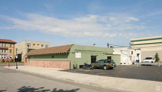
2113 Delaware Ave, Buffalo, NY 14216


NEARBY LISTINGS FOR SALE OR LEASE
-
-
-
-
-
-
-
-
-
-
-
-
-
-
-
-
-
-
-
No Photo
-
-
View all Buffalo listings for sale on LoopNet.com
Property Detail
2113 Delaware Ave
140200 89.23-2-31.1
Erie
Officebuilding
New York
X
31.100
36029C0205H
0.27 AC
2025
Greater Buffalo
2024
Buffalo/Niagara Falls
005400
Buffalo-Cheektowaga, NY
2,774 SF
DEMOGRAPHICS near 2113 Delaware Ave
1 mile
3 mile
5 mile
2024 Total Population
15,286
187,607
346,365
2029 Population
14,713
183,011
340,104
Pop Growth 2024-2029
(3.75%)
(2.45%)
(1.81%)
Average Age
39
38
39
2024 Total Households
7,442
82,375
150,644
HH Growth 2024-2029
(3.83%)
(2.43%)
(1.78%)
Median Household Inc
$61,308
$49,578
$49,400
Avg Household Size
2.00
2.10
2.20
2024 Avg HH Vehicles
1.00
1.00
1.00
Median Home Value
$262,531
$176,279
$163,625
Median Year Built
1946
1946
1948
Nearby Places
Map Layers
Map Styles
 Street
 Aerial
Transit
 Traffic
 Biking
Places
Listings with unknown addresses are not visible on the map
- Restaurants
- Banks
- Shops
- Fitness
- Groceries
PUBLIC TRANSPORTATION
COMMUTER RAIL
Drive
Walk
Distance
13 min
6.0 mi
Drive
Walk
Distance
18 min
9.6 mi
AIRPORT
Buffalo Niagara International
Drive
Walk
Distance
Buffalo Niagara International
19 min
10.3 mi
Niagara Falls International
Drive
Walk
Distance
Niagara Falls International
27 min
12.9 mi
Nearby Properties
Address
Land Use
TOTAL SIZE
Lot Size
Zoning
Address
Land Use
TOTAL SIZE
Lot Size
Zoning
6,120 SF
87.10 AC
D-IL
Address
Land Use
TOTAL SIZE
Lot Size
Zoning
135,396 SF
146.32 AC
D-E
Address
Land Use
TOTAL SIZE
Lot Size
Zoning
22,010 SF
D-M
Address
Land Use
TOTAL SIZE
Lot Size
Zoning
401,805 SF
2.04 AC
D-M
Address
Land Use
TOTAL SIZE
Lot Size
Zoning
166,250 SF
0.59 AC
D-M
Address
Land Use
TOTAL SIZE
Lot Size
Zoning
151,371 SF
0.51 AC
D-M
Address
Land Use
TOTAL SIZE
Lot Size
Zoning
8,317 SF
39.03 AC
SPLIT ZONE
Address
Land Use
TOTAL SIZE
Lot Size
Zoning
646,259 SF
16.31 AC
D-M
Address
Land Use
TOTAL SIZE
Lot Size
Zoning
117,679 SF
0.41 AC
N-1C
Address
Land Use
TOTAL SIZE
Lot Size
Zoning
870,511 SF
4.40 AC
D-M
Address
Land Use
TOTAL SIZE
Lot Size
Zoning
121,015 SF
92.60 AC
D-E
Address
Land Use
TOTAL SIZE
Lot Size
Zoning
686,000 SF
3.62 AC
N-2R
Address
Land Use
TOTAL SIZE
Lot Size
Zoning
314,029 SF
D-M
Address
Land Use
TOTAL SIZE
Lot Size
Zoning
561,196 SF
16 AC
D-M
Address
Land Use
TOTAL SIZE
Lot Size
Zoning
251,908 SF
D-M
Address
Land Use
TOTAL SIZE
Lot Size
Zoning
86,825 SF
1.57 AC
D-M
Address
Land Use
TOTAL SIZE
Lot Size
Zoning
74,316 SF
0.25 AC
D-M
Address
Land Use
TOTAL SIZE
Lot Size
Zoning
21,200 SF
20.94 AC
D-IL
Address
Land Use
TOTAL SIZE
Lot Size
Zoning
66,655 SF
0.25 AC
D-M
Address
Land Use
TOTAL SIZE
Lot Size
Zoning
36,325 SF
12.50 AC
D-E
Address
Land Use
TOTAL SIZE
Lot Size
Zoning
239,735 SF
17.73 AC
TND
Address
Land Use
TOTAL SIZE
Lot Size
Zoning
12,641 SF
0.56 AC
N-2C
Address
Land Use
TOTAL SIZE
Lot Size
Zoning
19,608 SF
0.45 AC
N-3C
Address
Land Use
TOTAL SIZE
Lot Size
Zoning
156,870 SF
D-M
Address
Land Use
TOTAL SIZE
Lot Size
Zoning
94,680 SF
175.90 AC
D-OG
Address
Land Use
TOTAL SIZE
Lot Size
Zoning
540,154 SF
7.06 AC
D-E
Address
Land Use
TOTAL SIZE
Lot Size
Zoning
17,778 SF
14 AC
GB
Address
Land Use
TOTAL SIZE
Lot Size
Zoning
3,456 SF
6.90 AC
MFR-5
Address
Land Use
TOTAL SIZE
Lot Size
Zoning
312,340 SF
3.83 AC
N-2R
Address
Land Use
TOTAL SIZE
Lot Size
Zoning
7,753 SF
1 AC
N-1C
The World's #1 Commercial Real Estate Marketplace
Connect with us
© 2026 CoStar Group
The information above has been obtained from sources believed reliable. While we do not doubt its accuracy we have not verified it and make no guarantee, warranty or representation about it. It is your responsibility to independently confirm its accuracy and completeness. Any projections, opinions, assumptions, or estimates used are for example only and do not represent the current or future performance of the property. The value of this transaction to you depends on tax and other factors which should be evaluated by your tax, financial, and legal advisors. You and your advisors should conduct a careful, independent investigation of the property to determine to your satisfaction the suitability of the property for your needs.