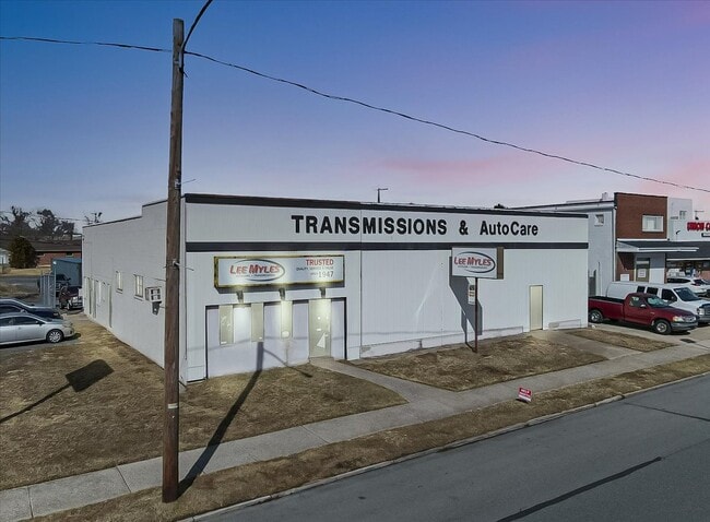
Property Record
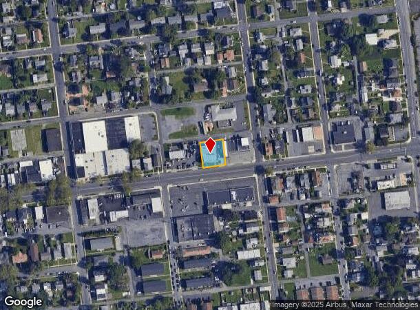
2113 Union Blvd, Allentown, PA 18109
NEARBY LISTINGS FOR SALE OR LEASE
Property Detail
2113 Union Blvd
Allentown-Bethlehem-Easton, PA-NJ
Park Place
641749044474-1
LOTS: 003
Officebuilding
Lehigh
X
Pennsylvania
42095C0243E
3
2025
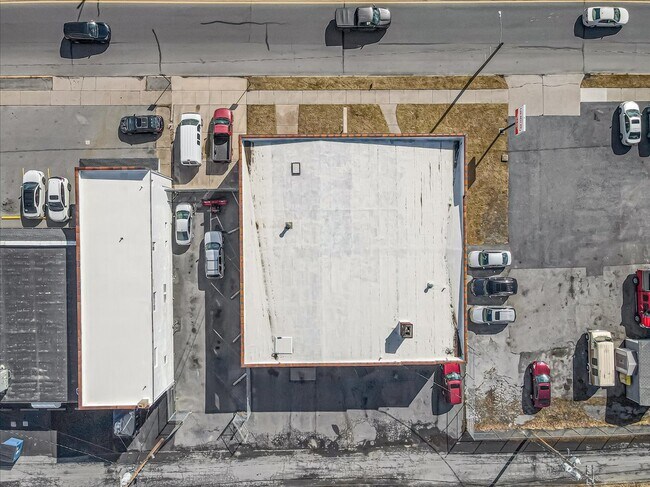
0.25 AC
2025
Lehigh Valley
000101
Philadelphia
6,230 SF
DEMOGRAPHICS near 2113 Union Blvd
1 Mile
3 Mile
5 Mile
2024 Total Population
13,852
118,956
272,787
2029 Population
13,880
119,809
274,484
Pop Growth 2024-2029
+ 0.20%
+ 0.72%
+ 0.62%
Average Age
40
38
39
2024 Total Households
5,600
45,193
104,243
HH Growth 2024-2029
+ 0.14%
+ 0.83%
+ 0.71%
Median Household Inc
$48,679
$52,467
$56,846
Avg Household Size
2.40
2.40
2.50
2024 Avg HH Vehicles
2.00
2.00
2.00
Median Home Value
$184,964
$182,579
$198,720
Median Year Built
1959
1955
1957
Nearby Places
Map Layers
Map Styles
 Street
 Aerial
- Restaurants
- Banks
- Shops
- Fitness
- Groceries
PUBLIC TRANSPORTATION
AIRPORT
Lehigh Valley International
DRIVE
WALK
Distance
Lehigh Valley International
10 min
5.4 mi
Freight Ports
Port of Philadelphia
DRIVE
WALK
Distance
Port of Philadelphia
88 min
54.6 mi
SALE & LEASE HISTORY
LISTING DATE
SALE/LEASE

Mar 03, 2025
For Sale
Nearby Properties
Address
Land Use
TOTAL SIZE
Lot Size
Zoning
Address
Land Use
TOTAL SIZE
Lot Size
Zoning
541,843 SF
35.82 AC
INST
Address
Land Use
TOTAL SIZE
Lot Size
Zoning
93,719 SF
789.61 AC
AI
Address
Land Use
TOTAL SIZE
Lot Size
Zoning
649,498 SF
22.51 AC
I
Address
Land Use
TOTAL SIZE
Lot Size
Zoning
187,337 SF
2.11 AC
I-G
Address
Land Use
TOTAL SIZE
Lot Size
Zoning
298,543 SF
55.08 AC
PIO
Address
Land Use
TOTAL SIZE
Lot Size
Zoning
505,128 SF
25.92 AC
C-2
Address
Land Use
TOTAL SIZE
Lot Size
Zoning
295,502 SF
0.77 AC
B-2
Address
Land Use
TOTAL SIZE
Lot Size
Zoning
229,379 SF
1.16 AC
I-G
Address
Land Use
TOTAL SIZE
Lot Size
Zoning
520,201 SF
77.66 AC
PIO
Address
Land Use
TOTAL SIZE
Lot Size
Zoning
314,421 SF
2.22 AC
I-G
Address
Land Use
TOTAL SIZE
Lot Size
Zoning
13,164 SF
27.89 AC
RT
Address
Land Use
TOTAL SIZE
Lot Size
Zoning
25.75 AC
B/LI
Address
Land Use
TOTAL SIZE
Lot Size
Zoning
184,739 SF
6.75 AC
I
Address
Land Use
TOTAL SIZE
Lot Size
Zoning
29,982 SF
14.39 AC
RT
Address
Land Use
TOTAL SIZE
Lot Size
Zoning
252,920 SF
12.88 AC
I-G
Address
Land Use
TOTAL SIZE
Lot Size
Zoning
72,678 SF
17.21 AC
PC
Address
Land Use
TOTAL SIZE
Lot Size
Zoning
165,557 SF
0.48 AC
B-2
Address
Land Use
TOTAL SIZE
Lot Size
Zoning
139,462 SF
1.30 AC
B-2
Address
Land Use
TOTAL SIZE
Lot Size
Zoning
85,440 SF
2.10 AC
I-G
Address
Land Use
TOTAL SIZE
Lot Size
Zoning
509,445 SF
43.15 AC
PIO
Address
Land Use
TOTAL SIZE
Lot Size
Zoning
139,812 SF
0.14 AC
B-2
Address
Land Use
TOTAL SIZE
Lot Size
Zoning
104,379 SF
21.57 AC
CS
Address
Land Use
TOTAL SIZE
Lot Size
Zoning
164,451 SF
15.06 AC
PI
Address
Land Use
TOTAL SIZE
Lot Size
Zoning
12,838 SF
36.50 AC
IP
Address
Land Use
TOTAL SIZE
Lot Size
Zoning
326,320 SF
11.73 AC
PC
Address
Land Use
TOTAL SIZE
Lot Size
Zoning
71,838 SF
0.48 AC
I-G
Address
Land Use
TOTAL SIZE
Lot Size
Zoning
133,912 SF
0.79 AC
I-3
Address
Land Use
TOTAL SIZE
Lot Size
Zoning
1.76 AC
B-2
Address
Land Use
TOTAL SIZE
Lot Size
Zoning
219,048 SF
1.48 AC
B-2
Address
Land Use
TOTAL SIZE
Lot Size
Zoning
19,581 SF
15.99 AC
R-MP
The World's #1 Commercial Real Estate Marketplace
Connect with us
© 2025 CoStar Group
The information above has been obtained from sources believed reliable. While we do not doubt its accuracy we have not verified it and make no guarantee, warranty or representation about it. It is your responsibility to independently confirm its accuracy and completeness. Any projections, opinions, assumptions, or estimates used are for example only and do not represent the current or future performance of the property. The value of this transaction to you depends on tax and other factors which should be evaluated by your tax, financial, and legal advisors. You and your advisors should conduct a careful, independent investigation of the property to determine to your satisfaction the suitability of the property for your needs.