Property Record
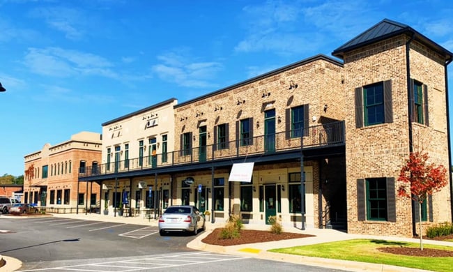
2115 Loganville Hwy, Grayson, GA 30017

Current Lease Availabilities
Property Detail
2115 Loganville Hwy
5-135A-070
TR2 RAILYARD PH1 - PB144-261
Storebuilding
GWINNETT
PUD
Georgia
B and X Area of moderate flood hazard, usually the area between the limits of the 100-year and 500-year floods.
5,1
2025
0.82 AC
2025
Lawrenceville/Dacula
050746
Atlanta
22,282 SF
Atlanta-Sandy Springs-Roswell, GA
NEARBY LISTINGS FOR SALE OR LEASE
DEMOGRAPHICS near 2115 Loganville Hwy
1 mile
3 mile
5 mile
2025 Total Population
7,592
61,768
175,212
2030 Population
8,100
65,524
184,867
Pop Growth 2025-2030
+ 6.69%
+ 6.08%
+ 5.51%
Average Age
40
39
38
2025 Total Households
2,400
19,638
55,180
HH Growth 2025-2030
+ 6.75%
+ 6.17%
+ 5.62%
Median Household Inc
$107,373
$93,476
$91,887
Avg Household Size
3.10
3.10
3.10
2025 Avg HH Vehicles
2.00
2.00
2.00
Median Home Value
$450,947
$409,578
$395,153
Median Year Built
2007
2003
2000
Nearby Places
Map Layers
Map Styles
 Street
 Aerial
Layers
 Traffic
 Biking
Places
Listings with unknown addresses are not visible on the map
- Restaurants
- Banks
- Shops
- Fitness
- Groceries
Nearby Properties
Address
Land Use
TOTAL SIZE
Lot Size
Zoning
Address
Land Use
TOTAL SIZE
Lot Size
Zoning
484,262 SF
34.27 AC
RM
Address
Land Use
TOTAL SIZE
Lot Size
Zoning
352,924 SF
86.43 AC
R100
Address
Land Use
TOTAL SIZE
Lot Size
Zoning
455,030 SF
80.40 AC
R100
Address
Land Use
TOTAL SIZE
Lot Size
Zoning
702.83 AC
R100
Address
Land Use
TOTAL SIZE
Lot Size
Zoning
360,279 SF
13.16 AC
RM24
Address
Land Use
TOTAL SIZE
Lot Size
Zoning
349,060 SF
59.85 AC
R100
Address
Land Use
TOTAL SIZE
Lot Size
Zoning
221,082 SF
12.90 AC
RM24
Address
Land Use
TOTAL SIZE
Lot Size
Zoning
194,295 SF
36.59 AC
R100
Address
Land Use
TOTAL SIZE
Lot Size
Zoning
214,399 SF
29.91 AC
C2
Address
Land Use
TOTAL SIZE
Lot Size
Zoning
222,622 SF
49.17 AC
R100
Address
Land Use
TOTAL SIZE
Lot Size
Zoning
145,681 SF
49.84 AC
RA200
Address
Land Use
TOTAL SIZE
Lot Size
Zoning
309,156 SF
17.39 AC
OI
Address
Land Use
TOTAL SIZE
Lot Size
Zoning
59,949 SF
71.12 AC
C1
Address
Land Use
TOTAL SIZE
Lot Size
Zoning
4,408 SF
148.92 AC
R100
Address
Land Use
TOTAL SIZE
Lot Size
Zoning
186,309 SF
15.53 AC
RM
Address
Land Use
TOTAL SIZE
Lot Size
Zoning
118,804 SF
17.66 AC
C2
Address
Land Use
TOTAL SIZE
Lot Size
Zoning
105,948 SF
1.24 AC
BG
Address
Land Use
TOTAL SIZE
Lot Size
Zoning
101,193 SF
5.34 AC
C2
Address
Land Use
TOTAL SIZE
Lot Size
Zoning
107,829 SF
7.82 AC
RM
Address
Land Use
TOTAL SIZE
Lot Size
Zoning
87,365 SF
11.32 AC
BG
Address
Land Use
TOTAL SIZE
Lot Size
Zoning
108,123 SF
13.96 AC
R100
Address
Land Use
TOTAL SIZE
Lot Size
Zoning
93,046 SF
82 AC
R100
Address
Land Use
TOTAL SIZE
Lot Size
Zoning
111,920 SF
8.20 AC
C2
Address
Land Use
TOTAL SIZE
Lot Size
Zoning
119,600 SF
1.33 AC
C2
Address
Land Use
TOTAL SIZE
Lot Size
Zoning
112,640 SF
5.17 AC
C2
Address
Land Use
TOTAL SIZE
Lot Size
Zoning
91,131 SF
15.60 AC
C2
Address
Land Use
TOTAL SIZE
Lot Size
Zoning
55,320 SF
4.13 AC
C2
Address
Land Use
TOTAL SIZE
Lot Size
Zoning
105,453 SF
14.57 AC
OI
Address
Land Use
TOTAL SIZE
Lot Size
Zoning
52,260 SF
3.62 AC
C2
Address
Land Use
TOTAL SIZE
Lot Size
Zoning
135,192 SF
16.88 AC
R75
The World's #1 Commercial Real Estate Marketplace
Connect with us
© 2026 CoStar Group
The information above has been obtained from sources believed reliable. While we do not doubt its accuracy we have not verified it and make no guarantee, warranty or representation about it. It is your responsibility to independently confirm its accuracy and completeness. Any projections, opinions, assumptions, or estimates used are for example only and do not represent the current or future performance of the property. The value of this transaction to you depends on tax and other factors which should be evaluated by your tax, financial, and legal advisors. You and your advisors should conduct a careful, independent investigation of the property to determine to your satisfaction the suitability of the property for your needs.