Property Record
2115 Miller Trunk Hwy, Duluth, MN 55811
NEARBY LISTINGS FOR SALE OR LEASE
-
-
View all Duluth listings for sale on LoopNet.com
Property Detail
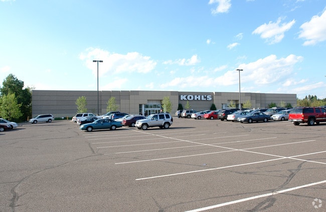
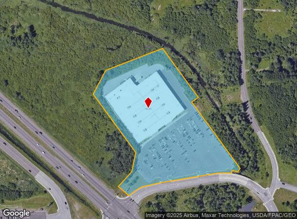
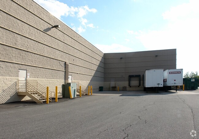
2115 Miller Trunk Hwy
Duluth, MN-WI
Miller Creek Division
010325700010
LOT 1 BLOCK 1 EX THAT PART PLATTED AS PARCEL222 ON MINN DOT RIGHT OF WAY PLAT NUMBERED69-103 & EX BEG AT MOST NLY COR OF LOT
Commercialnec
St Louis
AE
Minnesota
27137C3766E
1
2024
7.86 AC
2024
Miller Hill/Airpark
000302
Duluth
93,634 SF
DEMOGRAPHICS near 2115 Miller Trunk Hwy
1 Mile
3 Mile
5 Mile
2024 Total Population
2,515
19,309
68,715
2029 Population
2,498
19,048
67,837
Pop Growth 2024-2029
(0.68%)
(1.35%)
(1.28%)
Average Age
44
41
38
2024 Total Households
1,119
7,862
28,889
HH Growth 2024-2029
(0.80%)
(1.73%)
(1.35%)
Median Household Inc
$57,368
$71,428
$57,628
Avg Household Size
2.10
2.20
2.10
2024 Avg HH Vehicles
2.00
2.00
2.00
Median Home Value
$256,614
$256,099
$225,500
Median Year Built
1990
1977
1956
Nearby Places
Map Layers
Map Styles
 Street
 Aerial
- Restaurants
- Banks
- Shops
- Fitness
- Groceries
PUBLIC TRANSPORTATION
AIRPORT
Duluth International
DRIVE
WALK
Distance
Duluth International
12 min
4.4 mi
Freight Ports
Port Milwaukee
DRIVE
WALK
Distance
Port Milwaukee
457 min
402.0 mi
Nearby Properties
Address
Land Use
TOTAL SIZE
Lot Size
Zoning
Address
Land Use
TOTAL SIZE
Lot Size
Zoning
524,275 SF
38.23 AC
Address
Land Use
TOTAL SIZE
Lot Size
Zoning
195,455 SF
54.06 AC
Address
Land Use
TOTAL SIZE
Lot Size
Zoning
143,132 SF
41.55 AC
Address
Land Use
TOTAL SIZE
Lot Size
Zoning
6,500 SF
3.31 AC
R3
Address
Land Use
TOTAL SIZE
Lot Size
Zoning
32,824 SF
117.72 AC
Address
Land Use
TOTAL SIZE
Lot Size
Zoning
178,184 SF
20 AC
Address
Land Use
TOTAL SIZE
Lot Size
Zoning
20,388 SF
20 AC
Address
Land Use
TOTAL SIZE
Lot Size
Zoning
100,246 SF
12.24 AC
Address
Land Use
TOTAL SIZE
Lot Size
Zoning
126,349 SF
8.35 AC
Address
Land Use
TOTAL SIZE
Lot Size
Zoning
82,119 SF
5.21 AC
Address
Land Use
TOTAL SIZE
Lot Size
Zoning
118,418 SF
13.62 AC
Address
Land Use
TOTAL SIZE
Lot Size
Zoning
7,300 SF
19.85 AC
Address
Land Use
TOTAL SIZE
Lot Size
Zoning
113,448 SF
10 AC
Address
Land Use
TOTAL SIZE
Lot Size
Zoning
62,634 SF
4.32 AC
Address
Land Use
TOTAL SIZE
Lot Size
Zoning
72,980 SF
2.85 AC
R1B
Address
Land Use
TOTAL SIZE
Lot Size
Zoning
109,021 SF
10.01 AC
Address
Land Use
TOTAL SIZE
Lot Size
Zoning
98,994 SF
185.96 AC
Address
Land Use
TOTAL SIZE
Lot Size
Zoning
158,240 SF
0.13 AC
Address
Land Use
TOTAL SIZE
Lot Size
Zoning
183,097 SF
27.58 AC
Address
Land Use
TOTAL SIZE
Lot Size
Zoning
174,964 SF
41.97 AC
Address
Land Use
TOTAL SIZE
Lot Size
Zoning
81,316 SF
1.89 AC
Address
Land Use
TOTAL SIZE
Lot Size
Zoning
176,840 SF
27.50 AC
Address
Land Use
TOTAL SIZE
Lot Size
Zoning
161,568 SF
20.87 AC
Address
Land Use
TOTAL SIZE
Lot Size
Zoning
15,246 SF
10.98 AC
R3
Address
Land Use
TOTAL SIZE
Lot Size
Zoning
153,866 SF
13.83 AC
Address
Land Use
TOTAL SIZE
Lot Size
Zoning
172,700 SF
33.34 AC
Address
Land Use
TOTAL SIZE
Lot Size
Zoning
164,720 SF
19.81 AC
Address
Land Use
TOTAL SIZE
Lot Size
Zoning
123,720 SF
2.65 AC
Address
Land Use
TOTAL SIZE
Lot Size
Zoning
108,788 SF
2.86 AC
Address
Land Use
TOTAL SIZE
Lot Size
Zoning
21,204 SF
26.34 AC
The World's #1 Commercial Real Estate Marketplace
Connect with us
© 2025 CoStar Group
The information above has been obtained from sources believed reliable. While we do not doubt its accuracy we have not verified it and make no guarantee, warranty or representation about it. It is your responsibility to independently confirm its accuracy and completeness. Any projections, opinions, assumptions, or estimates used are for example only and do not represent the current or future performance of the property. The value of this transaction to you depends on tax and other factors which should be evaluated by your tax, financial, and legal advisors. You and your advisors should conduct a careful, independent investigation of the property to determine to your satisfaction the suitability of the property for your needs.