Property Record
2115 Oxford Square Ct, Memphis, TN 38116


NEARBY LISTINGS FOR SALE OR LEASE
-
-
View all Memphis listings for sale on LoopNet.com
Property Detail
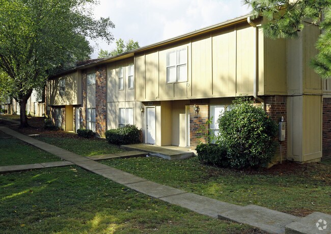
2115 Oxford Square Ct
Memphis, TN-MS-AR
Hilderbrand
07-9021-0-0073
SS RAINES RD 663 FT W OF C/L AIRWAYS BLVD
Apartment
Shelby
X
Tennessee
47157C0440F
11
2024
18.34 AC
2025
Whitehaven
022132
Memphis
193,643 SF
DEMOGRAPHICS near 2115 Oxford Square Ct
1 Mile
3 Mile
5 Mile
2024 Total Population
6,141
52,410
148,236
2029 Population
6,063
52,305
150,986
Pop Growth 2024-2029
(1.27%)
(0.20%)
+ 1.86%
Average Age
35
37
38
2024 Total Households
2,345
19,805
56,956
HH Growth 2024-2029
(1.49%)
(0.25%)
+ 1.82%
Median Household Inc
$40,157
$41,874
$38,856
Avg Household Size
2.60
2.60
2.50
2024 Avg HH Vehicles
1.00
2.00
2.00
Median Home Value
$97,885
$107,895
$92,755
Median Year Built
1963
1966
1967
Nearby Places
Map Layers
Map Styles
 Street
 Aerial
- Restaurants
- Banks
- Shops
- Fitness
- Groceries
PUBLIC TRANSPORTATION
AIRPORT
Memphis International
DRIVE
WALK
Distance
Memphis International
5 min
2.8 mi
Freight Ports
Port of Shreveport
DRIVE
WALK
Distance
Port of Shreveport
412 min
377.9 mi
Nearby Properties
Address
Land Use
TOTAL SIZE
Lot Size
Zoning
Address
Land Use
TOTAL SIZE
Lot Size
Zoning
1,013,319 SF
38.86 AC
EMP
Address
Land Use
TOTAL SIZE
Lot Size
Zoning
732,894 SF
79.73 AC
WD
Address
Land Use
TOTAL SIZE
Lot Size
Zoning
118,116 SF
60.70 AC
CMU-2
Address
Land Use
TOTAL SIZE
Lot Size
Zoning
180,831 SF
13.11 AC
EMP
Address
Land Use
TOTAL SIZE
Lot Size
Zoning
279,419 SF
172.07 AC
EMP
Address
Land Use
TOTAL SIZE
Lot Size
Zoning
357,582 SF
5.61 AC
EMP
Address
Land Use
TOTAL SIZE
Lot Size
Zoning
146,316 SF
18.07 AC
CMU-3
Address
Land Use
TOTAL SIZE
Lot Size
Zoning
853,440 SF
39.22 AC
EMP
Address
Land Use
TOTAL SIZE
Lot Size
Zoning
321.59 AC
R-8
Address
Land Use
TOTAL SIZE
Lot Size
Zoning
144,078 SF
17.93 AC
RU-3
Address
Land Use
TOTAL SIZE
Lot Size
Zoning
38,600 SF
30.35 AC
RU-3
Address
Land Use
TOTAL SIZE
Lot Size
Zoning
2,847.82 AC
EMP
Address
Land Use
TOTAL SIZE
Lot Size
Zoning
345,806 SF
33.16 AC
RU-3
Address
Land Use
TOTAL SIZE
Lot Size
Zoning
605,539 SF
28.59 AC
RU-1
Address
Land Use
TOTAL SIZE
Lot Size
Zoning
47.65 AC
R-8
Address
Land Use
TOTAL SIZE
Lot Size
Zoning
14,075 SF
9.36 AC
RU-3
Address
Land Use
TOTAL SIZE
Lot Size
Zoning
214,950 SF
17.05 AC
CMU-2
Address
Land Use
TOTAL SIZE
Lot Size
Zoning
63,842 SF
11 AC
R-6
Address
Land Use
TOTAL SIZE
Lot Size
Zoning
509,111 SF
EMP
Address
Land Use
TOTAL SIZE
Lot Size
Zoning
52,347 SF
11.55 AC
R-8
Address
Land Use
TOTAL SIZE
Lot Size
Zoning
81,790 SF
17.82 AC
CMU-2
Address
Land Use
TOTAL SIZE
Lot Size
Zoning
432,700 SF
28.16 AC
EMP
Address
Land Use
TOTAL SIZE
Lot Size
Zoning
342,605 SF
82.99 AC
CA
Address
Land Use
TOTAL SIZE
Lot Size
Zoning
409,298 SF
18.94 AC
RU-1
Address
Land Use
TOTAL SIZE
Lot Size
Zoning
414,189 SF
16.71 AC
R-6
Address
Land Use
TOTAL SIZE
Lot Size
Zoning
338,368 SF
15.70 AC
R-8
Address
Land Use
TOTAL SIZE
Lot Size
Zoning
344,016 SF
16.50 AC
R-8
Address
Land Use
TOTAL SIZE
Lot Size
Zoning
188,404 SF
59.17 AC
R-8
Address
Land Use
TOTAL SIZE
Lot Size
Zoning
165,227 SF
25.12 AC
RU-3
Address
Land Use
TOTAL SIZE
Lot Size
Zoning
71,308 SF
EMP
The World's #1 Commercial Real Estate Marketplace
Connect with us
© 2026 CoStar Group
The information above has been obtained from sources believed reliable. While we do not doubt its accuracy we have not verified it and make no guarantee, warranty or representation about it. It is your responsibility to independently confirm its accuracy and completeness. Any projections, opinions, assumptions, or estimates used are for example only and do not represent the current or future performance of the property. The value of this transaction to you depends on tax and other factors which should be evaluated by your tax, financial, and legal advisors. You and your advisors should conduct a careful, independent investigation of the property to determine to your satisfaction the suitability of the property for your needs.