Property Record
2115 Pinehurst Dr, Middleton, WI 53562
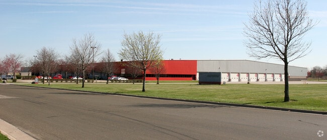

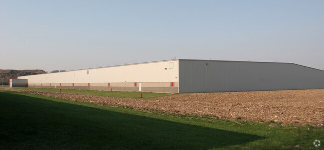
Property Detail
2115 Pinehurst Dr
Madison, WI
REPLAT OF FIRST ADDITION TO GOLF GREEN INDUSTRIAL PARK LOT 14
0708-102-4104-4
Dane
Commercialnec
Wisconsin
B and X Area of moderate flood hazard, usually the area between the limits of the 100-year and 500-year floods.
14
2025
15.34 AC
2025
Northwest Madison
010908
Milwaukee/Madison
NEARBY LISTINGS FOR SALE OR LEASE
DEMOGRAPHICS near 2115 Pinehurst Dr
1 mile
3 mile
5 mile
2025 Total Population
2,784
41,135
91,953
2030 Population
2,881
43,014
96,216
Pop Growth 2025-2030
+ 3.48%
+ 4.57%
+ 4.64%
Average Age
40
41
41
2025 Total Households
1,249
18,474
42,327
HH Growth 2025-2030
+ 3.52%
+ 4.80%
+ 4.96%
Median Household Inc
$113,582
$98,012
$93,119
Avg Household Size
2.20
2.20
2.10
2025 Avg HH Vehicles
2.00
2.00
2.00
Median Home Value
$684,922
$523,725
$487,153
Median Year Built
2000
1992
1990
Nearby Places
Map Layers
Map Styles
 Street
 Aerial
Transit
 Traffic
 Biking
Places
Listings with unknown addresses are not visible on the map
- Restaurants
- Banks
- Shops
- Fitness
- Groceries
PUBLIC TRANSPORTATION
AIRPORT
Dane County Regional/Truax Field
Drive
Walk
Distance
Dane County Regional/Truax Field
25 min
15.1 mi
Nearby Properties
Address
Land Use
TOTAL SIZE
Lot Size
Zoning
Address
Land Use
TOTAL SIZE
Lot Size
Zoning
526,685 SF
23.94 AC
SR-V2
Address
Land Use
TOTAL SIZE
Lot Size
Zoning
143,360 SF
10.27 AC
SEC
Address
Land Use
TOTAL SIZE
Lot Size
Zoning
235,052 SF
7.34 AC
WP-28
Address
Land Use
TOTAL SIZE
Lot Size
Zoning
8.48 AC
Address
Land Use
TOTAL SIZE
Lot Size
Zoning
175,209 SF
12.60 AC
SEC
Address
Land Use
TOTAL SIZE
Lot Size
Zoning
169,563 SF
19.82 AC
SEC
Address
Land Use
TOTAL SIZE
Lot Size
Zoning
15.61 AC
Address
Land Use
TOTAL SIZE
Lot Size
Zoning
5.95 AC
Address
Land Use
TOTAL SIZE
Lot Size
Zoning
10.12 AC
Address
Land Use
TOTAL SIZE
Lot Size
Zoning
181,269 SF
4.58 AC
CC-T
Address
Land Use
TOTAL SIZE
Lot Size
Zoning
2.91 AC
CC-T
Address
Land Use
TOTAL SIZE
Lot Size
Zoning
204,228 SF
4.23 AC
PD
Address
Land Use
TOTAL SIZE
Lot Size
Zoning
243,290 SF
9.28 AC
SR-V2
Address
Land Use
TOTAL SIZE
Lot Size
Zoning
Address
Land Use
TOTAL SIZE
Lot Size
Zoning
134,951 SF
7.39 AC
SEC
Address
Land Use
TOTAL SIZE
Lot Size
Zoning
11.09 AC
Address
Land Use
TOTAL SIZE
Lot Size
Zoning
37,909 SF
10.27 AC
SEC
Address
Land Use
TOTAL SIZE
Lot Size
Zoning
Address
Land Use
TOTAL SIZE
Lot Size
Zoning
10.01 AC
Address
Land Use
TOTAL SIZE
Lot Size
Zoning
178,542 SF
10.32 AC
PD
Address
Land Use
TOTAL SIZE
Lot Size
Zoning
4.37 AC
Address
Land Use
TOTAL SIZE
Lot Size
Zoning
40.70 AC
Address
Land Use
TOTAL SIZE
Lot Size
Zoning
Address
Land Use
TOTAL SIZE
Lot Size
Zoning
26.62 AC
Address
Land Use
TOTAL SIZE
Lot Size
Zoning
162,786 SF
17.48 AC
PD
Address
Land Use
TOTAL SIZE
Lot Size
Zoning
137,317 SF
5.10 AC
PD
Address
Land Use
TOTAL SIZE
Lot Size
Zoning
110,721 SF
10.76 AC
PD
Address
Land Use
TOTAL SIZE
Lot Size
Zoning
141,774 SF
9.53 AC
SR-V2
Address
Land Use
TOTAL SIZE
Lot Size
Zoning
127,696 SF
4.29 AC
TR-U1
Address
Land Use
TOTAL SIZE
Lot Size
Zoning
1.19 AC
The World's #1 Commercial Real Estate Marketplace
Connect with us
© 2026 CoStar Group
The information above has been obtained from sources believed reliable. While we do not doubt its accuracy we have not verified it and make no guarantee, warranty or representation about it. It is your responsibility to independently confirm its accuracy and completeness. Any projections, opinions, assumptions, or estimates used are for example only and do not represent the current or future performance of the property. The value of this transaction to you depends on tax and other factors which should be evaluated by your tax, financial, and legal advisors. You and your advisors should conduct a careful, independent investigation of the property to determine to your satisfaction the suitability of the property for your needs.