Property Record
2115 Rowesville Rd, Orangeburg, SC 29115
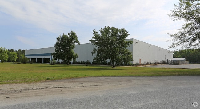


Property Detail
2115 Rowesville Rd
Orangeburg, SC
MFG # 638-00253 ROWESVILLE, SC
0172-20-00-004.000
Orangeburg
Taxexempt
South Carolina
B and X Area of moderate flood hazard, usually the area between the limits of the 100-year and 500-year floods.
6.75 AC
0
Orangeburg/Sumter
2024
Other Market Areas
010602
NEARBY LISTINGS FOR SALE OR LEASE
DEMOGRAPHICS near 2115 Rowesville Rd
1 mile
3 mile
5 mile
2025 Total Population
899
15,132
31,525
2030 Population
902
15,390
31,757
Pop Growth 2025-2030
+ 0.33%
+ 1.70%
+ 0.74%
Average Age
42
37
39
2025 Total Households
341
5,000
11,871
HH Growth 2025-2030
0.00%
+ 1.94%
+ 0.64%
Median Household Inc
$31,419
$34,397
$44,706
Avg Household Size
2.30
2.30
2.30
2025 Avg HH Vehicles
1.00
1.00
2.00
Median Home Value
$159,677
$105,423
$128,181
Median Year Built
1977
1975
1976
Nearby Places
Map Layers
Map Styles
 Street
 Aerial
Layers
 Traffic
 Biking
Places
Listings with unknown addresses are not visible on the map
- Restaurants
- Banks
- Shops
- Fitness
- Groceries
PUBLIC TRANSPORTATION
AIRPORT
Columbia Metro
Drive
Walk
Distance
Columbia Metro
58 min
44.1 mi
Freight Ports
North Charleston Terminal
Drive
Walk
Distance
North Charleston Terminal
80 min
68.0 mi
SALE & LEASE HISTORY
LISTING DATE
SALE/LEASE

Sep 25, 2016
For Lease
Sep 23, 2016
For Sale
Nearby Properties
Address
Land Use
TOTAL SIZE
Lot Size
Zoning
Address
Land Use
TOTAL SIZE
Lot Size
Zoning
534,738 SF
53.78 AC
Address
Land Use
TOTAL SIZE
Lot Size
Zoning
24,351 SF
1.23 AC
Address
Land Use
TOTAL SIZE
Lot Size
Zoning
20,838 SF
7.70 AC
Address
Land Use
TOTAL SIZE
Lot Size
Zoning
352,112 SF
288.60 AC
Address
Land Use
TOTAL SIZE
Lot Size
Zoning
41,412 SF
7.40 AC
Address
Land Use
TOTAL SIZE
Lot Size
Zoning
7,634 SF
0.72 AC
Address
Land Use
TOTAL SIZE
Lot Size
Zoning
100,693 SF
6.61 AC
Address
Land Use
TOTAL SIZE
Lot Size
Zoning
120,375 SF
19.57 AC
Address
Land Use
TOTAL SIZE
Lot Size
Zoning
5,059 SF
3.60 AC
Address
Land Use
TOTAL SIZE
Lot Size
Zoning
4,794 SF
5 AC
Address
Land Use
TOTAL SIZE
Lot Size
Zoning
102,557 SF
10.30 AC
Address
Land Use
TOTAL SIZE
Lot Size
Zoning
205,299 SF
44.40 AC
Address
Land Use
TOTAL SIZE
Lot Size
Zoning
14,606 SF
1.80 AC
Address
Land Use
TOTAL SIZE
Lot Size
Zoning
41,838 SF
2.40 AC
Address
Land Use
TOTAL SIZE
Lot Size
Zoning
9,358 SF
2.20 AC
Address
Land Use
TOTAL SIZE
Lot Size
Zoning
100,000 SF
8.62 AC
Address
Land Use
TOTAL SIZE
Lot Size
Zoning
16,182 SF
4.02 AC
Address
Land Use
TOTAL SIZE
Lot Size
Zoning
3,228 SF
19.40 AC
Address
Land Use
TOTAL SIZE
Lot Size
Zoning
7,500 SF
6 AC
Address
Land Use
TOTAL SIZE
Lot Size
Zoning
13,824 SF
1.40 AC
Address
Land Use
TOTAL SIZE
Lot Size
Zoning
2,432 SF
8.44 AC
9090
Address
Land Use
TOTAL SIZE
Lot Size
Zoning
1,200 SF
7.10 AC
Address
Land Use
TOTAL SIZE
Lot Size
Zoning
480 SF
24.99 AC
Address
Land Use
TOTAL SIZE
Lot Size
Zoning
18,200 SF
15.50 AC
Address
Land Use
TOTAL SIZE
Lot Size
Zoning
11,652 SF
1.24 AC
Address
Land Use
TOTAL SIZE
Lot Size
Zoning
11,858 SF
6.30 AC
Address
Land Use
TOTAL SIZE
Lot Size
Zoning
21,288 SF
3.59 AC
Address
Land Use
TOTAL SIZE
Lot Size
Zoning
2,305 SF
583.80 AC
Address
Land Use
TOTAL SIZE
Lot Size
Zoning
2,490 SF
0.55 AC
Address
Land Use
TOTAL SIZE
Lot Size
Zoning
8,570 SF
3.90 AC
The World's #1 Commercial Real Estate Marketplace
Connect with us
© 2026 CoStar Group
The information above has been obtained from sources believed reliable. While we do not doubt its accuracy we have not verified it and make no guarantee, warranty or representation about it. It is your responsibility to independently confirm its accuracy and completeness. Any projections, opinions, assumptions, or estimates used are for example only and do not represent the current or future performance of the property. The value of this transaction to you depends on tax and other factors which should be evaluated by your tax, financial, and legal advisors. You and your advisors should conduct a careful, independent investigation of the property to determine to your satisfaction the suitability of the property for your needs.