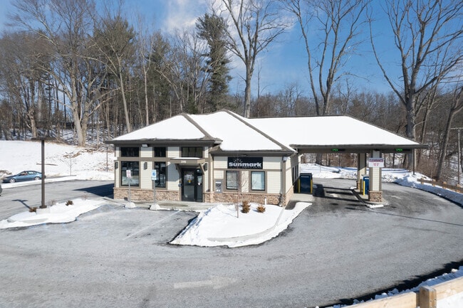
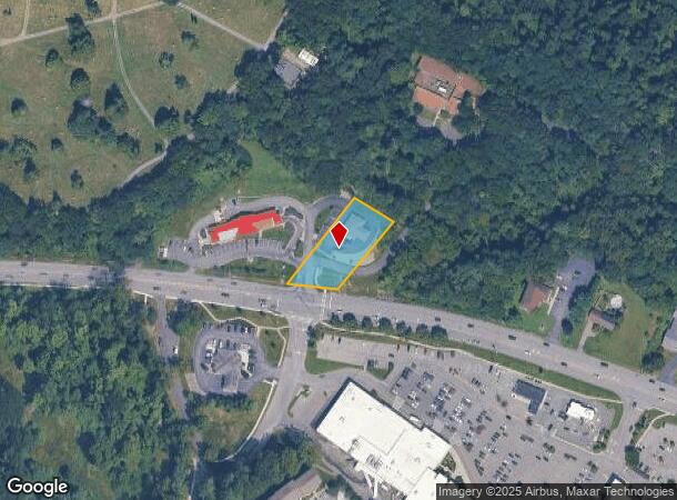
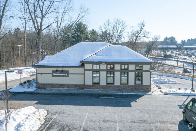
Property Record
2115 Western Ave, Guilderland, NY 12084
NEARBY LISTINGS FOR SALE OR LEASE
-
-
View all Guilderland listings for sale on LoopNet.com
Property Detail
2115 Western Ave
013089-051-002-0001-019-000-0000
Albany
Financialbuilding
New York
X
19.000
36001C0159D
0.83 AC
2025
W Outer Albany County
2024
Albany/Schenectady/Troy
014617
Albany-Schenectady-Troy, NY
1,052 SF
DEMOGRAPHICS near 2115 Western Ave
1 Mile
3 Mile
5 Mile
2024 Total Population
5,865
25,915
91,563
2029 Population
5,874
25,917
91,299
Pop Growth 2024-2029
+ 0.15%
+ 0.01%
(0.29%)
Average Age
40
43
42
2024 Total Households
2,688
11,175
36,489
HH Growth 2024-2029
+ 0.15%
+ 0.11%
(0.19%)
Median Household Inc
$76,637
$88,613
$87,113
Avg Household Size
2.10
2.20
2.20
2024 Avg HH Vehicles
1.00
2.00
2.00
Median Home Value
$290,789
$295,812
$268,886
Median Year Built
1976
1979
1973
Nearby Places
- Restaurants
- Banks
- Shops
- Fitness
- Groceries
PUBLIC TRANSPORTATION
AIRPORT
Albany International
DRIVE
WALK
Distance
Albany International
19 min
10.1 mi
Freight Ports
Albany, NY Port
DRIVE
WALK
Distance
Albany, NY Port
23 min
12.8 mi
Nearby Properties
Address
Land Use
TOTAL SIZE
Lot Size
Zoning
Address
Land Use
TOTAL SIZE
Lot Size
Zoning
812,458 SF
38.74 AC
F
Address
Land Use
TOTAL SIZE
Lot Size
Zoning
561,128 SF
33.58 AC
GB
Address
Land Use
TOTAL SIZE
Lot Size
Zoning
190 AC
LC
Address
Land Use
TOTAL SIZE
Lot Size
Zoning
47,424 SF
37.60 AC
MR
Address
Land Use
TOTAL SIZE
Lot Size
Zoning
3,760 SF
28.30 AC
MR
Address
Land Use
TOTAL SIZE
Lot Size
Zoning
98.20 AC
LC
Address
Land Use
TOTAL SIZE
Lot Size
Zoning
213,860 SF
28.20 AC
C2
Address
Land Use
TOTAL SIZE
Lot Size
Zoning
135,000 SF
14.64 AC
R1B
Address
Land Use
TOTAL SIZE
Lot Size
Zoning
80.10 AC
LC
Address
Land Use
TOTAL SIZE
Lot Size
Zoning
279,150 SF
21.10 AC
CO
Address
Land Use
TOTAL SIZE
Lot Size
Zoning
31,080 SF
13.60 AC
LB
Address
Land Use
TOTAL SIZE
Lot Size
Zoning
8,600 SF
14.80 AC
MR
Address
Land Use
TOTAL SIZE
Lot Size
Zoning
66,419 SF
2 AC
CPB
Address
Land Use
TOTAL SIZE
Lot Size
Zoning
18,240 SF
26.70 AC
MR
Address
Land Use
TOTAL SIZE
Lot Size
Zoning
10,368 SF
17 AC
MR
Address
Land Use
TOTAL SIZE
Lot Size
Zoning
9,000 SF
10.32 AC
GB
Address
Land Use
TOTAL SIZE
Lot Size
Zoning
119,112 SF
4.13 AC
LB
Address
Land Use
TOTAL SIZE
Lot Size
Zoning
22,446 SF
11.30 AC
MR
Address
Land Use
TOTAL SIZE
Lot Size
Zoning
1,584 SF
9.60 AC
MR
Address
Land Use
TOTAL SIZE
Lot Size
Zoning
10,880 SF
13.50 AC
TH
Address
Land Use
TOTAL SIZE
Lot Size
Zoning
103.30 AC
LC
Address
Land Use
TOTAL SIZE
Lot Size
Zoning
75,790 SF
19.23 AC
RO40
Address
Land Use
TOTAL SIZE
Lot Size
Zoning
161,797 SF
13.69 AC
GB
Address
Land Use
TOTAL SIZE
Lot Size
Zoning
19,968 SF
12 AC
MR
Address
Land Use
TOTAL SIZE
Lot Size
Zoning
78,326 SF
27.47 AC
R40
Address
Land Use
TOTAL SIZE
Lot Size
Zoning
14,436 SF
13.20 AC
MR
Address
Land Use
TOTAL SIZE
Lot Size
Zoning
49,889 SF
9.74 AC
MR
Address
Land Use
TOTAL SIZE
Lot Size
Zoning
45 AC
LC
Address
Land Use
TOTAL SIZE
Lot Size
Zoning
131,716 SF
65.09 AC
RO40
Address
Land Use
TOTAL SIZE
Lot Size
Zoning
91,000 SF
3.60 AC
R1B
The World's #1 Commercial Real Estate Marketplace
Connect with us
© 2025 CoStar Group
The information above has been obtained from sources believed reliable. While we do not doubt its accuracy we have not verified it and make no guarantee, warranty or representation about it. It is your responsibility to independently confirm its accuracy and completeness. Any projections, opinions, assumptions, or estimates used are for example only and do not represent the current or future performance of the property. The value of this transaction to you depends on tax and other factors which should be evaluated by your tax, financial, and legal advisors. You and your advisors should conduct a careful, independent investigation of the property to determine to your satisfaction the suitability of the property for your needs.