Property Record
2115 Zion Hill Rd, Weatherford, TX 76088

Property Detail
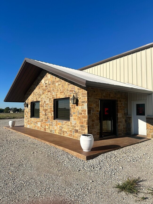
2115 Zion Hill Rd
R000053267
ACRES: 1.000 ABST: 1346,
Commercialnec
Parker
B and X Area of moderate flood hazard, usually the area between the limits of the 100-year and 500-year floods.
Texas
2024
1.51 AC
2025
Parker County
140503
Dallas/Ft Worth
6,330 SF
Dallas-Fort Worth-Arlington, TX
NEARBY LISTINGS FOR SALE OR LEASE
DEMOGRAPHICS near 2115 Zion Hill Rd
1 mile
3 mile
5 mile
2025 Total Population
1,726
10,281
33,599
2030 Population
2,023
11,984
39,105
Pop Growth 2025-2030
+ 17.21%
+ 16.56%
+ 16.39%
Average Age
39
39
40
2025 Total Households
608
3,697
12,622
HH Growth 2025-2030
+ 16.45%
+ 15.74%
+ 15.65%
Median Household Inc
$112,500
$96,806
$79,298
Avg Household Size
2.70
2.70
2.50
2025 Avg HH Vehicles
2.00
2.00
2.00
Median Home Value
$476,530
$355,009
$341,414
Median Year Built
2003
1992
1990
Nearby Places
Map Layers
Map Styles
 Street
 Aerial
Transit
 Traffic
 Biking
Places
Listings with unknown addresses are not visible on the map
- Restaurants
- Banks
- Shops
- Fitness
- Groceries
SALE & LEASE HISTORY
LISTING DATE
SALE/LEASE

Sep 18, 2024
For Sale
Nearby Properties
Address
Land Use
TOTAL SIZE
Lot Size
Zoning
Address
Land Use
TOTAL SIZE
Lot Size
Zoning
103,125 SF
18.25 AC
Address
Land Use
TOTAL SIZE
Lot Size
Zoning
146,651 SF
7.73 AC
Address
Land Use
TOTAL SIZE
Lot Size
Zoning
210,342 SF
5 AC
Address
Land Use
TOTAL SIZE
Lot Size
Zoning
34,000 SF
11.13 AC
Address
Land Use
TOTAL SIZE
Lot Size
Zoning
78,870 SF
1.84 AC
Address
Land Use
TOTAL SIZE
Lot Size
Zoning
180,371 SF
11.05 AC
Address
Land Use
TOTAL SIZE
Lot Size
Zoning
Address
Land Use
TOTAL SIZE
Lot Size
Zoning
15,112 SF
3.82 AC
Address
Land Use
TOTAL SIZE
Lot Size
Zoning
14,335 SF
3.82 AC
Address
Land Use
TOTAL SIZE
Lot Size
Zoning
25,160 SF
6.10 AC
Address
Land Use
TOTAL SIZE
Lot Size
Zoning
44,290 SF
6.29 AC
Address
Land Use
TOTAL SIZE
Lot Size
Zoning
1 SF
1.84 AC
Address
Land Use
TOTAL SIZE
Lot Size
Zoning
38,925 SF
4.01 AC
Address
Land Use
TOTAL SIZE
Lot Size
Zoning
Address
Land Use
TOTAL SIZE
Lot Size
Zoning
13,135 SF
4 AC
Address
Land Use
TOTAL SIZE
Lot Size
Zoning
Address
Land Use
TOTAL SIZE
Lot Size
Zoning
18,000 SF
9.17 AC
Address
Land Use
TOTAL SIZE
Lot Size
Zoning
40,747 SF
3.91 AC
Address
Land Use
TOTAL SIZE
Lot Size
Zoning
18,818 SF
1.28 AC
Address
Land Use
TOTAL SIZE
Lot Size
Zoning
25,600 SF
7.09 AC
Address
Land Use
TOTAL SIZE
Lot Size
Zoning
20,650 SF
1.82 AC
Address
Land Use
TOTAL SIZE
Lot Size
Zoning
16,864 SF
1.25 AC
Address
Land Use
TOTAL SIZE
Lot Size
Zoning
23,400 SF
5.67 AC
Address
Land Use
TOTAL SIZE
Lot Size
Zoning
25,800 SF
7.30 AC
Address
Land Use
TOTAL SIZE
Lot Size
Zoning
10,000 SF
2.88 AC
Address
Land Use
TOTAL SIZE
Lot Size
Zoning
4.07 AC
Address
Land Use
TOTAL SIZE
Lot Size
Zoning
11,716 SF
5 AC
Address
Land Use
TOTAL SIZE
Lot Size
Zoning
1,228 SF
2 AC
Address
Land Use
TOTAL SIZE
Lot Size
Zoning
42,721 SF
4.27 AC
Address
Land Use
TOTAL SIZE
Lot Size
Zoning
9,504 SF
2.59 AC
The World's #1 Commercial Real Estate Marketplace
Connect with us
© 2026 CoStar Group
The information above has been obtained from sources believed reliable. While we do not doubt its accuracy we have not verified it and make no guarantee, warranty or representation about it. It is your responsibility to independently confirm its accuracy and completeness. Any projections, opinions, assumptions, or estimates used are for example only and do not represent the current or future performance of the property. The value of this transaction to you depends on tax and other factors which should be evaluated by your tax, financial, and legal advisors. You and your advisors should conduct a careful, independent investigation of the property to determine to your satisfaction the suitability of the property for your needs.