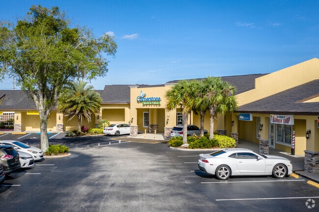
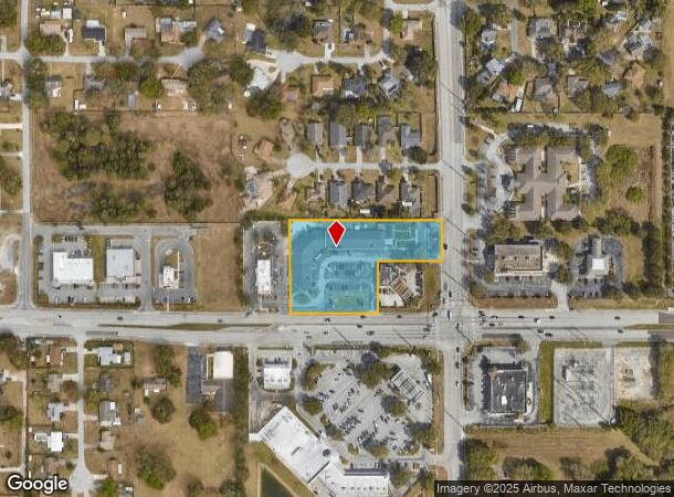
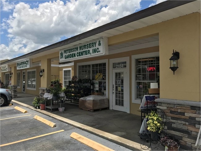
Property Record
2116 E Highway 540 A E, Lakeland, FL 33813
Current Lease Availabilities
NEARBY LISTINGS FOR SALE OR LEASE
Property Detail
2116 E Highway 540 A E
Lakeland-Winter Haven, FL
W. F. Hallam And Cos Subdivision Farming
24-29-17-285000-006402
W F HALLAM & COS CLUB COLONY TRACT PB 1 PG 102A LOT 64 S1/2 LESS S 205 FT OF E 242 FT & LESS W 150 FT & LESS E 40 FT FOR RD & LESS S 40 FT FOR RD
Regionalshoppingcenterormallwithanchorstore
Polk
X
Florida
12105C0485G
64
2024
2.41 AC
2025
Polk County
011821
Tampa/St Petersburg
18,645 SF
DEMOGRAPHICS near 2116 E Highway 540 A E
1 Mile
3 Mile
5 Mile
2024 Total Population
6,800
45,429
98,798
2029 Population
8,066
53,957
117,425
Pop Growth 2024-2029
+ 18.62%
+ 18.77%
+ 18.85%
Average Age
40
40
40
2024 Total Households
2,313
16,539
37,958
HH Growth 2024-2029
+ 18.50%
+ 18.72%
+ 18.80%
Median Household Inc
$114,679
$96,627
$75,140
Avg Household Size
2.90
2.70
2.60
2024 Avg HH Vehicles
2.00
2.00
2.00
Median Home Value
$351,916
$293,350
$255,359
Median Year Built
1998
1992
1987
Nearby Places
Map Layers
Map Styles
 Street
 Aerial
- Restaurants
- Banks
- Shops
- Fitness
- Groceries
PUBLIC TRANSPORTATION
COMMUTER RAIL
Lakeland (Silver Star - Amtrak)
DRIVE
WALK
Distance
Lakeland (Silver Star - Amtrak)
15 min
8.2 mi
Freight Ports
Port of Tampa Bay
DRIVE
WALK
Distance
Port of Tampa Bay
54 min
40.3 mi
Nearby Properties
Address
Land Use
TOTAL SIZE
Lot Size
Zoning
Address
Land Use
TOTAL SIZE
Lot Size
Zoning
480,363 SF
40.15 AC
Address
Land Use
TOTAL SIZE
Lot Size
Zoning
336,260 SF
93.82 AC
RE1
Address
Land Use
TOTAL SIZE
Lot Size
Zoning
341,795 SF
37.28 AC
Address
Land Use
TOTAL SIZE
Lot Size
Zoning
75,580 SF
8.92 AC
RE1
Address
Land Use
TOTAL SIZE
Lot Size
Zoning
106,312 SF
22.64 AC
RC
Address
Land Use
TOTAL SIZE
Lot Size
Zoning
76,527 SF
17.51 AC
R1
Address
Land Use
TOTAL SIZE
Lot Size
Zoning
101,103 SF
13.87 AC
Address
Land Use
TOTAL SIZE
Lot Size
Zoning
147,718 SF
52.29 AC
PUD
Address
Land Use
TOTAL SIZE
Lot Size
Zoning
95,955 SF
14.37 AC
Address
Land Use
TOTAL SIZE
Lot Size
Zoning
146,700 SF
12.30 AC
C4
Address
Land Use
TOTAL SIZE
Lot Size
Zoning
119,901 SF
8.46 AC
Address
Land Use
TOTAL SIZE
Lot Size
Zoning
199,906 SF
19.73 AC
R2
Address
Land Use
TOTAL SIZE
Lot Size
Zoning
73,090 SF
5.81 AC
PUD
Address
Land Use
TOTAL SIZE
Lot Size
Zoning
75,566 SF
12 AC
RA1
Address
Land Use
TOTAL SIZE
Lot Size
Zoning
75,210 SF
7.68 AC
Address
Land Use
TOTAL SIZE
Lot Size
Zoning
149,528 SF
21.75 AC
Address
Land Use
TOTAL SIZE
Lot Size
Zoning
61,474 SF
8.18 AC
PUD
Address
Land Use
TOTAL SIZE
Lot Size
Zoning
110,784 SF
15.58 AC
Address
Land Use
TOTAL SIZE
Lot Size
Zoning
115,162 SF
17.89 AC
RE1
Address
Land Use
TOTAL SIZE
Lot Size
Zoning
20,231 SF
44.52 AC
Address
Land Use
TOTAL SIZE
Lot Size
Zoning
54,315 SF
10.60 AC
C4
Address
Land Use
TOTAL SIZE
Lot Size
Zoning
123,899 SF
5.12 AC
C4
Address
Land Use
TOTAL SIZE
Lot Size
Zoning
158,234 SF
14.41 AC
Address
Land Use
TOTAL SIZE
Lot Size
Zoning
42,032 SF
2.68 AC
Address
Land Use
TOTAL SIZE
Lot Size
Zoning
101,500 SF
8.47 AC
Address
Land Use
TOTAL SIZE
Lot Size
Zoning
39,936 SF
3.16 AC
C4
Address
Land Use
TOTAL SIZE
Lot Size
Zoning
122,724 SF
14.05 AC
Address
Land Use
TOTAL SIZE
Lot Size
Zoning
63,640 SF
8.81 AC
C4
Address
Land Use
TOTAL SIZE
Lot Size
Zoning
62,749 SF
7.35 AC
Address
Land Use
TOTAL SIZE
Lot Size
Zoning
27,425 SF
8.02 AC
The World's #1 Commercial Real Estate Marketplace
Connect with us
© 2025 CoStar Group
The information above has been obtained from sources believed reliable. While we do not doubt its accuracy we have not verified it and make no guarantee, warranty or representation about it. It is your responsibility to independently confirm its accuracy and completeness. Any projections, opinions, assumptions, or estimates used are for example only and do not represent the current or future performance of the property. The value of this transaction to you depends on tax and other factors which should be evaluated by your tax, financial, and legal advisors. You and your advisors should conduct a careful, independent investigation of the property to determine to your satisfaction the suitability of the property for your needs.