Property Record
2116 Preston St, Rockford, IL 61102

NEARBY LISTINGS FOR SALE OR LEASE
Property Detail
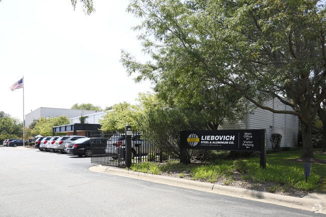
2116 Preston St
Rockford, IL
Liebovich Bros Sub No 1
11-21-410-006
LIEBOVICH BROS SUB NO 1 PT S1/2 SEC 21-44-1 (EXC N 288.9 FT W 280 FT) LOT 1
Industrialgeneral
Winnebago
X
Illinois
17201C0263E
1
2024
18.84 AC
2024
I-39 Cor/Winnebago Cy
002500
Chicago
299,238 SF
DEMOGRAPHICS near 2116 Preston St
1 Mile
3 Mile
5 Mile
2024 Total Population
11,635
61,894
122,814
2029 Population
11,753
61,907
121,784
Pop Growth 2024-2029
+ 1.01%
+ 0.02%
(0.84%)
Average Age
34
36
38
2024 Total Households
3,840
24,257
49,246
HH Growth 2024-2029
+ 1.09%
(0.04%)
(0.92%)
Median Household Inc
$30,668
$32,071
$41,762
Avg Household Size
2.70
2.40
2.40
2024 Avg HH Vehicles
2.00
1.00
2.00
Median Home Value
$57,602
$69,898
$87,174
Median Year Built
1953
1951
1955
Nearby Places
Map Layers
Map Styles
 Street
 Aerial
- Restaurants
- Banks
- Shops
- Fitness
- Groceries
PUBLIC TRANSPORTATION
AIRPORT
Chicago/Rockford International
DRIVE
WALK
Distance
Chicago/Rockford International
19 min
9.0 mi
Freight Ports
Port Milwaukee
DRIVE
WALK
Distance
Port Milwaukee
118 min
95.8 mi
Nearby Properties
Address
Land Use
TOTAL SIZE
Lot Size
Zoning
Address
Land Use
TOTAL SIZE
Lot Size
Zoning
1,456,216 SF
103.10 AC
I1
Address
Land Use
TOTAL SIZE
Lot Size
Zoning
216,540 SF
22 AC
C3
Address
Land Use
TOTAL SIZE
Lot Size
Zoning
201,507 SF
C4
Address
Land Use
TOTAL SIZE
Lot Size
Zoning
13,308 SF
19.30 AC
I2
Address
Land Use
TOTAL SIZE
Lot Size
Zoning
115,095 SF
0.25 AC
C4
Address
Land Use
TOTAL SIZE
Lot Size
Zoning
117,360 SF
1.52 AC
R4
Address
Land Use
TOTAL SIZE
Lot Size
Zoning
111,491 SF
0.32 AC
C4
Address
Land Use
TOTAL SIZE
Lot Size
Zoning
79,318 SF
1.55 AC
C4
Address
Land Use
TOTAL SIZE
Lot Size
Zoning
43.23 AC
I1
Address
Land Use
TOTAL SIZE
Lot Size
Zoning
192,575 SF
46.19 AC
I1
Address
Land Use
TOTAL SIZE
Lot Size
Zoning
238,884 SF
15.96 AC
R3
Address
Land Use
TOTAL SIZE
Lot Size
Zoning
2,975 SF
5.42 AC
I2
Address
Land Use
TOTAL SIZE
Lot Size
Zoning
108,233 SF
0.34 AC
C4
Address
Land Use
TOTAL SIZE
Lot Size
Zoning
158,754 SF
0.91 AC
C4
Address
Land Use
TOTAL SIZE
Lot Size
Zoning
39,184 SF
3.10 AC
C2
Address
Land Use
TOTAL SIZE
Lot Size
Zoning
77,936 SF
1.71 AC
C4
Address
Land Use
TOTAL SIZE
Lot Size
Zoning
239,792 SF
0.25 AC
C4
Address
Land Use
TOTAL SIZE
Lot Size
Zoning
137,546 SF
0.71 AC
C4
Address
Land Use
TOTAL SIZE
Lot Size
Zoning
79,642 SF
10.56 AC
I1
Address
Land Use
TOTAL SIZE
Lot Size
Zoning
111,696 SF
11.99 AC
CG
Address
Land Use
TOTAL SIZE
Lot Size
Zoning
118,780 SF
30.47 AC
I2
Address
Land Use
TOTAL SIZE
Lot Size
Zoning
191,265 SF
9.67 AC
I1
Address
Land Use
TOTAL SIZE
Lot Size
Zoning
67,586 SF
1.21 AC
R2
Address
Land Use
TOTAL SIZE
Lot Size
Zoning
133,645 SF
5.51 AC
R4
Address
Land Use
TOTAL SIZE
Lot Size
Zoning
93,216 SF
4.35 AC
R4
Address
Land Use
TOTAL SIZE
Lot Size
Zoning
40,812 SF
0.24 AC
C4
Address
Land Use
TOTAL SIZE
Lot Size
Zoning
46,872 SF
2.13 AC
R1
Address
Land Use
TOTAL SIZE
Lot Size
Zoning
210,980 SF
12.56 AC
I1
Address
Land Use
TOTAL SIZE
Lot Size
Zoning
47,940 SF
0.34 AC
C4
The World's #1 Commercial Real Estate Marketplace
Connect with us
© 2025 CoStar Group
The information above has been obtained from sources believed reliable. While we do not doubt its accuracy we have not verified it and make no guarantee, warranty or representation about it. It is your responsibility to independently confirm its accuracy and completeness. Any projections, opinions, assumptions, or estimates used are for example only and do not represent the current or future performance of the property. The value of this transaction to you depends on tax and other factors which should be evaluated by your tax, financial, and legal advisors. You and your advisors should conduct a careful, independent investigation of the property to determine to your satisfaction the suitability of the property for your needs.