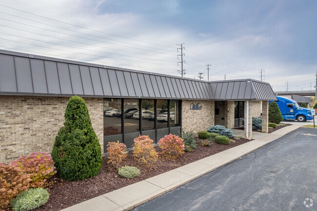
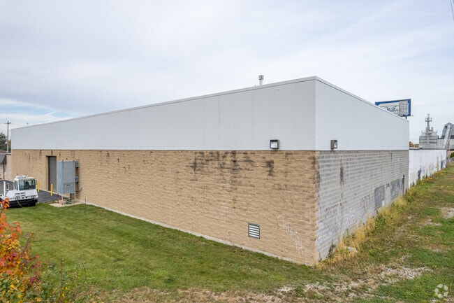
Property Record
2117 Gardner Rd, Broadview, IL 60155
Property Detail
2117 Gardner Rd
Chicago-Naperville-Elgin, IL-IN
(KOMAREKS)(22ND) STREET (SIXTH) ADD SUB OF PT OF SE S E SEC21 LYING W OF W LINE OF RW OF CH & W RY SE SE SEC 21-39-12
15-21-420-020-0000
COOK
Industrialgeneral
Illinois
B and X Area of moderate flood hazard, usually the area between the limits of the 100-year and 500-year floods.
28,29
2023
0.77 AC
2025
West Cook South
818000
Chicago
NEARBY LISTINGS FOR SALE OR LEASE
DEMOGRAPHICS near 2117 Gardner Rd
1 mile
3 mile
5 mile
2025 Total Population
12,793
132,669
412,639
2030 Population
12,823
133,510
413,863
Pop Growth 2025-2030
+ 0.23%
+ 0.63%
+ 0.30%
Average Age
43
42
41
2025 Total Households
4,973
48,460
150,105
HH Growth 2025-2030
(0.02%)
+ 0.44%
+ 0.27%
Median Household Inc
$89,566
$89,465
$94,485
Avg Household Size
2.50
2.60
2.70
2025 Avg HH Vehicles
2.00
2.00
2.00
Median Home Value
$316,840
$298,123
$343,358
Median Year Built
1955
1953
1953
Nearby Places
Map Layers
Map Styles
 Street
 Aerial
Transit
 Traffic
 Biking
Places
Listings with unknown addresses are not visible on the map
- Restaurants
- Banks
- Shops
- Fitness
- Groceries
PUBLIC TRANSPORTATION
COMMUTER RAIL
Brookfield Station (Burlington Northern-Santa Fe Railway Line - Northeast Illinois Regional Commuter Railroad (Metra))
Drive
Walk
Distance
Brookfield Station (Burlington Northern-Santa Fe Railway Line - Northeast Illinois Regional Commuter Railroad (Metra))
9 min
3.4 mi
Congress Park Station (Burlington Northern-Santa Fe Railway Line - Northeast Illinois Regional Commuter Railroad (Metra))
Drive
Walk
Distance
Congress Park Station (Burlington Northern-Santa Fe Railway Line - Northeast Illinois Regional Commuter Railroad (Metra))
8 min
4.0 mi
AIRPORT
Chicago Midway International
Drive
Walk
Distance
Chicago Midway International
18 min
10.4 mi
Chicago O'Hare International
Drive
Walk
Distance
Chicago O'Hare International
23 min
12.2 mi
Freight Ports
Port Milwaukee
Drive
Walk
Distance
Port Milwaukee
107 min
88.5 mi
Nearby Properties
Address
Land Use
TOTAL SIZE
Lot Size
Zoning
Address
Land Use
TOTAL SIZE
Lot Size
Zoning
973,922 SF
53.84 AC
I
Address
Land Use
TOTAL SIZE
Lot Size
Zoning
646,763 SF
17.54 AC
Address
Land Use
TOTAL SIZE
Lot Size
Zoning
221,111 SF
20.62 AC
Address
Land Use
TOTAL SIZE
Lot Size
Zoning
8.53 AC
Address
Land Use
TOTAL SIZE
Lot Size
Zoning
1,156,393 SF
6.55 AC
Address
Land Use
TOTAL SIZE
Lot Size
Zoning
6.11 AC
Address
Land Use
TOTAL SIZE
Lot Size
Zoning
134,361 SF
4.09 AC
Address
Land Use
TOTAL SIZE
Lot Size
Zoning
7.16 AC
Address
Land Use
TOTAL SIZE
Lot Size
Zoning
424,376 SF
3.48 AC
Address
Land Use
TOTAL SIZE
Lot Size
Zoning
8.01 AC
Address
Land Use
TOTAL SIZE
Lot Size
Zoning
389,155 SF
17.69 AC
Address
Land Use
TOTAL SIZE
Lot Size
Zoning
Address
Land Use
TOTAL SIZE
Lot Size
Zoning
137,144 SF
11.77 AC
Address
Land Use
TOTAL SIZE
Lot Size
Zoning
195,355 SF
8.65 AC
C
Address
Land Use
TOTAL SIZE
Lot Size
Zoning
184,970 SF
11.64 AC
Address
Land Use
TOTAL SIZE
Lot Size
Zoning
108,276 SF
3.80 AC
Address
Land Use
TOTAL SIZE
Lot Size
Zoning
220,137 SF
13.24 AC
Address
Land Use
TOTAL SIZE
Lot Size
Zoning
225,000 SF
5.82 AC
Address
Land Use
TOTAL SIZE
Lot Size
Zoning
1.65 AC
Address
Land Use
TOTAL SIZE
Lot Size
Zoning
101,146 SF
2.24 AC
Address
Land Use
TOTAL SIZE
Lot Size
Zoning
193,511 SF
17.89 AC
Address
Land Use
TOTAL SIZE
Lot Size
Zoning
53,800 SF
0.88 AC
Address
Land Use
TOTAL SIZE
Lot Size
Zoning
103,050 SF
7.49 AC
Address
Land Use
TOTAL SIZE
Lot Size
Zoning
42,720 SF
0.98 AC
Address
Land Use
TOTAL SIZE
Lot Size
Zoning
Address
Land Use
TOTAL SIZE
Lot Size
Zoning
274,375 SF
9.35 AC
Address
Land Use
TOTAL SIZE
Lot Size
Zoning
7.35 AC
Address
Land Use
TOTAL SIZE
Lot Size
Zoning
170,722 SF
5.24 AC
Address
Land Use
TOTAL SIZE
Lot Size
Zoning
7.17 AC
Address
Land Use
TOTAL SIZE
Lot Size
Zoning
296,351 SF
13.76 AC
The World's #1 Commercial Real Estate Marketplace
Connect with us
© 2026 CoStar Group
The information above has been obtained from sources believed reliable. While we do not doubt its accuracy we have not verified it and make no guarantee, warranty or representation about it. It is your responsibility to independently confirm its accuracy and completeness. Any projections, opinions, assumptions, or estimates used are for example only and do not represent the current or future performance of the property. The value of this transaction to you depends on tax and other factors which should be evaluated by your tax, financial, and legal advisors. You and your advisors should conduct a careful, independent investigation of the property to determine to your satisfaction the suitability of the property for your needs.