Property Record
2117 N Orange Olive Rd, Orange, CA 92865
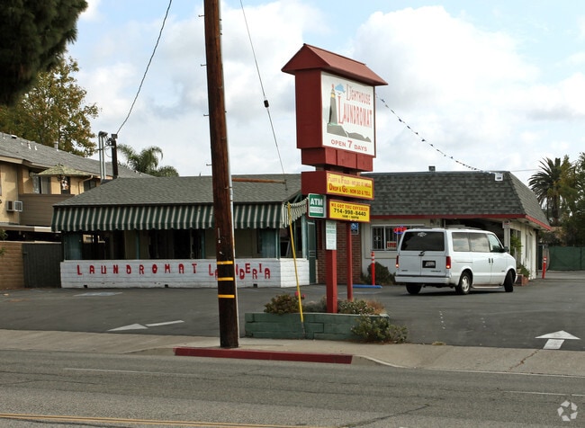

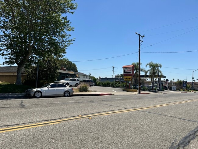

Property Detail
2117 N Orange Olive Rd
Anaheim-Santa Ana-Irvine, CA
A TR FLETCHER TR BLK LOT 23 FLETCHER TR LOT 23 POR OF LOT AS PER DD -7195/809
374-411-19
Orange
Commercialnec
California
B and X Area of moderate flood hazard, usually the area between the limits of the 100-year and 500-year floods.
23
2024
0.52 AC
2025
East Orange
076208
Orange County (California)
2,109 SF
NEARBY LISTINGS FOR SALE OR LEASE
DEMOGRAPHICS near 2117 N Orange Olive Rd
1 mile
3 mile
5 mile
2025 Total Population
16,922
156,899
510,794
2030 Population
16,868
156,869
509,725
Pop Growth 2025-2030
(0.32%)
(0.02%)
(0.21%)
Average Age
39
38
39
2025 Total Households
5,416
49,060
159,351
HH Growth 2025-2030
(0.46%)
(0.12%)
(0.31%)
Median Household Inc
$126,484
$106,976
$102,003
Avg Household Size
3.00
3.00
3.00
2025 Avg HH Vehicles
2.00
2.00
2.00
Median Home Value
$775,680
$838,195
$848,477
Median Year Built
1969
1970
1971
Nearby Places
Map Layers
Map Styles
 Street
 Aerial
Layers
 Traffic
 Biking
Places
Listings with unknown addresses are not visible on the map
- Restaurants
- Banks
- Shops
- Fitness
- Groceries
PUBLIC TRANSPORTATION
COMMUTER RAIL
Drive
Walk
Distance
6 min
2.7 mi
Orange (Inland Empire-Orange County Line - Southern California Regional Rail Authority (Metrolink), Orange County Line - Southern California Regional Rail Authority (Metrolink))
Drive
Walk
Distance
Orange (Inland Empire-Orange County Line - Southern California Regional Rail Authority (Metrolink), Orange County Line - Southern California Regional Rail Authority (Metrolink))
7 min
2.8 mi
AIRPORT
John Wayne/Orange County
Drive
Walk
Distance
John Wayne/Orange County
17 min
12.5 mi
Long Beach (Daugherty Field)
Drive
Walk
Distance
Long Beach (Daugherty Field)
30 min
23.7 mi
Ontario International
Drive
Walk
Distance
Ontario International
41 min
32.2 mi
Freight Ports
Port of Long Beach
Drive
Walk
Distance
Port of Long Beach
36 min
23.3 mi
SALE & LEASE HISTORY
LISTING DATE
SALE/LEASE

Jun 24, 2025
For Sale
Nearby Properties
Address
Land Use
TOTAL SIZE
Lot Size
Zoning
Address
Land Use
TOTAL SIZE
Lot Size
Zoning
26.08 AC
Address
Land Use
TOTAL SIZE
Lot Size
Zoning
5.07 AC
Address
Land Use
TOTAL SIZE
Lot Size
Zoning
4.89 AC
Address
Land Use
TOTAL SIZE
Lot Size
Zoning
4.13 AC
Address
Land Use
TOTAL SIZE
Lot Size
Zoning
12.20 AC
Address
Land Use
TOTAL SIZE
Lot Size
Zoning
6.60 AC
Address
Land Use
TOTAL SIZE
Lot Size
Zoning
Address
Land Use
TOTAL SIZE
Lot Size
Zoning
Address
Land Use
TOTAL SIZE
Lot Size
Zoning
Address
Land Use
TOTAL SIZE
Lot Size
Zoning
3.47 AC
Address
Land Use
TOTAL SIZE
Lot Size
Zoning
Address
Land Use
TOTAL SIZE
Lot Size
Zoning
Address
Land Use
TOTAL SIZE
Lot Size
Zoning
126,979 SF
6.42 AC
Address
Land Use
TOTAL SIZE
Lot Size
Zoning
50.72 AC
Address
Land Use
TOTAL SIZE
Lot Size
Zoning
4.25 AC
Address
Land Use
TOTAL SIZE
Lot Size
Zoning
Address
Land Use
TOTAL SIZE
Lot Size
Zoning
3.37 AC
Address
Land Use
TOTAL SIZE
Lot Size
Zoning
Address
Land Use
TOTAL SIZE
Lot Size
Zoning
Address
Land Use
TOTAL SIZE
Lot Size
Zoning
Address
Land Use
TOTAL SIZE
Lot Size
Zoning
3.20 AC
Address
Land Use
TOTAL SIZE
Lot Size
Zoning
2.25 AC
Address
Land Use
TOTAL SIZE
Lot Size
Zoning
Address
Land Use
TOTAL SIZE
Lot Size
Zoning
3.35 AC
Address
Land Use
TOTAL SIZE
Lot Size
Zoning
5.13 AC
Address
Land Use
TOTAL SIZE
Lot Size
Zoning
1,404 SF
10.63 AC
Address
Land Use
TOTAL SIZE
Lot Size
Zoning
86,707 SF
9.07 AC
Address
Land Use
TOTAL SIZE
Lot Size
Zoning
12.72 AC
Address
Land Use
TOTAL SIZE
Lot Size
Zoning
13.27 AC
Address
Land Use
TOTAL SIZE
Lot Size
Zoning
4,000 SF
4.11 AC
The World's #1 Commercial Real Estate Marketplace
Connect with us
© 2026 CoStar Group
The information above has been obtained from sources believed reliable. While we do not doubt its accuracy we have not verified it and make no guarantee, warranty or representation about it. It is your responsibility to independently confirm its accuracy and completeness. Any projections, opinions, assumptions, or estimates used are for example only and do not represent the current or future performance of the property. The value of this transaction to you depends on tax and other factors which should be evaluated by your tax, financial, and legal advisors. You and your advisors should conduct a careful, independent investigation of the property to determine to your satisfaction the suitability of the property for your needs.