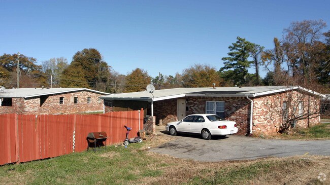
Property Record
2118 Chamblee Tucker Rd, Atlanta, GA 30341
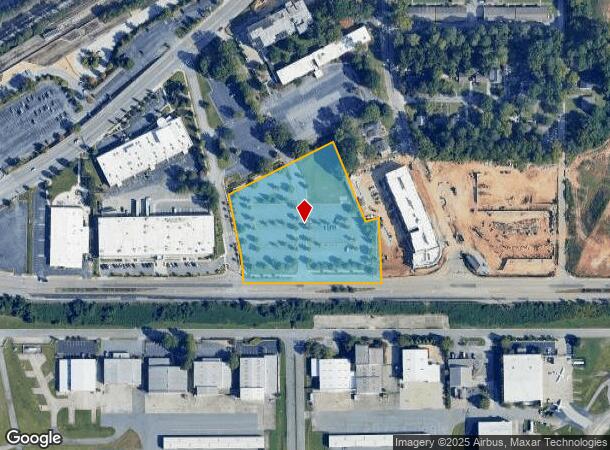
NEARBY LISTINGS FOR SALE OR LEASE
Property Detail
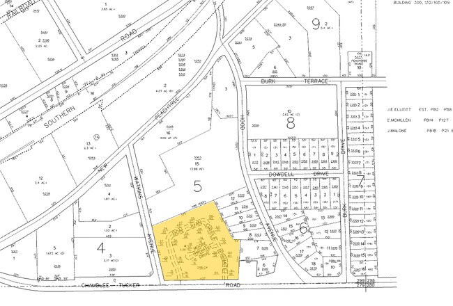
2118 Chamblee Tucker Rd
18-299-05-004
DeKalb
Commercialacreage
Georgia
X
4
13089C0018K
3.39 AC
2025
Chamblee
2025
Atlanta
021204
Atlanta-Sandy Springs-Roswell, GA
35,200 SF
DEMOGRAPHICS near 2118 Chamblee Tucker Rd
1 Mile
3 Mile
5 Mile
2024 Total Population
11,044
107,427
302,887
2029 Population
11,220
107,211
304,912
Pop Growth 2024-2029
+ 1.59%
(0.20%)
+ 0.67%
Average Age
34
36
38
2024 Total Households
4,624
44,493
131,569
HH Growth 2024-2029
+ 2.44%
(0.17%)
+ 0.81%
Median Household Inc
$72,477
$87,510
$92,584
Avg Household Size
2.30
2.30
2.20
2024 Avg HH Vehicles
1.00
2.00
2.00
Median Home Value
$378,618
$476,713
$475,043
Median Year Built
1996
1984
1987
Nearby Places
Map Layers
Map Styles
 Street
 Aerial
- Restaurants
- Banks
- Shops
- Fitness
- Groceries
PUBLIC TRANSPORTATION
TRANSIT/SUBWAY
Chamblee (Gold Line - Metropolitan Atlanta Rapid Transit Authority (MARTA))
DRIVE
WALK
Distance
Chamblee (Gold Line - Metropolitan Atlanta Rapid Transit Authority (MARTA))
1 min
13 min
0.4 mi
COMMUTER RAIL
DRIVE
WALK
Distance
15 min
8.9 mi
AIRPORT
Hartsfield - Jackson Atlanta International
DRIVE
WALK
Distance
Hartsfield - Jackson Atlanta International
34 min
22.1 mi
Nearby Properties
Address
Land Use
TOTAL SIZE
Lot Size
Zoning
Address
Land Use
TOTAL SIZE
Lot Size
Zoning
705,518 SF
39.09 AC
M
Address
Land Use
TOTAL SIZE
Lot Size
Zoning
12,600 SF
508.30 AC
M
Address
Land Use
TOTAL SIZE
Lot Size
Zoning
299,993 SF
4.72 AC
I1
Address
Land Use
TOTAL SIZE
Lot Size
Zoning
213,408 SF
6.35 AC
I1
Address
Land Use
TOTAL SIZE
Lot Size
Zoning
432,424 SF
3.87 AC
MC
Address
Land Use
TOTAL SIZE
Lot Size
Zoning
276,504 SF
3.40 AC
C1
Address
Land Use
TOTAL SIZE
Lot Size
Zoning
191,941 SF
3.02 AC
OCR
Address
Land Use
TOTAL SIZE
Lot Size
Zoning
140,183 SF
4.20 AC
OI
Address
Land Use
TOTAL SIZE
Lot Size
Zoning
103,056 SF
8.66 AC
OI
Address
Land Use
TOTAL SIZE
Lot Size
Zoning
157,133 SF
5.03 AC
M
Address
Land Use
TOTAL SIZE
Lot Size
Zoning
166,377 SF
7.56 AC
X
Address
Land Use
TOTAL SIZE
Lot Size
Zoning
283,784 SF
30.88 AC
RM100
Address
Land Use
TOTAL SIZE
Lot Size
Zoning
204,376 SF
14.23 AC
X
Address
Land Use
TOTAL SIZE
Lot Size
Zoning
366,276 SF
11.54 AC
RM-HD
Address
Land Use
TOTAL SIZE
Lot Size
Zoning
457,330 SF
20.49 AC
RM-HD
Address
Land Use
TOTAL SIZE
Lot Size
Zoning
345,441 SF
25.78 AC
C1
Address
Land Use
TOTAL SIZE
Lot Size
Zoning
144,380 SF
3.84 AC
X
Address
Land Use
TOTAL SIZE
Lot Size
Zoning
395,191 SF
2.78 AC
OIC
Address
Land Use
TOTAL SIZE
Lot Size
Zoning
267,983 SF
13 AC
X
Address
Land Use
TOTAL SIZE
Lot Size
Zoning
214,915 SF
3.55 AC
Address
Land Use
TOTAL SIZE
Lot Size
Zoning
406,188 SF
4.43 AC
X
Address
Land Use
TOTAL SIZE
Lot Size
Zoning
325,232 SF
23.10 AC
X
Address
Land Use
TOTAL SIZE
Lot Size
Zoning
108,006 SF
11.23 AC
X
Address
Land Use
TOTAL SIZE
Lot Size
Zoning
169,476 SF
3 AC
MC
Address
Land Use
TOTAL SIZE
Lot Size
Zoning
536,151 SF
30.35 AC
X
Address
Land Use
TOTAL SIZE
Lot Size
Zoning
343,471 SF
8.90 AC
X
Address
Land Use
TOTAL SIZE
Lot Size
Zoning
287,657 SF
13.09 AC
X
Address
Land Use
TOTAL SIZE
Lot Size
Zoning
199,734 SF
8.30 AC
X
Address
Land Use
TOTAL SIZE
Lot Size
Zoning
185,050 SF
3.34 AC
OCR
Address
Land Use
TOTAL SIZE
Lot Size
Zoning
189,724 SF
3.50 AC
PC-2
The World's #1 Commercial Real Estate Marketplace
Connect with us
© 2026 CoStar Group
The information above has been obtained from sources believed reliable. While we do not doubt its accuracy we have not verified it and make no guarantee, warranty or representation about it. It is your responsibility to independently confirm its accuracy and completeness. Any projections, opinions, assumptions, or estimates used are for example only and do not represent the current or future performance of the property. The value of this transaction to you depends on tax and other factors which should be evaluated by your tax, financial, and legal advisors. You and your advisors should conduct a careful, independent investigation of the property to determine to your satisfaction the suitability of the property for your needs.