Property Record
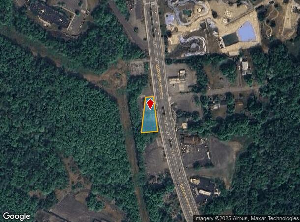
2119 State Route 9, Lake George, NY 12845
NEARBY LISTINGS FOR SALE OR LEASE
-
-
View all Lake George listings for sale on LoopNet.com
Property Detail
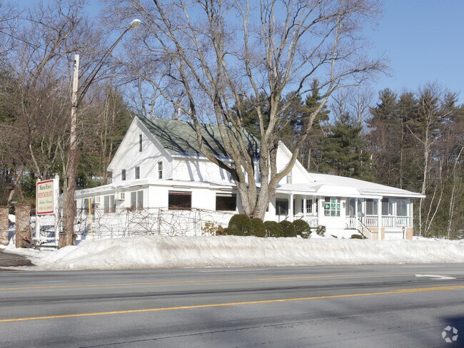
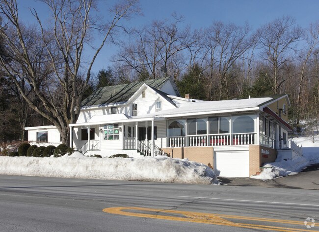
2119 State Route 9
Glens Falls, NY
RESTAURANT/APT 15.-1-10
522289-264-003-0002-006-000-0000
Warren
Restaurantbuilding
New York
2025
6.000
2024
0.34 AC
072001
Warren County
4,794 SF
Albany/Schenectady/Troy
DEMOGRAPHICS near 2119 State Route 9
1 Mile
3 Mile
5 Mile
2024 Total Population
982
3,681
12,021
2029 Population
1,000
3,735
12,144
Pop Growth 2024-2029
+ 1.83%
+ 1.47%
+ 1.02%
Average Age
47
47
47
2024 Total Households
454
1,673
5,253
HH Growth 2024-2029
+ 1.54%
+ 1.32%
+ 0.99%
Median Household Inc
$80,966
$85,572
$86,729
Avg Household Size
2.20
2.20
2.20
2024 Avg HH Vehicles
2.00
2.00
2.00
Median Home Value
$321,296
$339,130
$310,194
Median Year Built
1974
1974
1978
Nearby Places
- Restaurants
- Banks
- Shops
- Fitness
- Groceries
Nearby Properties
Address
Land Use
TOTAL SIZE
Lot Size
Zoning
Address
Land Use
TOTAL SIZE
Lot Size
Zoning
3,060 SF
129.15 AC
RC
Address
Land Use
TOTAL SIZE
Lot Size
Zoning
8,400 SF
9.42 AC
07 - MIXED
Address
Land Use
TOTAL SIZE
Lot Size
Zoning
102,671 SF
2.16 AC
05 - COMME
Address
Land Use
TOTAL SIZE
Lot Size
Zoning
34,362 SF
3.01 AC
Address
Land Use
TOTAL SIZE
Lot Size
Zoning
80,591 SF
9.76 AC
05 - COMME
Address
Land Use
TOTAL SIZE
Lot Size
Zoning
91,204 SF
4.73 AC
07 - MIXED
Address
Land Use
TOTAL SIZE
Lot Size
Zoning
86,968 SF
7.05 AC
CI
Address
Land Use
TOTAL SIZE
Lot Size
Zoning
15,000 SF
10.58 AC
07 - MIXED
Address
Land Use
TOTAL SIZE
Lot Size
Zoning
4,363 SF
3.64 AC
05 - COMME
Address
Land Use
TOTAL SIZE
Lot Size
Zoning
56,924 SF
3.45 AC
07 - MIXED
Address
Land Use
TOTAL SIZE
Lot Size
Zoning
59,690 SF
6.27 AC
05 - COMME
Address
Land Use
TOTAL SIZE
Lot Size
Zoning
69,646 SF
4.96 AC
CI
Address
Land Use
TOTAL SIZE
Lot Size
Zoning
696 SF
55.11 AC
MDR
Address
Land Use
TOTAL SIZE
Lot Size
Zoning
3,599 SF
3.69 AC
05
Address
Land Use
TOTAL SIZE
Lot Size
Zoning
49,308 SF
3.33 AC
CI
Address
Land Use
TOTAL SIZE
Lot Size
Zoning
6,915 SF
62.15 AC
07 - MIXED
Address
Land Use
TOTAL SIZE
Lot Size
Zoning
808 SF
19.55 AC
MDR
Address
Land Use
TOTAL SIZE
Lot Size
Zoning
1,934 SF
6.92 AC
05 - COMME
Address
Land Use
TOTAL SIZE
Lot Size
Zoning
2,250 SF
36.02 AC
07 - MIXED
Address
Land Use
TOTAL SIZE
Lot Size
Zoning
2,978 SF
4.15 AC
05 - COMME
Address
Land Use
TOTAL SIZE
Lot Size
Zoning
572 SF
11.37 AC
05 - COMME
Address
Land Use
TOTAL SIZE
Lot Size
Zoning
2,452 SF
18.89 AC
05 - COMME
Address
Land Use
TOTAL SIZE
Lot Size
Zoning
4,924 SF
9 AC
02 - SINGL
Address
Land Use
TOTAL SIZE
Lot Size
Zoning
46,800 SF
4.11 AC
CI
Address
Land Use
TOTAL SIZE
Lot Size
Zoning
1,664 SF
29.78 AC
07 - MIXED
Address
Land Use
TOTAL SIZE
Lot Size
Zoning
43,120 SF
4.51 AC
CI
Address
Land Use
TOTAL SIZE
Lot Size
Zoning
25,752 SF
6.83 AC
05 - COMME
Address
Land Use
TOTAL SIZE
Lot Size
Zoning
49,621 SF
4.71 AC
05 - COMME
Address
Land Use
TOTAL SIZE
Lot Size
Zoning
7,547 SF
1.40 AC
05 - COMME
Address
Land Use
TOTAL SIZE
Lot Size
Zoning
742 SF
1.91 AC
05 - COMME
The World's #1 Commercial Real Estate Marketplace
Connect with us
© 2025 CoStar Group
The information above has been obtained from sources believed reliable. While we do not doubt its accuracy we have not verified it and make no guarantee, warranty or representation about it. It is your responsibility to independently confirm its accuracy and completeness. Any projections, opinions, assumptions, or estimates used are for example only and do not represent the current or future performance of the property. The value of this transaction to you depends on tax and other factors which should be evaluated by your tax, financial, and legal advisors. You and your advisors should conduct a careful, independent investigation of the property to determine to your satisfaction the suitability of the property for your needs.