Property Record
212 E Conde St, Janesville, WI 53546


NEARBY LISTINGS FOR SALE OR LEASE
Property Detail
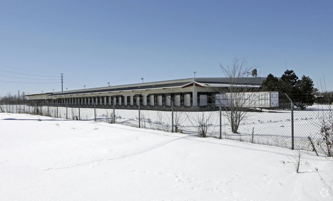
212 E Conde St
030-7100005
PT SW 1/4 NW 1/4 SEC 7-2-13COMM SW 1/4 COR SD 1/4 SEC.TH. S.89D18'50 E.1136.61'TO POB; TH. N. 0D10'20 E.1300.86';TH.N.89D18'50 W.480.41';TH. DUE S. 1139.51TH.S.59D26'20 E.323.59' TOS.L. SD 1/4 SEC.;TH. S.89D18'50 E.197.83' TO POBEX. STREET JC56030710
Commercialnec
Rock
X
Wisconsin
55105C0194E
12.16 AC
2024
Rock County
2024
Milwaukee/Madison
001400
Janesville-Beloit, WI
52,000 SF
DEMOGRAPHICS near 212 E Conde St
1 Mile
3 Mile
5 Mile
2024 Total Population
2,461
30,476
61,824
2029 Population
2,483
30,740
62,345
Pop Growth 2024-2029
+ 0.89%
+ 0.87%
+ 0.84%
Average Age
39
40
41
2024 Total Households
1,003
12,758
26,123
HH Growth 2024-2029
+ 0.80%
+ 0.93%
+ 0.88%
Median Household Inc
$48,826
$59,887
$62,366
Avg Household Size
2.40
2.30
2.30
2024 Avg HH Vehicles
2.00
2.00
2.00
Median Home Value
$149,538
$159,494
$171,651
Median Year Built
1966
1962
1970
Nearby Places
Map Layers
Map Styles
 Street
 Aerial
- Restaurants
- Banks
- Shops
- Fitness
- Groceries
PUBLIC TRANSPORTATION
AIRPORT
Chicago/Rockford International
DRIVE
WALK
Distance
Chicago/Rockford International
55 min
42.2 mi
Dane County Regional/Truax Field
DRIVE
WALK
Distance
Dane County Regional/Truax Field
60 min
46.9 mi
Nearby Properties
Address
Land Use
TOTAL SIZE
Lot Size
Zoning
Address
Land Use
TOTAL SIZE
Lot Size
Zoning
2,580 SF
122.77 AC
M1
Address
Land Use
TOTAL SIZE
Lot Size
Zoning
56.41 AC
M2
Address
Land Use
TOTAL SIZE
Lot Size
Zoning
700,000 SF
50.74 AC
M1
Address
Land Use
TOTAL SIZE
Lot Size
Zoning
32,518 SF
26.74 AC
B4
Address
Land Use
TOTAL SIZE
Lot Size
Zoning
31,064 SF
11.57 AC
R3
Address
Land Use
TOTAL SIZE
Lot Size
Zoning
12,620 SF
8.05 AC
R3
Address
Land Use
TOTAL SIZE
Lot Size
Zoning
48,110 SF
13.04 AC
R3
Address
Land Use
TOTAL SIZE
Lot Size
Zoning
16,959 SF
47.11 AC
M1
Address
Land Use
TOTAL SIZE
Lot Size
Zoning
18,480 SF
14.50 AC
O1
Address
Land Use
TOTAL SIZE
Lot Size
Zoning
70,000 SF
63.05 AC
M1
Address
Land Use
TOTAL SIZE
Lot Size
Zoning
17.51 AC
M1
Address
Land Use
TOTAL SIZE
Lot Size
Zoning
24.75 AC
Address
Land Use
TOTAL SIZE
Lot Size
Zoning
250,000 SF
22.56 AC
M1
Address
Land Use
TOTAL SIZE
Lot Size
Zoning
44,638 SF
91.27 AC
M1
Address
Land Use
TOTAL SIZE
Lot Size
Zoning
Address
Land Use
TOTAL SIZE
Lot Size
Zoning
161,629 SF
16.91 AC
M1
Address
Land Use
TOTAL SIZE
Lot Size
Zoning
178,710 SF
9.92 AC
M1
Address
Land Use
TOTAL SIZE
Lot Size
Zoning
178,710 SF
14.73 AC
M1
Address
Land Use
TOTAL SIZE
Lot Size
Zoning
12.42 AC
M1
Address
Land Use
TOTAL SIZE
Lot Size
Zoning
200,500 SF
22.73 AC
M1
Address
Land Use
TOTAL SIZE
Lot Size
Zoning
110,000 SF
14.14 AC
M1
Address
Land Use
TOTAL SIZE
Lot Size
Zoning
101,195 SF
1.40 AC
B6
Address
Land Use
TOTAL SIZE
Lot Size
Zoning
39,485 SF
10.70 AC
M1
Address
Land Use
TOTAL SIZE
Lot Size
Zoning
20.84 AC
M2
Address
Land Use
TOTAL SIZE
Lot Size
Zoning
2,480 SF
16.27 AC
M2
Address
Land Use
TOTAL SIZE
Lot Size
Zoning
49,524 SF
1.57 AC
B6
Address
Land Use
TOTAL SIZE
Lot Size
Zoning
110,100 SF
15.75 AC
M1
Address
Land Use
TOTAL SIZE
Lot Size
Zoning
9,246 SF
0.59 AC
B5
Address
Land Use
TOTAL SIZE
Lot Size
Zoning
7.25 AC
M1
Address
Land Use
TOTAL SIZE
Lot Size
Zoning
12.44 AC
M1
The World's #1 Commercial Real Estate Marketplace
Connect with us
© 2025 CoStar Group
The information above has been obtained from sources believed reliable. While we do not doubt its accuracy we have not verified it and make no guarantee, warranty or representation about it. It is your responsibility to independently confirm its accuracy and completeness. Any projections, opinions, assumptions, or estimates used are for example only and do not represent the current or future performance of the property. The value of this transaction to you depends on tax and other factors which should be evaluated by your tax, financial, and legal advisors. You and your advisors should conduct a careful, independent investigation of the property to determine to your satisfaction the suitability of the property for your needs.