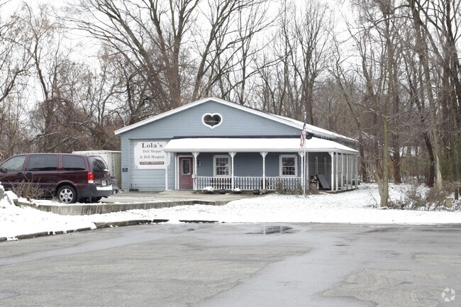
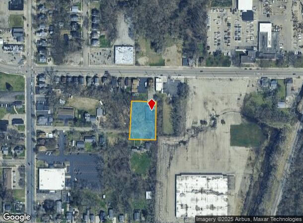
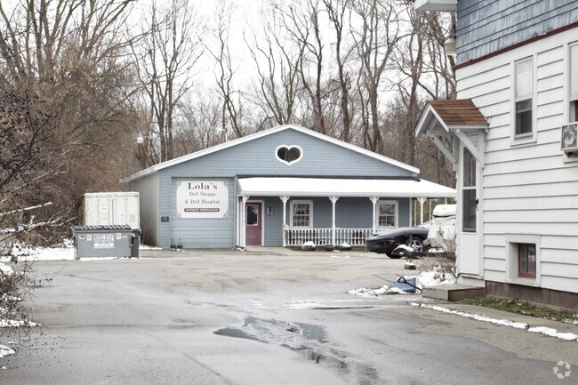
Property Record
212 E Stockbridge Ave, Kalamazoo, MI 49001
NEARBY LISTINGS FOR SALE OR LEASE
Property Detail
212 E Stockbridge Ave
06-22-384-001
7492 COM 697.53FT E OF E LI OF BURDICK ST & 132FT S OF S LI OF STOCKBRIDGE AVE S 204 1/2FT W 136.78FT N 204 1/2FT E 136.78FT
Commercialnec
Kalamazoo
AE
Michigan
26077C0189E
0.65 AC
2024
Southern Kalamazoo County
2025
West Michigan
001100
Kalamazoo-Portage, MI
3,200 SF
DEMOGRAPHICS near 212 E Stockbridge Ave
1 Mile
3 Mile
5 Mile
2024 Total Population
15,962
79,266
153,775
2029 Population
16,101
79,436
153,769
Pop Growth 2024-2029
+ 0.87%
+ 0.21%
0.00%
Average Age
35
34
36
2024 Total Households
6,879
31,793
64,851
HH Growth 2024-2029
+ 0.97%
+ 0.23%
(0.01%)
Median Household Inc
$43,434
$45,937
$50,427
Avg Household Size
2.20
2.20
2.20
2024 Avg HH Vehicles
2.00
2.00
2.00
Median Home Value
$131,435
$144,866
$165,734
Median Year Built
1947
1955
1969
Nearby Places
Map Layers
Map Styles
 Street
 Aerial
- Restaurants
- Banks
- Shops
- Fitness
- Groceries
PUBLIC TRANSPORTATION
COMMUTER RAIL
DRIVE
WALK
Distance
5 min
1.7 mi
AIRPORT
Kalamazoo/Battle Creek International
DRIVE
WALK
Distance
Kalamazoo/Battle Creek International
15 min
4.6 mi
Nearby Properties
Address
Land Use
TOTAL SIZE
Lot Size
Zoning
Address
Land Use
TOTAL SIZE
Lot Size
Zoning
632,218 SF
10.84 AC
M-1
Address
Land Use
TOTAL SIZE
Lot Size
Zoning
374,906 SF
16.31 AC
RM-36
Address
Land Use
TOTAL SIZE
Lot Size
Zoning
329,276 SF
43.86 AC
RM-1
Address
Land Use
TOTAL SIZE
Lot Size
Zoning
429,500 SF
2 AC
CCBD
Address
Land Use
TOTAL SIZE
Lot Size
Zoning
877,422 SF
38.18 AC
M-2
Address
Land Use
TOTAL SIZE
Lot Size
Zoning
105,046 SF
19.30 AC
RM-15
Address
Land Use
TOTAL SIZE
Lot Size
Zoning
201,940 SF
9.30 AC
RM-36
Address
Land Use
TOTAL SIZE
Lot Size
Zoning
255,452 SF
20.57 AC
Address
Land Use
TOTAL SIZE
Lot Size
Zoning
110,686 SF
9.45 AC
CCBD
Address
Land Use
TOTAL SIZE
Lot Size
Zoning
5.04 AC
CPD
Address
Land Use
TOTAL SIZE
Lot Size
Zoning
134,876 SF
16.45 AC
RM-15
Address
Land Use
TOTAL SIZE
Lot Size
Zoning
275,595 SF
0.65 AC
CCBD
Address
Land Use
TOTAL SIZE
Lot Size
Zoning
35.87 AC
I-1
Address
Land Use
TOTAL SIZE
Lot Size
Zoning
Address
Land Use
TOTAL SIZE
Lot Size
Zoning
50,826 SF
0.79 AC
CCBD
Address
Land Use
TOTAL SIZE
Lot Size
Zoning
498,424 SF
41.72 AC
M-2
Address
Land Use
TOTAL SIZE
Lot Size
Zoning
228,368 SF
9.60 AC
PUD
Address
Land Use
TOTAL SIZE
Lot Size
Zoning
606,439 SF
34.61 AC
M-2
Address
Land Use
TOTAL SIZE
Lot Size
Zoning
274,412 SF
12.10 AC
RM-1
Address
Land Use
TOTAL SIZE
Lot Size
Zoning
2.31 AC
CPD
Address
Land Use
TOTAL SIZE
Lot Size
Zoning
80,064 SF
6.13 AC
M-1
Address
Land Use
TOTAL SIZE
Lot Size
Zoning
216,427 SF
18.83 AC
B-2
Address
Land Use
TOTAL SIZE
Lot Size
Zoning
4.65 AC
CPD
Address
Land Use
TOTAL SIZE
Lot Size
Zoning
133,976 SF
15.04 AC
CPD
Address
Land Use
TOTAL SIZE
Lot Size
Zoning
393,522 SF
33.31 AC
M-2
Address
Land Use
TOTAL SIZE
Lot Size
Zoning
99,092 SF
1.45 AC
CCBD
Address
Land Use
TOTAL SIZE
Lot Size
Zoning
153,637 SF
12.28 AC
PUD
Address
Land Use
TOTAL SIZE
Lot Size
Zoning
98,401 SF
2.94 AC
RM-15
Address
Land Use
TOTAL SIZE
Lot Size
Zoning
110,656 SF
7.54 AC
RM-15
Address
Land Use
TOTAL SIZE
Lot Size
Zoning
171,772 SF
0.68 AC
CCBD
The World's #1 Commercial Real Estate Marketplace
Connect with us
© 2025 CoStar Group
The information above has been obtained from sources believed reliable. While we do not doubt its accuracy we have not verified it and make no guarantee, warranty or representation about it. It is your responsibility to independently confirm its accuracy and completeness. Any projections, opinions, assumptions, or estimates used are for example only and do not represent the current or future performance of the property. The value of this transaction to you depends on tax and other factors which should be evaluated by your tax, financial, and legal advisors. You and your advisors should conduct a careful, independent investigation of the property to determine to your satisfaction the suitability of the property for your needs.