Property Record
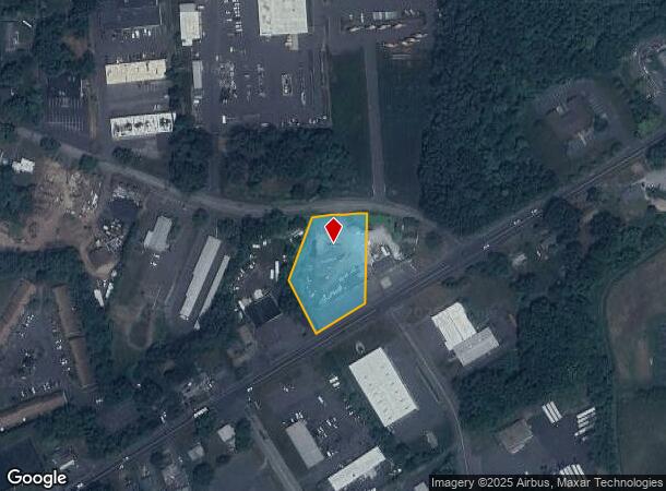
212 Hartford Tpke, Tolland, CT 06084


NEARBY LISTINGS FOR SALE OR LEASE
Property Detail
212 Hartford Tpke
Hartford-West Hartford-East Hartford, CT
Tolland
TOLL-000019-A000000-000010
Connecticut
Commercialacreage
10-0
2025
1.10 AC
2025
Tolland County
533103
Hartford
DEMOGRAPHICS near 212 Hartford Tpke
1 Mile
3 Mile
5 Mile
2024 Total Population
2,600
26,487
58,975
2029 Population
2,591
26,381
58,720
Pop Growth 2024-2029
(0.35%)
(0.40%)
(0.43%)
Average Age
42
41
42
2024 Total Households
1,188
11,424
25,026
HH Growth 2024-2029
(0.42%)
(0.44%)
(0.44%)
Median Household Inc
$63,910
$63,719
$77,936
Avg Household Size
2.20
2.30
2.30
2024 Avg HH Vehicles
2.00
2.00
2.00
Median Home Value
$243,781
$256,940
$276,274
Median Year Built
1960
1965
1973
Nearby Places
Map Layers
Map Styles
 Street
 Aerial
- Restaurants
- Banks
- Shops
- Fitness
- Groceries
PUBLIC TRANSPORTATION
AIRPORT
Bradley International
DRIVE
WALK
Distance
Bradley International
45 min
24.5 mi
Freight Ports
Port of New Haven
DRIVE
WALK
Distance
Port of New Haven
68 min
53.1 mi
SALE & LEASE HISTORY
LISTING DATE
SALE/LEASE

Sep 25, 2016
For Lease
Sep 24, 2016
For Sale
May 04, 2017
For Sale
Jul 28, 2017
For Sale
Nearby Properties
Address
Land Use
TOTAL SIZE
Lot Size
Zoning
Address
Land Use
TOTAL SIZE
Lot Size
Zoning
71.60 AC
MF
Address
Land Use
TOTAL SIZE
Lot Size
Zoning
46.42 AC
VCZ
Address
Land Use
TOTAL SIZE
Lot Size
Zoning
Address
Land Use
TOTAL SIZE
Lot Size
Zoning
188,775 SF
74.13 AC
R-27
Address
Land Use
TOTAL SIZE
Lot Size
Zoning
7.95 AC
DBR
Address
Land Use
TOTAL SIZE
Lot Size
Zoning
29.97 AC
PC
Address
Land Use
TOTAL SIZE
Lot Size
Zoning
11 AC
R-27
Address
Land Use
TOTAL SIZE
Lot Size
Zoning
54.80 AC
PRD
Address
Land Use
TOTAL SIZE
Lot Size
Zoning
15.89 AC
PRD
Address
Land Use
TOTAL SIZE
Lot Size
Zoning
193 AC
R-40
Address
Land Use
TOTAL SIZE
Lot Size
Zoning
85.13 AC
RW
Address
Land Use
TOTAL SIZE
Lot Size
Zoning
80,487 SF
11.41 AC
DMF
Address
Land Use
TOTAL SIZE
Lot Size
Zoning
18.49 AC
PRD
Address
Land Use
TOTAL SIZE
Lot Size
Zoning
15.84 AC
R
Address
Land Use
TOTAL SIZE
Lot Size
Zoning
13.44 AC
RC
Address
Land Use
TOTAL SIZE
Lot Size
Zoning
8.22 AC
PRD
Address
Land Use
TOTAL SIZE
Lot Size
Zoning
10.30 AC
PRD
Address
Land Use
TOTAL SIZE
Lot Size
Zoning
73,280 SF
0.52 AC
DBR
Address
Land Use
TOTAL SIZE
Lot Size
Zoning
229,674 SF
14.30 AC
CIZ
Address
Land Use
TOTAL SIZE
Lot Size
Zoning
77,212 SF
19.60 AC
R
Address
Land Use
TOTAL SIZE
Lot Size
Zoning
10.35 AC
PRD
Address
Land Use
TOTAL SIZE
Lot Size
Zoning
12.23 AC
C
Address
Land Use
TOTAL SIZE
Lot Size
Zoning
71,343 SF
26.01 AC
TBP
Address
Land Use
TOTAL SIZE
Lot Size
Zoning
65,721 SF
6.39 AC
RDD
Address
Land Use
TOTAL SIZE
Lot Size
Zoning
12.05 AC
COMMER
Address
Land Use
TOTAL SIZE
Lot Size
Zoning
87,198 SF
6.44 AC
PND
Address
Land Use
TOTAL SIZE
Lot Size
Zoning
6.30 AC
PRD
Address
Land Use
TOTAL SIZE
Lot Size
Zoning
47,300 SF
24.48 AC
CIZ
Address
Land Use
TOTAL SIZE
Lot Size
Zoning
10,196 SF
5.51 AC
R-15
Address
Land Use
TOTAL SIZE
Lot Size
Zoning
14.13 AC
PRD
The World's #1 Commercial Real Estate Marketplace
Connect with us
© 2025 CoStar Group
The information above has been obtained from sources believed reliable. While we do not doubt its accuracy we have not verified it and make no guarantee, warranty or representation about it. It is your responsibility to independently confirm its accuracy and completeness. Any projections, opinions, assumptions, or estimates used are for example only and do not represent the current or future performance of the property. The value of this transaction to you depends on tax and other factors which should be evaluated by your tax, financial, and legal advisors. You and your advisors should conduct a careful, independent investigation of the property to determine to your satisfaction the suitability of the property for your needs.