Property Record
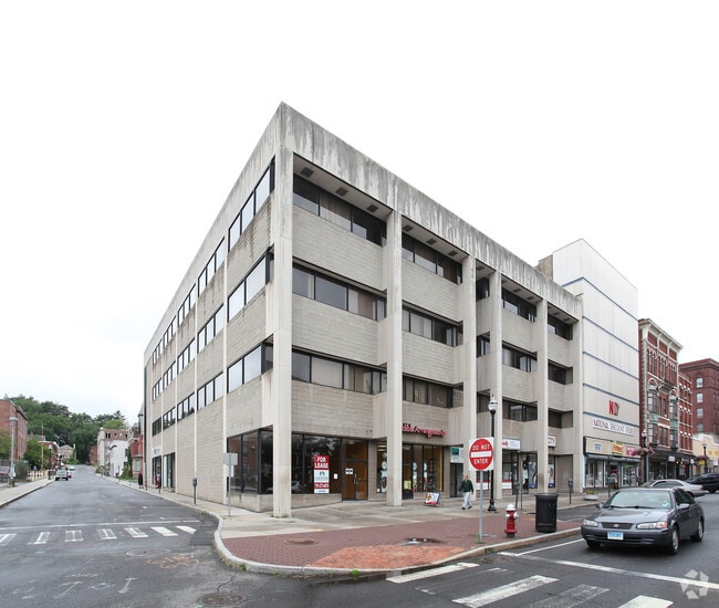
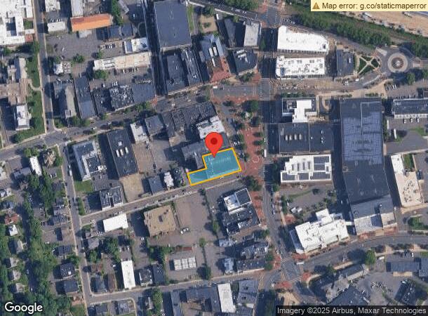
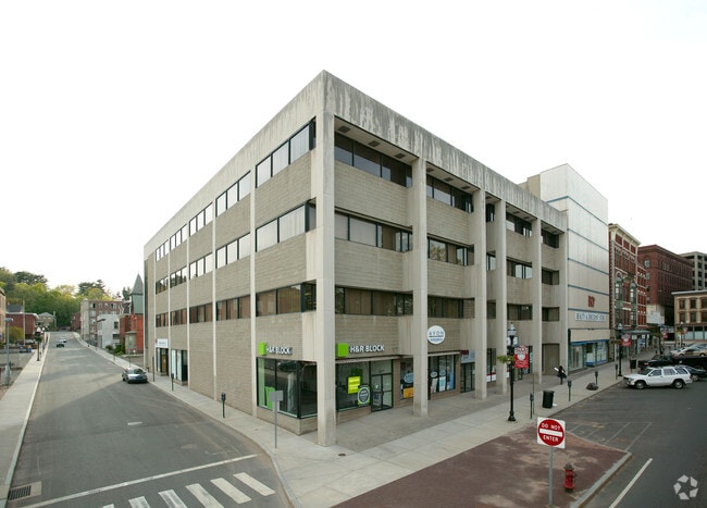
200 Main St, New Britain, CT 06051
Current Lease Availabilities
NEARBY LISTINGS FOR SALE OR LEASE
Property Detail
200 Main St
Commercialbuilding
Hartford
X
Connecticut
09003C0491F
0.41 AC
2025
New Britain
2025
Hartford
417100
Hartford-West Hartford-East Hartford, CT
50,328 SF
NBRI-000008B-000000-C000089
DEMOGRAPHICS near 200 Main St
1 Mile
3 Mile
5 Mile
2024 Total Population
28,317
86,326
157,393
2029 Population
28,083
85,385
155,981
Pop Growth 2024-2029
(0.83%)
(1.09%)
(0.90%)
Average Age
37
39
41
2024 Total Households
11,609
33,603
63,583
HH Growth 2024-2029
(0.75%)
(1.10%)
(0.92%)
Median Household Inc
$37,638
$57,196
$72,427
Avg Household Size
2.30
2.40
2.30
2024 Avg HH Vehicles
1.00
2.00
2.00
Median Home Value
$175,526
$208,140
$252,347
Median Year Built
1948
1955
1961
Nearby Places
- Restaurants
- Banks
- Shops
- Fitness
- Groceries
PUBLIC TRANSPORTATION
COMMUTER RAIL
DRIVE
WALK
Distance
5 min
2.7 mi
DRIVE
WALK
Distance
5 min
2.7 mi
AIRPORT
Bradley International
DRIVE
WALK
Distance
Bradley International
49 min
28.9 mi
Tweed/New Haven
DRIVE
WALK
Distance
Tweed/New Haven
47 min
33.5 mi
Freight Ports
Port of New Haven
DRIVE
WALK
Distance
Port of New Haven
43 min
31.2 mi
Nearby Properties
Address
Land Use
TOTAL SIZE
Lot Size
Zoning
Address
Land Use
TOTAL SIZE
Lot Size
Zoning
146,740 SF
18.23 AC
TPC
Address
Land Use
TOTAL SIZE
Lot Size
Zoning
23.64 AC
S3
Address
Land Use
TOTAL SIZE
Lot Size
Zoning
131.09 AC
OP
Address
Land Use
TOTAL SIZE
Lot Size
Zoning
19.60 AC
S2
Address
Land Use
TOTAL SIZE
Lot Size
Zoning
134,488 SF
63.26 AC
GC
Address
Land Use
TOTAL SIZE
Lot Size
Zoning
138.27 AC
S1
Address
Land Use
TOTAL SIZE
Lot Size
Zoning
64,822 SF
9.47 AC
TP
Address
Land Use
TOTAL SIZE
Lot Size
Zoning
155,161 SF
18.18 AC
S1
Address
Land Use
TOTAL SIZE
Lot Size
Zoning
2.07 AC
CBD
Address
Land Use
TOTAL SIZE
Lot Size
Zoning
117,139 SF
6.77 AC
T
Address
Land Use
TOTAL SIZE
Lot Size
Zoning
90,625 SF
0.97 AC
CBD
Address
Land Use
TOTAL SIZE
Lot Size
Zoning
96,238 SF
6.75 AC
T
Address
Land Use
TOTAL SIZE
Lot Size
Zoning
2.46 AC
CBD
Address
Land Use
TOTAL SIZE
Lot Size
Zoning
33.36 AC
T
Address
Land Use
TOTAL SIZE
Lot Size
Zoning
78,109 SF
8.22 AC
T
Address
Land Use
TOTAL SIZE
Lot Size
Zoning
112,304 SF
10.39 AC
S3
Address
Land Use
TOTAL SIZE
Lot Size
Zoning
14,364 SF
2.72 AC
S3
Address
Land Use
TOTAL SIZE
Lot Size
Zoning
89,544 SF
6.20 AC
S1
Address
Land Use
TOTAL SIZE
Lot Size
Zoning
21.35 AC
PD
Address
Land Use
TOTAL SIZE
Lot Size
Zoning
68 AC
R-20
Address
Land Use
TOTAL SIZE
Lot Size
Zoning
74,670 SF
4.46 AC
S2
Address
Land Use
TOTAL SIZE
Lot Size
Zoning
78,132 SF
11.76 AC
S2
Address
Land Use
TOTAL SIZE
Lot Size
Zoning
5.20 AC
PD
Address
Land Use
TOTAL SIZE
Lot Size
Zoning
83,464 SF
13.96 AC
T
Address
Land Use
TOTAL SIZE
Lot Size
Zoning
185,902 SF
101.89 AC
GI-2
Address
Land Use
TOTAL SIZE
Lot Size
Zoning
183,626 SF
12.72 AC
UI
Address
Land Use
TOTAL SIZE
Lot Size
Zoning
4.43 AC
B3/A2
Address
Land Use
TOTAL SIZE
Lot Size
Zoning
69,025 SF
10.90 AC
S2
Address
Land Use
TOTAL SIZE
Lot Size
Zoning
8.51 AC
S2
Address
Land Use
TOTAL SIZE
Lot Size
Zoning
76,510 SF
10 AC
R-11
The World's #1 Commercial Real Estate Marketplace
Connect with us
© 2025 CoStar Group
The information above has been obtained from sources believed reliable. While we do not doubt its accuracy we have not verified it and make no guarantee, warranty or representation about it. It is your responsibility to independently confirm its accuracy and completeness. Any projections, opinions, assumptions, or estimates used are for example only and do not represent the current or future performance of the property. The value of this transaction to you depends on tax and other factors which should be evaluated by your tax, financial, and legal advisors. You and your advisors should conduct a careful, independent investigation of the property to determine to your satisfaction the suitability of the property for your needs.