Property Record
222 S Highway 55, Price, UT 84501
NEARBY LISTINGS FOR SALE OR LEASE
-
-
View all Price listings for lease on LoopNet.com
Property Detail
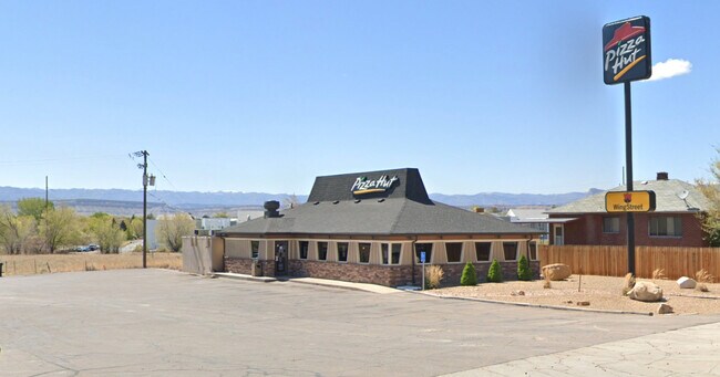
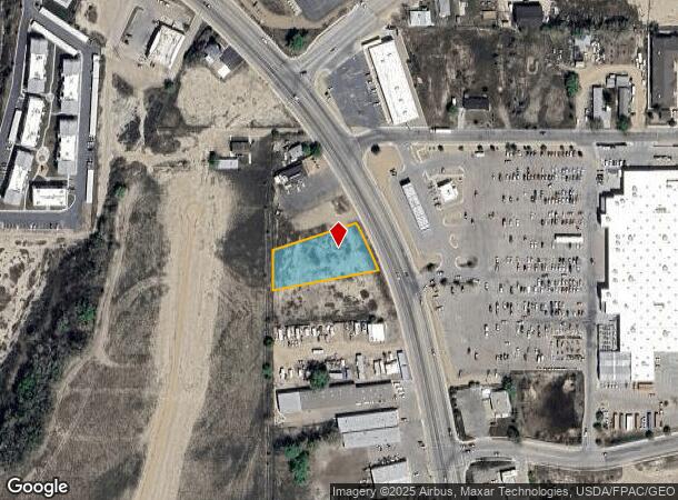
222 S Highway 55
Price, UT
Restaurant Subdivision
01-2545-0001
LOT 2 RESTAURANT SUBDIVISION AMENDMENT II. 0.75 AC
Vacantlandnec
Carbon
X
Utah
49007C0656E
2
2025
0.75 AC
2025
Utah North Area
000300
Other Market Areas
DEMOGRAPHICS near 222 S Highway 55
1 Mile
3 Mile
5 Mile
2024 Total Population
4,099
12,029
14,291
2029 Population
4,251
12,468
14,827
Pop Growth 2024-2029
+ 3.71%
+ 3.65%
+ 3.75%
Average Age
38
39
39
2024 Total Households
1,656
4,633
5,493
HH Growth 2024-2029
+ 3.68%
+ 3.67%
+ 3.77%
Median Household Inc
$42,749
$52,148
$53,905
Avg Household Size
2.40
2.50
2.60
2024 Avg HH Vehicles
2.00
2.00
2.00
Median Home Value
$122,059
$172,187
$176,309
Median Year Built
1972
1973
1974
Nearby Places
- Restaurants
- Banks
- Shops
- Fitness
- Groceries
SALE & LEASE HISTORY
LISTING DATE
SALE/LEASE

Aug 07, 2024
For Lease
Nearby Properties
Address
Land Use
TOTAL SIZE
Lot Size
Zoning
Address
Land Use
TOTAL SIZE
Lot Size
Zoning
103,448 SF
11.89 AC
Address
Land Use
TOTAL SIZE
Lot Size
Zoning
187,197 SF
16.63 AC
Address
Land Use
TOTAL SIZE
Lot Size
Zoning
50,696 SF
3.98 AC
Address
Land Use
TOTAL SIZE
Lot Size
Zoning
93,140 SF
5.19 AC
Address
Land Use
TOTAL SIZE
Lot Size
Zoning
89,262 SF
5.20 AC
Address
Land Use
TOTAL SIZE
Lot Size
Zoning
100,206 SF
9.83 AC
Address
Land Use
TOTAL SIZE
Lot Size
Zoning
40,352 SF
3.10 AC
Address
Land Use
TOTAL SIZE
Lot Size
Zoning
17,340 SF
3.84 AC
Address
Land Use
TOTAL SIZE
Lot Size
Zoning
100,018 SF
3.41 AC
Address
Land Use
TOTAL SIZE
Lot Size
Zoning
Address
Land Use
TOTAL SIZE
Lot Size
Zoning
32,601 SF
1.44 AC
Address
Land Use
TOTAL SIZE
Lot Size
Zoning
1,349 SF
3.75 AC
Address
Land Use
TOTAL SIZE
Lot Size
Zoning
55,665 SF
2.83 AC
Address
Land Use
TOTAL SIZE
Lot Size
Zoning
23,072 SF
4.22 AC
Address
Land Use
TOTAL SIZE
Lot Size
Zoning
23,750 SF
3.54 AC
Address
Land Use
TOTAL SIZE
Lot Size
Zoning
21,299 SF
5.13 AC
Address
Land Use
TOTAL SIZE
Lot Size
Zoning
79,514 SF
9.36 AC
Address
Land Use
TOTAL SIZE
Lot Size
Zoning
9,969 SF
1.18 AC
Address
Land Use
TOTAL SIZE
Lot Size
Zoning
6,288 SF
2.66 AC
Address
Land Use
TOTAL SIZE
Lot Size
Zoning
96,848 SF
8.55 AC
Address
Land Use
TOTAL SIZE
Lot Size
Zoning
6,821 SF
1.63 AC
Address
Land Use
TOTAL SIZE
Lot Size
Zoning
9,764 SF
0.70 AC
Address
Land Use
TOTAL SIZE
Lot Size
Zoning
64,700 SF
12.27 AC
Address
Land Use
TOTAL SIZE
Lot Size
Zoning
18.95 AC
Address
Land Use
TOTAL SIZE
Lot Size
Zoning
27,024 SF
1.14 AC
Address
Land Use
TOTAL SIZE
Lot Size
Zoning
4,762 SF
0.97 AC
Address
Land Use
TOTAL SIZE
Lot Size
Zoning
15,756 SF
8.49 AC
Address
Land Use
TOTAL SIZE
Lot Size
Zoning
32,248 SF
4.29 AC
Address
Land Use
TOTAL SIZE
Lot Size
Zoning
24,995 SF
4.03 AC
Address
Land Use
TOTAL SIZE
Lot Size
Zoning
21,818 SF
2.25 AC
The World's #1 Commercial Real Estate Marketplace
Connect with us
© 2025 CoStar Group
The information above has been obtained from sources believed reliable. While we do not doubt its accuracy we have not verified it and make no guarantee, warranty or representation about it. It is your responsibility to independently confirm its accuracy and completeness. Any projections, opinions, assumptions, or estimates used are for example only and do not represent the current or future performance of the property. The value of this transaction to you depends on tax and other factors which should be evaluated by your tax, financial, and legal advisors. You and your advisors should conduct a careful, independent investigation of the property to determine to your satisfaction the suitability of the property for your needs.