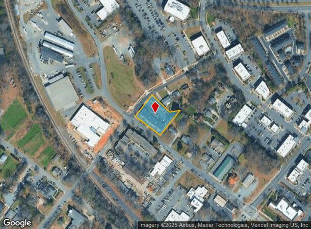
Property Record
212 W Matthews St, Matthews, NC 28105
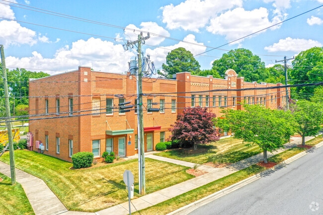
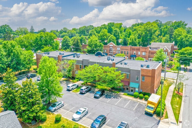

This Property Is For Sale
Current Lease Availabilities
NEARBY LISTINGS FOR SALE OR LEASE
Property Detail
212 W Matthews St
Charlotte-Concord-Gastonia, NC-SC
Matthews Row Office Condo
193-271-44
BLDG 212 UNIT F2 U/F 812-1
Officecondo
Mecklenburg
X
North Carolina
3710458000K
99
2024
0.74 AC
2025
Matthews
005866
Charlotte
803 SF
DEMOGRAPHICS near 212 W Matthews St
1 Mile
3 Mile
5 Mile
2024 Total Population
7,114
63,194
169,362
2029 Population
7,707
66,976
179,900
Pop Growth 2024-2029
+ 8.34%
+ 5.98%
+ 6.22%
Average Age
46
41
40
2024 Total Households
3,238
25,280
65,416
HH Growth 2024-2029
+ 8.59%
+ 6.17%
+ 6.29%
Median Household Inc
$64,097
$88,664
$90,651
Avg Household Size
2.10
2.50
2.50
2024 Avg HH Vehicles
2.00
2.00
2.00
Median Home Value
$360,810
$359,593
$377,323
Median Year Built
1993
1992
1989
Nearby Places
Map Layers
Map Styles
 Street
 Aerial
- Restaurants
- Banks
- Shops
- Fitness
- Groceries
PUBLIC TRANSPORTATION
AIRPORT
Charlotte/Douglas International
DRIVE
WALK
Distance
Charlotte/Douglas International
34 min
19.4 mi
Concord-Padgett Regional
DRIVE
WALK
Distance
Concord-Padgett Regional
37 min
27.6 mi
Nearby Properties
Address
Land Use
TOTAL SIZE
Lot Size
Zoning
Address
Land Use
TOTAL SIZE
Lot Size
Zoning
1,064,632 SF
73.76 AC
Address
Land Use
TOTAL SIZE
Lot Size
Zoning
466,084 SF
42.13 AC
C
Address
Land Use
TOTAL SIZE
Lot Size
Zoning
395,963 SF
43.37 AC
R15
Address
Land Use
TOTAL SIZE
Lot Size
Zoning
442,934 SF
40.80 AC
R12MFCD
Address
Land Use
TOTAL SIZE
Lot Size
Zoning
750,813 SF
56.11 AC
C
Address
Land Use
TOTAL SIZE
Lot Size
Zoning
262,337 SF
7.35 AC
Address
Land Use
TOTAL SIZE
Lot Size
Zoning
282,922 SF
47.76 AC
R4
Address
Land Use
TOTAL SIZE
Lot Size
Zoning
269,164 SF
18.57 AC
Address
Land Use
TOTAL SIZE
Lot Size
Zoning
382,175 SF
31.67 AC
R12MFCD
Address
Land Use
TOTAL SIZE
Lot Size
Zoning
362,388 SF
26.88 AC
R12MFCD
Address
Land Use
TOTAL SIZE
Lot Size
Zoning
258,053 SF
14.99 AC
Address
Land Use
TOTAL SIZE
Lot Size
Zoning
288,495 SF
22.35 AC
R9PUD
Address
Land Use
TOTAL SIZE
Lot Size
Zoning
282,780 SF
21.75 AC
R17MF
Address
Land Use
TOTAL SIZE
Lot Size
Zoning
281,872 SF
37.85 AC
R12CD
Address
Land Use
TOTAL SIZE
Lot Size
Zoning
294,525 SF
24.80 AC
C
Address
Land Use
TOTAL SIZE
Lot Size
Zoning
292,066 SF
2.67 AC
R15MF
Address
Land Use
TOTAL SIZE
Lot Size
Zoning
288,504 SF
30.19 AC
RI
Address
Land Use
TOTAL SIZE
Lot Size
Zoning
274,215 SF
17.50 AC
O9CD
Address
Land Use
TOTAL SIZE
Lot Size
Zoning
232,858 SF
21.74 AC
R15MF
Address
Land Use
TOTAL SIZE
Lot Size
Zoning
256,498 SF
23.52 AC
C
Address
Land Use
TOTAL SIZE
Lot Size
Zoning
241,703 SF
17.43 AC
R12MFCD
Address
Land Use
TOTAL SIZE
Lot Size
Zoning
254,369 SF
43.75 AC
B1SCD
Address
Land Use
TOTAL SIZE
Lot Size
Zoning
218,876 SF
14.82 AC
R6MFCD
Address
Land Use
TOTAL SIZE
Lot Size
Zoning
104,880 SF
10.01 AC
R-12
Address
Land Use
TOTAL SIZE
Lot Size
Zoning
174,834 SF
2.51 AC
Address
Land Use
TOTAL SIZE
Lot Size
Zoning
231,072 SF
17.52 AC
R15MFCD
Address
Land Use
TOTAL SIZE
Lot Size
Zoning
254,671 SF
16.10 AC
R12MFCD
Address
Land Use
TOTAL SIZE
Lot Size
Zoning
227,750 SF
25.53 AC
C
Address
Land Use
TOTAL SIZE
Lot Size
Zoning
246,624 SF
24.06 AC
R17MF
Address
Land Use
TOTAL SIZE
Lot Size
Zoning
258,047 SF
64.31 AC
I-CUD
The World's #1 Commercial Real Estate Marketplace
Connect with us
© 2025 CoStar Group
The information above has been obtained from sources believed reliable. While we do not doubt its accuracy we have not verified it and make no guarantee, warranty or representation about it. It is your responsibility to independently confirm its accuracy and completeness. Any projections, opinions, assumptions, or estimates used are for example only and do not represent the current or future performance of the property. The value of this transaction to you depends on tax and other factors which should be evaluated by your tax, financial, and legal advisors. You and your advisors should conduct a careful, independent investigation of the property to determine to your satisfaction the suitability of the property for your needs.