Property Record
2120 E Fire Tower Rd, Greenville, NC 27858


Property Detail
2120 E Fire Tower Rd
042243
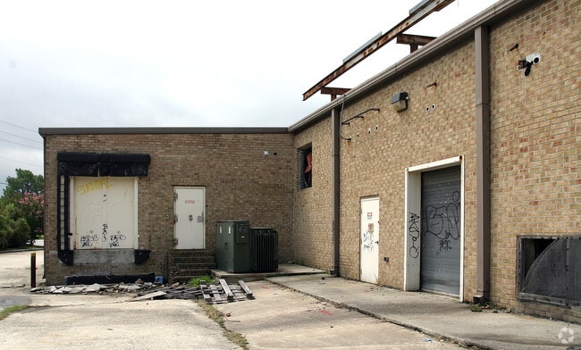
BELLS FORK SHOPPING CENTE
Supermarket
Pitt
CG
North Carolina
B and X Area of moderate flood hazard, usually the area between the limits of the 100-year and 500-year floods.
5.98 AC
2025
North Carolina Northeast Area
2025
Other Market Areas
000301
Greenville, NC
67,219 SF
NEARBY LISTINGS FOR SALE OR LEASE
DEMOGRAPHICS near 2120 E Fire Tower Rd
1 mile
3 mile
5 mile
2025 Total Population
9,691
59,905
115,833
2030 Population
9,947
62,096
120,021
Pop Growth 2025-2030
+ 2.64%
+ 3.66%
+ 3.62%
Average Age
37
37
36
2025 Total Households
4,688
25,956
47,542
HH Growth 2025-2030
+ 2.75%
+ 3.93%
+ 4.02%
Median Household Inc
$59,677
$66,151
$60,901
Avg Household Size
2.00
2.20
2.20
2025 Avg HH Vehicles
2.00
2.00
2.00
Median Home Value
$265,287
$276,648
$258,016
Median Year Built
1994
1991
1993
Nearby Places
Map Layers
Map Styles
 Street
 Aerial
Layers
 Traffic
 Biking
Places
Listings with unknown addresses are not visible on the map
- Restaurants
- Banks
- Shops
- Fitness
- Groceries
SALE & LEASE HISTORY
LISTING DATE
SALE/LEASE

Sep 25, 2016
For Lease
Sep 24, 2020
For Lease
Apr 21, 2017
For Lease
Nearby Properties
Address
Land Use
TOTAL SIZE
Lot Size
Zoning
Address
Land Use
TOTAL SIZE
Lot Size
Zoning
1,555,005 SF
61.20 AC
OR
Address
Land Use
TOTAL SIZE
Lot Size
Zoning
207,166 SF
36.57 AC
OR
Address
Land Use
TOTAL SIZE
Lot Size
Zoning
780,261 SF
36.60 AC
OR
Address
Land Use
TOTAL SIZE
Lot Size
Zoning
473,026 SF
0.69 AC
OR
Address
Land Use
TOTAL SIZE
Lot Size
Zoning
682,180 SF
4.57 AC
CDF-UC
Address
Land Use
TOTAL SIZE
Lot Size
Zoning
33,163 SF
20.14 AC
OR
Address
Land Use
TOTAL SIZE
Lot Size
Zoning
512,349 SF
39.27 AC
CG
Address
Land Use
TOTAL SIZE
Lot Size
Zoning
33,791 SF
21.01 AC
OR
Address
Land Use
TOTAL SIZE
Lot Size
Zoning
24,993 SF
15.81 AC
OR
Address
Land Use
TOTAL SIZE
Lot Size
Zoning
24,032 SF
22.74 AC
R6
Address
Land Use
TOTAL SIZE
Lot Size
Zoning
356,216 SF
4.08 AC
CDF-UC
Address
Land Use
TOTAL SIZE
Lot Size
Zoning
24,161 SF
53.66 AC
R6A
Address
Land Use
TOTAL SIZE
Lot Size
Zoning
138,115 SF
13.60 AC
OR
Address
Land Use
TOTAL SIZE
Lot Size
Zoning
16,462 SF
30.51 AC
OR
Address
Land Use
TOTAL SIZE
Lot Size
Zoning
25,290 SF
18.26 AC
OR
Address
Land Use
TOTAL SIZE
Lot Size
Zoning
103,256 SF
8.80 AC
OR
Address
Land Use
TOTAL SIZE
Lot Size
Zoning
251,265 SF
30.17 AC
0&I
Address
Land Use
TOTAL SIZE
Lot Size
Zoning
20,138 SF
26.90 AC
R6A
Address
Land Use
TOTAL SIZE
Lot Size
Zoning
6,148 SF
10.75 AC
R6
Address
Land Use
TOTAL SIZE
Lot Size
Zoning
152,334 SF
15.92 AC
CG
Address
Land Use
TOTAL SIZE
Lot Size
Zoning
19,183 SF
5.85 AC
OR
Address
Land Use
TOTAL SIZE
Lot Size
Zoning
31.04 AC
R6S
Address
Land Use
TOTAL SIZE
Lot Size
Zoning
194,420 SF
40 AC
RR
Address
Land Use
TOTAL SIZE
Lot Size
Zoning
20,742 SF
12.83 AC
R6
Address
Land Use
TOTAL SIZE
Lot Size
Zoning
121,384 SF
17.80 AC
CG
Address
Land Use
TOTAL SIZE
Lot Size
Zoning
63,504 SF
15.20 AC
CG
Address
Land Use
TOTAL SIZE
Lot Size
Zoning
18,662 SF
29.43 AC
R6
Address
Land Use
TOTAL SIZE
Lot Size
Zoning
118,668 SF
9.49 AC
CH
Address
Land Use
TOTAL SIZE
Lot Size
Zoning
124,845 SF
13.48 AC
CG
Address
Land Use
TOTAL SIZE
Lot Size
Zoning
98,836 SF
45.03 AC
RA20
The World's #1 Commercial Real Estate Marketplace
Connect with us
© 2026 CoStar Group
The information above has been obtained from sources believed reliable. While we do not doubt its accuracy we have not verified it and make no guarantee, warranty or representation about it. It is your responsibility to independently confirm its accuracy and completeness. Any projections, opinions, assumptions, or estimates used are for example only and do not represent the current or future performance of the property. The value of this transaction to you depends on tax and other factors which should be evaluated by your tax, financial, and legal advisors. You and your advisors should conduct a careful, independent investigation of the property to determine to your satisfaction the suitability of the property for your needs.